
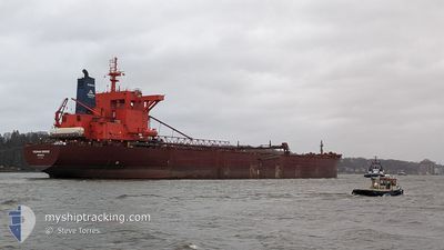
YEOMAN BRIDGE
Self Discharging Bulk Carrier
Current Trip
| Time Travelled | 2 days |
|---|---|
| Remaining Time | 11 h, 51 mins |
| Distance Travelled | 634.44 nm |
| Remaining Distance | 123.15 nm |
| AVG Speed | 9.5 Knots |
| MAX Speed | 13.6 Knots |
| AVG Wind | 13.2 knots |
| MAX Wind | 20.5 knots |
| MIN Temp | 3.6°C / 38.48°F |
| MAX Temp | 9.3°C / 48.74°F |
| Draught | 13.5 m |
| Position Received | 4 h, 4 m ago |
Current Position
| Longitude | 1.78958° |
|---|---|
| Latitude | 53.48354° |
| Status | Under way using engine |
| Speed | 9.8 Knots |
| Course | 144° |
| Area | North Sea |
| Station | T-AIS |
| Position Received | 4 h, 4 m ago |
Info
Information
The current position of YEOMAN BRIDGE is in North Sea with coordinates 53.48354° / 1.78958° as reported on 2024-04-25 17:03 by AIS to our vessel tracker app. The vessel's current speed is 9.8 Knots and is heading at the port of THAMESPORT. The estimated time of arrival as calculated by MyShipTracking vessel tracking app is 2024-04-26 08:59 LT
The vessel YEOMAN BRIDGE (IMO: 8912302, MMSI: 308919000) is a Self Discharging Bulk Carrier that was built in 1991 ( 33 years old ). It's sailing under the flag of [BS] Bahamas.
In this page you can find informations about the vessels current position, last detected port calls, and current voyage information. If the vessels is not in coverage by AIS you will find the latest position.
The current position of YEOMAN BRIDGE is detected by our AIS receivers and we are not responsible for the reliability of the data. The last position was recorded while the vessel was in Coverage by the Ais receivers of our vessel tracking app.
The current draught of YEOMAN BRIDGE as reported by AIS is 13.5 meters
Weather
| Temperature | 7.1°C / 44.78°F |
|---|---|
| Wind Speed | 15 knots |
| Direction | 289° WNW |
| Pressure | 1000.6 hPa |
| Humidity | 68.1 % |
| Cloud Coverage | 27 % |
Featured Company
Last Port Calls
| Port | Arrival | Departure | Time In Port |
|---|---|---|---|
| 2024-04-22 08:16 | 2024-04-23 04:45 | 20 h | |
| 2024-04-17 09:38 | 2024-04-19 06:43 | 1 d | |
| 2024-04-13 10:26 | 2024-04-14 10:38 | 1 d | |
| 2024-04-10 19:38 | 2024-04-10 20:25 | 47 m | |
| 2024-04-08 15:17 | 2024-04-10 18:34 | 2 d | |
| 2024-03-30 11:40 | 2024-03-30 12:21 | 41 m | |
| 2024-03-28 22:14 | 2024-03-30 10:41 | 1 d | |
| 2024-03-20 04:45 | 2024-03-22 03:01 | 1 d | |
| 2024-03-16 03:18 | 2024-03-17 10:53 | 1 d | |
| 2024-03-13 17:54 | 2024-03-13 18:26 | 31 m |
Most Visited Ports (Last year)
| Port | Arrivals | |
|---|---|---|
| 31 | ||
| 17 | ||
| 10 | ||
| 6 | ||
| 4 | ||
| 2 |
Last Trips
| Origin | Departure | Destination | Arrival | Distance | |
|---|---|---|---|---|---|
| 2024-04-19 08:43 | 2024-04-22 09:16 | 718.15 nm | |||
| 2024-04-14 11:38 | 2024-04-17 11:38 | 715.47 nm | |||
| 2024-04-10 22:25 | 2024-04-13 11:26 | 709.30 nm | |||
| 2024-04-10 20:34 | 2024-04-10 21:38 | 6.12 nm | |||
| 2024-03-30 13:21 | 2024-04-08 17:17 | 1337.88 nm | |||
| 2024-03-30 11:41 | 2024-03-30 12:40 | 6.15 nm | |||
| 2024-03-22 04:01 | 2024-03-28 23:14 | 1223.72 nm | |||
| 2024-03-17 10:53 | 2024-03-20 05:45 | 691.12 nm | |||
| 2024-03-13 19:26 | 2024-03-16 03:18 | 688.58 nm | |||
| 2024-03-13 17:42 | 2024-03-13 18:54 | 4.79 nm |
Events
| Time | Event | Details | Position / Dest | Info |
|---|---|---|---|---|
| 2024-04-25 17:15 | Status Changed | Default Under way using engine |
53.45833 / 1.82167
GBIOG
|
Speed: 9.8 kn Course: 144° |
| 2024-04-25 17:03 | OUT of Coverage |
53.48354 / 1.78958
North Sea
GBIOG
|
Speed: 9.8 kn Course: 144° |
|
| 2024-04-25 10:56 | ETA Changed | 2024/04/26 08:00 2024/04/25 22:50 |
54.30951 / 1.15318
GBIOG
|
Speed: 8.8 kn Course: 154° |
| 2024-04-25 10:25 | Status Changed | Under way using engine Default |
54.37989 / 1.10078
GBIOG
|
Speed: 8 kn Course: 157° |
| 2024-04-25 10:24 | IN Coverage |
54.37913 / 1.10134
North Sea
GBIOG
|
Speed: 8.8 kn Course: 157° |
|
| 2024-04-24 15:57 | Status Changed | Default Under way using engine |
57.04167 / -1.08500
GBIOG
|
Speed: 11.4 kn Course: 157° |
| 2024-04-24 15:49 | OUT of Coverage |
57.06758 / -1.10461
North Sea
GBIOG
|
Speed: 11.4 kn Course: 157° |
|
| 2024-04-24 15:39 | Status Changed | Under way using engine Default |
57.09433 / -1.12704
GBIOG
|
Speed: 11 kn Course: 152° |
| 2024-04-24 15:27 | Status Changed | Default Under way using engine |
57.12833 / -1.16167
GBIOG
|
Speed: 11.5 kn Course: 149° |
| 2024-04-24 10:51 | Status Changed | Under way using engine Default |
57.97277 / -1.97585
GBIOG
|
Speed: 11.9 kn Course: 143° |