
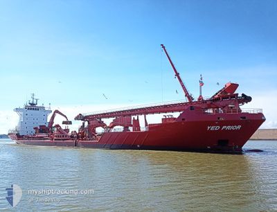
YED PRIOR
Container Ship
Current Trip
| Time Travelled | 1 day |
|---|---|
| Remaining Time | 7 h, 37 mins |
| Distance Travelled | 295.71 nm |
| Remaining Distance | 120.54 nm |
| AVG Speed | 12.1 Knots |
| MAX Speed | 16.8 Knots |
| AVG Wind | 16.5 knots |
| MAX Wind | 31 knots |
| MIN Temp | 7.4°C / 45.32°F |
| MAX Temp | 12.9°C / 55.22°F |
| Draught | 6.8 m |
| Position Received | 17 m ago |
Current Position
| Longitude | --- |
|---|---|
| Latitude | --- |
| Status | Under way using engine |
| Speed | 15.4 Knots |
| Course | 83.5° |
| Area | North Sea |
| Station | T-AIS |
| Position Received | 17 m ago |
Info
Information
The current position of YED PRIOR is in North Sea with coordinates 52.98202° / 2.29954° as reported on 2025-12-07 22:23 by AIS to our vessel tracker app. The vessel's current speed is 15.4 Knots and is heading at the port of HARLINGEN. The estimated time of arrival as calculated by MyShipTracking vessel tracking app is 2025-12-08 07:17 LT
The vessel YED PRIOR (IMO: 9255749, MMSI: 244086000) is a Container Ship that was built in 2003 ( 22 years old ). It's sailing under the flag of [NL] Netherlands.
In this page you can find informations about the vessels current position, last detected port calls, and current voyage information. If the vessels is not in coverage by AIS you will find the latest position.
The current position of YED PRIOR is detected by our AIS receivers and we are not responsible for the reliability of the data. The last position was recorded while the vessel was in Coverage by the Ais receivers of our vessel tracking app.
The current draught of YED PRIOR as reported by AIS is 6.8 meters
Weather
| Temperature | 11.5°C / 52.7°F |
|---|---|
| Wind Speed | 26 knots |
| Direction | 259° W |
| Pressure | 999.8 hPa |
| Humidity | 82.6 % |
| Cloud Coverage | 100 % |
Featured Company
Last Port Calls
| Port | Arrival | Departure | Time In Port |
|---|---|---|---|
| 2025-12-06 10:00 | 2025-12-06 16:34 | 6 h | |
| 2025-12-03 19:14 | 2025-12-04 06:41 | 11 h | |
| 2025-12-03 06:36 | 2025-12-03 12:41 | 6 h | |
| 2025-12-01 08:35 | 2025-12-01 09:39 | 1 h | |
| 2025-12-01 00:21 | 2025-12-01 04:42 | 4 h | |
| 2025-11-30 03:54 | 2025-11-30 14:40 | 10 h | |
| 2025-11-29 14:35 | 2025-11-29 19:48 | 5 h | |
| 2025-11-27 17:17 | 2025-11-27 18:17 | 59 m | |
| 2025-11-27 11:33 | 2025-11-27 13:26 | 1 h | |
| 2025-11-27 06:31 | 2025-11-27 07:26 | 54 m |
Last Trips
| Origin | Departure | Destination | Arrival | Distance | |
|---|---|---|---|---|---|
| 2025-12-04 06:41 | 2025-12-06 10:00 | 527.78 nm | |||
| 2025-12-03 12:41 | 2025-12-03 19:14 | 60.26 nm | |||
| 2025-12-01 09:39 | 2025-12-03 06:36 | 393.60 nm | |||
| 2025-12-01 04:42 | 2025-12-01 08:35 | 25.13 nm | |||
| 2025-11-30 14:40 | 2025-12-01 00:21 | 110.03 nm | |||
| 2025-11-29 19:48 | 2025-11-30 03:54 | 62.24 nm | |||
| 2025-11-27 18:17 | 2025-11-29 14:35 | 411.37 nm | |||
| 2025-11-27 13:26 | 2025-11-27 17:17 | 25.60 nm | |||
| 2025-11-27 07:26 | 2025-11-27 11:33 | 25.02 nm | |||
| 2025-11-26 21:01 | 2025-11-27 06:31 | 85.40 nm |
Events
| Time | Event | Details | Position / Dest | Info |
|---|---|---|---|---|
| 2025-12-07 22:29 | Status Changed | Default Under way using engine |
52.98504 / 2.34063
HARLINGEN
|
Speed: 15.4 kn Course: 83.5° |
| 2025-12-07 19:26 | Draught Changed | 6.8 5.6 |
53.10325 / 1.03363
HARLINGEN
|
Speed: 14.8 kn Course: 108.1° |
| 2025-12-07 19:26 | Destination Changed | HARLINGEN AREA 514 |
53.10325 / 1.03363
HARLINGEN
|
Speed: 14.8 kn Course: 108.1° |
| 2025-12-07 19:26 | ETA Changed | 2025/12/08 09:00 2025/12/07 05:00 |
53.10325 / 1.03363
HARLINGEN
|
Speed: 14.8 kn Course: 108.1° |
| 2025-12-07 19:11 | Status Changed | Under way using engine Default |
53.12192 / .94167
AREA 514
|
Speed: 15.3 kn Course: 131° |
| 2025-12-07 19:01 | IN Coverage |
53.11920 / .95349
North Sea
|
Speed: 15.5 kn Course: 110.7° |
|
| 2025-12-07 16:53 | Status Changed | Default Under way using engine |
53.56594 / .38513
AREA 514
|
Speed: 14.7 kn Course: 140.7° |
| 2025-12-07 16:47 | OUT of Coverage |
53.58748 / .36002
North Sea
|
Speed: 14.7 kn Course: 140.7° |
|
| 2025-12-07 16:44 | Status Changed | Under way using engine Default |
53.59623 / .34825
AREA 514
|
Speed: 12.7 kn Course: 143° |
| 2025-12-07 16:41 | Status Changed | Default Under way using engine |
53.60439 / .33768
AREA 514
|
Speed: 1.7 kn Course: 190° |