
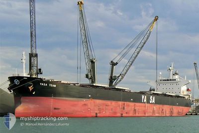
YASA TEAM
Bulk Carrier
Current Trip
| Time Travelled | 5 days |
|---|---|
| Remaining Time | --- |
| Distance Travelled | 1498.66 nm |
| Remaining Distance | --- |
| AVG Speed | 11.8 Knots |
| MAX Speed | 14.1 Knots |
| AVG Wind | 13.1 knots |
| MAX Wind | 21 knots |
| MIN Temp | 17.4°C / 63.32°F |
| MAX Temp | 26.4°C / 79.52°F |
| Draught | 13.7 m |
| Position Received | Now |
Current Position
| Longitude | -67.43089° |
|---|---|
| Latitude | 19.69732° |
| Status | Under way using engine |
| Speed | 11.6 Knots |
| Course | 91.1° |
| Area | North Atlantic Ocean |
| Station | T-AIS |
| Position Received | Now |
Info
Information
The current position of YASA TEAM is in North Atlantic Ocean with coordinates 19.69732° / -67.43089° as reported on 2024-04-19 08:41 by AIS to our vessel tracker app. The vessel's current speed is 11.6 Knots and is heading at the port of SINGAPORE. The estimated time of arrival as calculated by MyShipTracking vessel tracking app is 2024-05-31 08:00 LT
The vessel YASA TEAM (IMO: 9296250, MMSI: 538002528) is a Bulk Carrier that was built in 2006 ( 18 years old ). It's sailing under the flag of [MH] Marshall Is.
In this page you can find informations about the vessels current position, last detected port calls, and current voyage information. If the vessels is not in coverage by AIS you will find the latest position.
The current position of YASA TEAM is detected by our AIS receivers and we are not responsible for the reliability of the data. The last position was recorded while the vessel was in Coverage by the Ais receivers of our vessel tracking app.
The current draught of YASA TEAM as reported by AIS is 13.7 meters
Weather
| Temperature | 25°C / 77°F |
|---|---|
| Wind Speed | 10 knots |
| Direction | 46° NE |
| Pressure | 1013 hPa |
| Humidity | 76.1 % |
| Cloud Coverage | 4 % |
Featured Company
Last Port Calls
| Port | Arrival | Departure | Time In Port |
|---|---|---|---|
| 2024-04-09 17:24 | 2024-04-13 23:08 | 4 d | |
| 2024-03-15 22:10 | 2024-03-22 03:48 | 6 d | |
| 2024-03-15 20:06 | 2024-03-15 20:46 | 40 m | |
| 2024-02-02 05:44 |
Events
| Time | Event | Details | Position / Dest | Info |
|---|---|---|---|---|
| 2024-04-19 08:16 | Detected in Sea | Puerto Rican part of the North Atlantic Ocean |
19.69985 / -67.51912
North Atlantic Ocean
|
Speed: 11.8 kn Course: 91.3° |
| 2024-04-19 08:15 | Status Changed | Under way using engine Default |
19.69992 / -67.52265
SG SIN
|
Speed: 11.7 kn Course: 92° |
| 2024-04-19 08:15 | IN Coverage |
19.69985 / -67.51912
North Atlantic Ocean
|
Speed: 11.8 kn Course: 91.3° |
|
| 2024-04-15 23:01 | Status Changed | Default Under way using engine |
23.57647 / -83.22053
SG SIN
|
Speed: 13 kn Course: 94.8° |
| 2024-04-15 22:54 | OUT of Coverage |
23.57826 / -83.24906
Gulf of Mexico
|
Speed: 13 kn Course: 94.8° |
|
| 2024-04-15 22:26 | Detected in Sea | Cuban part of the Gulf of Mexico |
23.58310 / -83.36020
Gulf of Mexico
|
Speed: 13.1 kn Course: 92.4° |
| 2024-04-15 22:25 | Status Changed | Under way using engine Default |
23.58327 / -83.36415
SG SIN
|
Speed: 12.8 kn Course: 92° |
| 2024-04-15 22:13 | IN Coverage |
23.58310 / -83.36020
Gulf of Mexico
|
Speed: 13.1 kn Course: 92.4° |
|
| 2024-04-14 09:56 | Status Changed | Default Under way using engine |
28.16826 / -88.90411
SG SIN
|
Speed: 11.9 kn Course: 158.3° |
| 2024-04-14 09:51 | OUT of Coverage |
28.18349 / -88.91118
Gulf of Mexico
|
Speed: 11.9 kn Course: 158.3° |