
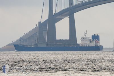
YARA SELA
Tanker D
Current Trip
| Time Travelled | 16 days |
|---|---|
| Remaining Time | 2 days |
| Distance Travelled | 4982.34 nm |
| Remaining Distance | 824.56 nm |
| AVG Speed | 11.9 Knots |
| MAX Speed | 15.3 Knots |
| AVG Wind | 17.8 knots |
| MAX Wind | 32 knots |
| MIN Temp | 10.3°C / 50.54°F |
| MAX Temp | 24.8°C / 76.64°F |
| Draught | 9 m |
| Position Received | 35 m ago |
Current Position
| Longitude | -4.22322° |
|---|---|
| Latitude | 49.32504° |
| Status | Under way using engine |
| Speed | 12.9 Knots |
| Course | 61° |
| Area | English Channel |
| Station | T-AIS |
| Position Received | 35 m ago |
Info
Information
The current position of YARA SELA is in English Channel with coordinates 49.32504° / -4.22322° as reported on 2024-04-19 05:52 by AIS to our vessel tracker app. The vessel's current speed is 12.9 Knots and is heading at the port of GOTEBORG. The estimated time of arrival as calculated by MyShipTracking vessel tracking app is 2024-04-21 19:14 LT
The vessel YARA SELA (IMO: 9734850, MMSI: 258936000) is a Tanker D It's sailing under the flag of [NO] Norway.
In this page you can find informations about the vessels current position, last detected port calls, and current voyage information. If the vessels is not in coverage by AIS you will find the latest position.
The current position of YARA SELA is detected by our AIS receivers and we are not responsible for the reliability of the data. The last position was recorded while the vessel was in Coverage by the Ais receivers of our vessel tracking app.
The current draught of YARA SELA as reported by AIS is 9 meters
Weather
| Temperature | 10.9°C / 51.62°F |
|---|---|
| Wind Speed | 16 knots |
| Direction | 300° WNW |
| Pressure | 1022.5 hPa |
| Humidity | 81.9 % |
| Cloud Coverage | 25 % |
Featured Company
Last Port Calls
| Port | Arrival | Departure | Time In Port |
|---|---|---|---|
| 2024-04-01 11:15 | 2024-04-02 10:43 | 23 h | |
| 2024-03-12 14:30 | 2024-03-14 06:29 | 1 d | |
| 2024-02-24 14:29 | 2024-02-25 12:09 | 21 h | |
| 2024-02-08 15:33 | 2024-02-09 16:08 | 1 d | |
| 2024-02-08 07:59 | 2024-02-08 08:05 | 5 m | |
| 2024-02-01 13:33 |
Most Visited Ports (Last year)
| Port | Arrivals | |
|---|---|---|
| 4 | ||
| 3 | ||
| 3 | ||
| 3 | ||
| 2 | ||
| 2 |
Last Trips
| Origin | Departure | Destination | Arrival | Distance | |
|---|---|---|---|---|---|
| 2024-03-14 07:29 | 2024-04-01 06:15 | 5827.03 nm | |||
| 2024-02-25 08:09 | 2024-03-12 15:30 | 4656.17 nm | |||
| 2024-02-09 17:08 | 2024-02-24 10:29 | 4530.98 nm | |||
| 2024-02-08 09:05 | 2024-02-08 16:33 | 81.68 nm | |||
| 2024-02-01 14:33 | 2024-02-08 08:59 | 1980.54 nm |
Events
| Time | Event | Details | Position / Dest | Info |
|---|---|---|---|---|
| 2024-04-19 06:07 | Status Changed | Default Under way using engine |
49.35166 / -4.14833
SEGOT
|
Speed: 12.9 kn Course: 61° |
| 2024-04-19 03:31 | Change Sea Area | French part of the English Channel French part of the Celtic Sea |
49.06887 / -4.91389
English Channel
SEGOT
|
Speed: 13.5 kn Course: 66.2° |
| 2024-04-18 23:05 | ETA Changed | 2024/04/22 03:00 2024/04/22 02:00 |
48.45341 / -6.08844
SEGOT
|
Speed: 13.7 kn Course: 57.4° |
| 2024-04-18 21:39 | Draught Changed | 9 6.7 |
48.27968 / -6.49604
SEGOT
|
Speed: 13.2 kn Course: 57.9° |
| 2024-04-18 21:39 | Destination Changed | SEGOT NOHRY>USFPO |
48.27968 / -6.49604
SEGOT
|
Speed: 13.2 kn Course: 57.9° |
| 2024-04-18 21:39 | ETA Changed | 2024/04/22 02:00 2024/04/01 13:00 |
48.27968 / -6.49604
SEGOT
|
Speed: 13.2 kn Course: 57.9° |
| 2024-04-18 21:35 | Change Sea Area | French part of the Celtic Sea High seas of the North Atlantic Ocean |
48.27258 / -6.51275
Celtic Sea
|
Speed: 13.2 kn Course: 57.5° |
| 2024-04-18 21:33 | Status Changed | Under way using engine Default |
48.26804 / -6.52330
NOHRY>USFPO
|
Speed: 13 kn Course: 57° |
| 2024-04-18 21:33 | IN Coverage |
48.27258 / -6.51275
Celtic Sea
|
Speed: 13.2 kn Course: 57.5° |
|
| 2024-04-16 00:26 | OUT of Coverage |
43.32530 / -25.72488
North Atlantic Ocean
|
Speed: 11.7 kn Course: 66.2° |