
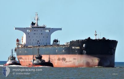
XIN HANG
Bulk Carrier
Current Trip
| Time Travelled | 40 days |
|---|---|
| Remaining Time | --- |
| Distance Travelled | 6242.20 nm |
| Remaining Distance | --- |
| AVG Speed | 10.1 Knots |
| MAX Speed | 14 Knots |
| AVG Wind | 12.1 knots |
| MAX Wind | 29.8 knots |
| MIN Temp | 6.6°C / 43.88°F |
| MAX Temp | 29.4°C / 84.92°F |
| Draught | 18.2 m |
| Position Received | 1 d ago |
Current Position
| Longitude | 136.05042° |
|---|---|
| Latitude | -35.11920° |
| Status | Under way using engine |
| Speed | 10.1 Knots |
| Course | 264.9° |
| Area | Great Australian Bight |
| Station | T-AIS |
| Position Received | 1 d ago |
Info
Information
The current position of XIN HANG is in Great Australian Bight with coordinates -35.11920° / 136.05042° as reported on 2024-04-22 21:20 by AIS to our vessel tracker app. The vessel's current speed is 10.1 Knots and is heading at the port of QINGDAO. The estimated time of arrival as calculated by MyShipTracking vessel tracking app is 2024-05-13 06:00 LT
The vessel XIN HANG (IMO: 9469649, MMSI: 636014628) is a Bulk Carrier that was built in 2010 ( 14 years old ). It's sailing under the flag of [LR] Liberia.
In this page you can find informations about the vessels current position, last detected port calls, and current voyage information. If the vessels is not in coverage by AIS you will find the latest position.
The current position of XIN HANG is detected by our AIS receivers and we are not responsible for the reliability of the data. The last position was recorded while the vessel was in Coverage by the Ais receivers of our vessel tracking app.
The current draught of XIN HANG as reported by AIS is 18.2 meters
Weather
| Temperature | 15.9°C / 60.62°F |
|---|---|
| Wind Speed | 8 knots |
| Direction | 143° SE |
| Pressure | 1032.5 hPa |
| Humidity | 56.5 % |
| Cloud Coverage | 89 % |
Featured Company
Last Port Calls
| Port | Arrival | Departure | Time In Port |
|---|---|---|---|
| 2024-03-12 23:59 | 2024-03-15 01:50 | 2 d | |
| 2024-02-24 11:18 | 2024-02-26 03:58 | 1 d | |
| 2024-02-06 14:54 | 2024-02-09 09:34 | 2 d |
Most Visited Ports (Last year)
| Port | Arrivals | |
|---|---|---|
| 2 | ||
| 1 | ||
| 1 | ||
| 1 | ||
| 1 | ||
| 1 |
Events
| Time | Event | Details | Position / Dest | Info |
|---|---|---|---|---|
| 2024-04-22 21:27 | Status Changed | Default Under way using engine |
-35.11982 / 136.02495
CN TAO
|
Speed: 10.1 kn Course: 264.9° |
| 2024-04-22 21:20 | OUT of Coverage |
-35.11920 / 136.05042
Great Australian Bight
CN TAO
|
Speed: 10.1 kn Course: 264.9° |
|
| 2024-04-22 21:13 | Status Changed | Under way using engine Default |
-35.11869 / 136.07647
CN TAO
|
Speed: 10.3 kn Course: 266° |
| 2024-04-22 21:11 | Status Changed | Default Under way using engine |
-35.11860 / 136.08121
CN TAO
|
Speed: 10.2 kn Course: 264.5° |
| 2024-04-22 20:54 | Status Changed | Under way using engine Default |
-35.11744 / 136.14583
CN TAO
|
Speed: 10.6 kn Course: 266° |
| 2024-04-22 20:35 | IN Coverage |
-35.11744 / 136.14583
Great Australian Bight
CN TAO
|
Speed: 10.5 kn Course: 266.9° |
|
| 2024-04-22 19:53 | Status Changed | Default Under way using engine |
-35.04333 / 136.33667
CN TAO
|
Speed: 10.8 kn Course: 226.9° |
| 2024-04-22 19:50 | OUT of Coverage |
-35.03847 / 136.34585
Great Australian Bight
CN TAO
|
Speed: 10.8 kn Course: 226.9° |
|
| 2024-04-22 19:11 | Draught Changed | 18.2 11.1 |
-34.95957 / 136.45703
CN TAO
|
Speed: 10.6 kn Course: 226.2° |
| 2024-04-22 19:11 | Destination Changed | CN TAO AU WYA |
-34.95957 / 136.45703
CN TAO
|
Speed: 10.6 kn Course: 226.2° |