
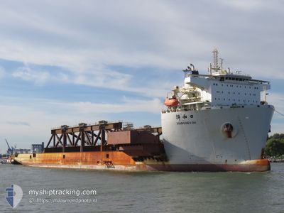
XIANG HE KOU
Cargo
Current Trip
| Time Travelled | --- |
|---|---|
| Remaining Time | --- |
| Distance Travelled | 4660.31 nm |
| Remaining Distance | 19.08 nm |
| AVG Speed | 10.4 Knots |
| MAX Speed | 14.7 Knots |
| AVG Wind | 6.9 knots |
| MAX Wind | 19.4 knots |
| MIN Temp | 12.7°C / 54.86°F |
| MAX Temp | 30.6°C / 87.08°F |
| Draught | 9.1 m |
| Position Received | 4 m ago |
Current Position
| Longitude | 54.76082° |
|---|---|
| Latitude | 25.20990° |
| Status | At anchor |
| Speed | |
| Course | 28° |
| Area | Persian Gulf |
| Station | T-AIS |
| Position Received | 4 m ago |
Info
Information
The current position of XIANG HE KOU is in Persian Gulf with coordinates 25.20990° / 54.76082° as reported on 2024-04-18 19:37 by AIS to our vessel tracker app. The vessel's current speed is 0 Knots and is heading at the port of JEBEL ALI. The estimated time of arrival as calculated by MyShipTracking vessel tracking app is 2024-04-18 10:00 LT
The vessel XIANG HE KOU (IMO: 9752656, MMSI: 477810700) is a Cargo It's sailing under the flag of [HK] Hong Kong.
In this page you can find informations about the vessels current position, last detected port calls, and current voyage information. If the vessels is not in coverage by AIS you will find the latest position.
The current position of XIANG HE KOU is detected by our AIS receivers and we are not responsible for the reliability of the data. The last position was recorded while the vessel was in Coverage by the Ais receivers of our vessel tracking app.
The current draught of XIANG HE KOU as reported by AIS is 9.1 meters
Weather
| Temperature | 25.5°C / 77.9°F |
|---|---|
| Wind Speed | 4 knots |
| Direction | 232° SW |
| Pressure | 1009.8 hPa |
| Humidity | 63.7 % |
| Cloud Coverage | --- |
Featured Company
Last Port Calls
| Port | Arrival | Departure | Time In Port |
|---|---|---|---|
| 2024-02-01 07:13 | 2024-02-01 16:42 | 9 h |
Most Visited Ports (Last year)
| Port | Arrivals | |
|---|---|---|
| 4 | ||
| 2 | ||
| 1 |
Last Trips
| Origin | Departure | Destination | Arrival | Distance | |
|---|---|---|---|---|---|
| 2024-01-17 16:16 | 2024-02-01 09:13 | 3820.75 nm |
Events
| Time | Event | Details | Position / Dest | Info |
|---|---|---|---|---|
| 2024-04-18 10:13 | Status Changed | At anchor Under way using engine |
25.21024 / 54.76039
JEBEL ALI
|
Speed: 0.5 kn Course: 244° |
| 2024-04-18 10:10 | STOP Moving | 18.93 nm, North West of JEBEL ALI |
25.21027 / 54.76002
JEBEL ALI
|
Speed: 0.3 kn Course: 246° |
| 2024-04-18 04:52 | Draught Changed | 9.1 7 |
25.73782 / 55.28651
JEBEL ALI
|
Speed: 8.6 kn Course: 237.5° |
| 2024-04-18 03:42 | Status Changed | Under way using engine Default |
25.83799 / 55.43957
JEBEL ALI
|
Speed: 9 kn Course: 238° |
| 2024-04-18 03:34 | Status Changed | Default Under way using engine |
25.84667 / 55.45667
JEBEL ALI
|
Speed: 9.2 kn Course: 238.5° |
| 2024-04-18 03:30 | Status Changed | Under way using engine Default |
25.85358 / 55.46722
JEBEL ALI
|
Speed: 9 kn Course: 233° |
| 2024-04-18 03:19 | Status Changed | Default Under way using engine |
25.86833 / 55.49166
JEBEL ALI
|
Speed: 9.2 kn Course: 233.9° |
| 2024-04-18 03:16 | Status Changed | Under way using engine Default |
25.87533 / 55.50003
JEBEL ALI
|
Speed: 9 kn Course: 234° |
| 2024-04-18 03:03 | Status Changed | Default Under way using engine |
25.89432 / 55.52885
JEBEL ALI
|
Speed: 9.2 kn Course: 226.5° |
| 2024-04-18 00:14 | Change Sea Area | United Arab Emirates part of the Persian Gulf Omani part of the Persian Gulf |
26.19123 / 55.87403
Persian Gulf
JEBEL ALI
|
Speed: 9.4 kn Course: 227.1° |