
WIND SERVER
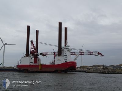
Offshore Construction Jack Up
Current Trip
| Time Travelled | 68 days |
|---|---|
| Remaining Time | 1 day |
| Distance Travelled | 292.93 nm |
| Remaining Distance | 257.82 nm |
| AVG Speed | 5.8 Knots |
| MAX Speed | 9.9 Knots |
| AVG Wind | 10.2 knots |
| MAX Wind | 23 knots |
| MIN Temp | 4.1°C / 39.38°F |
| MAX Temp | 14°C / 57.2°F |
| Draught | 5.3 m |
| Position Received | 4 h, 27 m ago |
Current Position
| Longitude | 2.22387° |
|---|---|
| Latitude | 52.58795° |
| Status | Under way using engine |
| Speed | 5.8 Knots |
| Course | 72.1° |
| Area | North Sea |
| Station | T-AIS |
| Position Received | 4 h, 27 m ago |
Info
Information
The current position of WIND SERVER is in North Sea with coordinates 52.58795° / 2.22387° as reported on 2024-04-24 21:12 by AIS to our vessel tracker app. The vessel's current speed is 5.8 Knots and is heading at the port of CUXHAVEN. The estimated time of arrival as calculated by MyShipTracking vessel tracking app is 2024-04-26 17:11 LT
The vessel WIND SERVER (IMO: 9670793, MMSI: 219615000) is a Offshore Construction Jack Up that was built in 2014 ( 10 years old ). It's sailing under the flag of [DK] Denmark.
In this page you can find informations about the vessels current position, last detected port calls, and current voyage information. If the vessels is not in coverage by AIS you will find the latest position.
The current position of WIND SERVER is detected by our AIS receivers and we are not responsible for the reliability of the data. The last position was recorded while the vessel was in Coverage by the Ais receivers of our vessel tracking app.
The current draught of WIND SERVER as reported by AIS is 5.3 meters
Weather
| Temperature | 7.3°C / 45.14°F |
|---|---|
| Wind Speed | 16 knots |
| Direction | 345° NNW |
| Pressure | 1011.6 hPa |
| Humidity | 63.3 % |
| Cloud Coverage | 65 % |
Featured Company
Events
| Time | Event | Details | Position / Dest | Info |
|---|---|---|---|---|
| 2024-04-24 21:12 | OUT of Coverage |
52.58795 / 2.22387
North Sea
DE CUX>CUXHAVEN
|
Speed: 5.8 kn Course: 72.1° |
|
| 2024-04-24 18:11 | START Moving | 1.04 nm, South East of GREAT YARMOUTH |
52.57790 / 1.74435
DE CUX>CUXHAVEN
|
Speed: 3.9 kn Course: 92° |
| 2024-04-24 17:15 | Destination Changed | DE CUX>CUXHAVEN LONDON ARRAY>GB GTY |
52.57962 / 1.74102
DE CUX>CUXHAVEN
|
Speed: Course: 93° |
| 2024-04-24 16:49 | Status Changed | Under way using engine Moored |
52.57964 / 1.74103
LONDON ARRAY>GB GTY
|
Speed: Course: 93° |
| 2024-04-24 16:49 | ETA Changed | 2024/04/26 14:00 2025/03/25 11:00 |
52.57963 / 1.74103
LONDON ARRAY>GB GTY
|
Speed: Course: 93° |
| 2024-04-24 15:41 | Status Changed | Moored Under way using engine |
52.57963 / 1.74103
LONDON ARRAY>GB GTY
|
Speed: Course: 0° |
| 2024-04-24 15:38 | Status Changed | Under way using engine Moored |
52.57962 / 1.74103
LONDON ARRAY>GB GTY
|
Speed: Course: 93° |
| 2024-04-23 11:52 | Status Changed | Moored Under way using engine |
52.57962 / 1.74102
LONDON ARRAY>GB GTY
|
Speed: Course: 93° |
| 2024-04-23 11:11 | STOP Moving | 0.9 nm, South East of GREAT YARMOUTH |
52.57933 / 1.74107
LONDON ARRAY>GB GTY
|
Speed: 0.2 kn Course: 91° |
| 2024-04-23 10:59 | START Moving | 1.39 nm, South East of GREAT YARMOUTH |
52.57786 / 1.75750
LONDON ARRAY>GB GTY
|
Speed: 3.1 kn Course: 268° |