
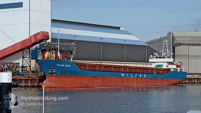
WILSON GAETA
General Cargo
Current Trip
| Time Travelled | 3 days |
|---|---|
| Remaining Time | 4 h, 22 mins |
| Distance Travelled | 628.20 nm |
| Remaining Distance | 31.93 nm |
| AVG Speed | 7.7 Knots |
| MAX Speed | 11.7 Knots |
| AVG Wind | 10.7 knots |
| MAX Wind | 20.9 knots |
| MIN Temp | 1.3°C / 34.34°F |
| MAX Temp | 10.3°C / 50.54°F |
| Draught | 5.1 m |
| Position Received | Now |
Current Position
| Longitude | 18.82177° |
|---|---|
| Latitude | 54.83127° |
| Status | Under way using engine |
| Speed | 6.8 Knots |
| Course | 131.5° |
| Area | Baltic Sea |
| Station | T-AIS |
| Position Received | Now |
Info
Information
The current position of WILSON GAETA is in Baltic Sea with coordinates 54.83127° / 18.82177° as reported on 2024-04-20 01:07 by AIS to our vessel tracker app. The vessel's current speed is 6.8 Knots and is heading at the port of GDANSK. The estimated time of arrival as calculated by MyShipTracking vessel tracking app is 2024-04-20 05:29 LT
The vessel WILSON GAETA (IMO: 9171096, MMSI: 314237000) is a General Cargo that was built in 1998 ( 26 years old ). It's sailing under the flag of [BB] Barbados.
In this page you can find informations about the vessels current position, last detected port calls, and current voyage information. If the vessels is not in coverage by AIS you will find the latest position.
The current position of WILSON GAETA is detected by our AIS receivers and we are not responsible for the reliability of the data. The last position was recorded while the vessel was in Coverage by the Ais receivers of our vessel tracking app.
The current draught of WILSON GAETA as reported by AIS is 5.1 meters
Weather
| Temperature | 3.5°C / 38.3°F |
|---|---|
| Wind Speed | 20 knots |
| Direction | 38° NE |
| Pressure | 1005.1 hPa |
| Humidity | 78 % |
| Cloud Coverage | 100 % |
Featured Company
Last Port Calls
| Port | Arrival | Departure | Time In Port |
|---|---|---|---|
| 2024-04-15 12:23 | 2024-04-16 21:17 | 1 d | |
| 2024-04-02 21:25 | 2024-04-05 19:27 | 2 d | |
| 2024-03-29 12:49 | 2024-03-30 07:25 | 18 h | |
| 2024-03-26 03:46 | 2024-03-27 14:11 | 1 d | |
| 2024-03-19 10:56 | 2024-03-20 21:26 | 1 d | |
| 2024-03-14 13:50 | |||
| 2024-03-08 15:39 | 2024-03-08 15:48 | 9 m | |
| 2024-03-07 19:40 | 2024-03-08 15:38 | 19 h | |
| 2024-03-07 19:28 | 2024-03-07 19:38 | 9 m | |
| 2024-02-28 22:34 | 2024-02-29 14:40 | 16 h |
Last Trips
| Origin | Departure | Destination | Arrival | Distance | |
|---|---|---|---|---|---|
| 2024-04-05 22:27 | 2024-04-15 14:23 | 1649.68 nm | |||
| 2024-03-30 08:25 | 2024-04-03 00:25 | 821.08 nm | |||
| 2024-03-27 15:11 | 2024-03-29 13:49 | 491.68 nm | |||
| 2024-03-20 22:26 | 2024-03-26 04:46 | 1083.79 nm | |||
| 2024-03-08 16:48 | 2024-03-14 14:50 | 527.91 nm | |||
| 2024-03-08 16:38 | 2024-03-08 16:39 | 0.13 nm | |||
| 2024-03-07 20:38 | 2024-03-07 20:40 | 0.06 nm | |||
| 2024-02-29 15:40 | 2024-03-07 20:28 | 635.62 nm | |||
| 2024-02-27 15:28 | 2024-02-28 23:34 | 77.57 nm | |||
| 2024-02-22 20:58 | 2024-02-26 18:49 | 848.97 nm |
Events
| Time | Event | Details | Position / Dest | Info |
|---|---|---|---|---|
| 2024-04-19 23:33 | Status Changed | Under way using engine Default |
54.91938 / 18.55350
PLGDN
|
Speed: 7 kn Course: 86° |
| 2024-04-19 23:29 | Status Changed | Default Under way using engine |
54.91833 / 18.54167
PLGDN
|
Speed: 6.6 kn Course: 84.4° |
| 2024-04-19 22:52 | Status Changed | Under way using engine Default |
54.91128 / 18.42178
PLGDN
|
Speed: 7 kn Course: 85° |
| 2024-04-19 22:52 | IN Coverage |
54.91128 / 18.42178
Baltic Sea
PLGDN
|
Speed: 6.8 kn Course: 86.2° |
|
| 2024-04-19 13:10 | OUT of Coverage |
54.74848 / 16.26858
Baltic Sea
PLGDN
|
Speed: 10.1 kn Course: 79.3° |
|
| 2024-04-19 08:10 | Change Sea Area | Polish part of the Baltic Sea Danish part of the Kattegat |
54.62120 / 14.83717
Baltic Sea
PLGDN
|
Speed: 10.2 kn Course: 80.8° |
| 2024-04-19 07:07 | Detected in Sea | Danish part of the Kattegat |
54.59667 / 14.53745
Kattegat
PLGDN
|
Speed: 9.8 kn Course: 81.3° |
| 2024-04-18 20:50 | Detected in Sea | German part of the Baltic Sea |
54.40077 / 12.08358
Baltic Sea
PLGDN
|
Speed: 9.5 kn Course: 87.8° |
| 2024-04-18 18:23 | Change Sea Area | Danish part of the Baltic Sea German part of the Baltic Sea |
54.49807 / 11.44653
Baltic Sea
PLGDN
|
Speed: 9.8 kn Course: 114.8° |
| 2024-04-18 15:56 | Change Sea Area | German part of the Baltic Sea Danish part of the Baltic Sea |
54.55777 / 10.76827
Baltic Sea
PLGDN
|
Speed: 10.9 kn Course: 84.7° |