
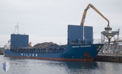
WILSON DRAMMEN
General Cargo
Current Trip
| Time Travelled | 17 h, 21 mins |
|---|---|
| Remaining Time | 2 days |
| Distance Travelled | 181.25 nm |
| Remaining Distance | 524.63 nm |
| AVG Speed | 9.9 Knots |
| MAX Speed | 10.9 Knots |
| AVG Wind | 10.7 knots |
| MAX Wind | 15.8 knots |
| MIN Temp | 1.2°C / 34.16°F |
| MAX Temp | 3.3°C / 37.94°F |
| Draught | 4.9 m |
| Position Received | Now |
Current Position
| Longitude | 21.89342° |
|---|---|
| Latitude | 59.29544° |
| Status | Under way using engine |
| Speed | 10.2 Knots |
| Course | 233.9° |
| Area | Baltic Sea |
| Station | T-AIS |
| Position Received | Now |
Info
Information
The current position of WILSON DRAMMEN is in Baltic Sea with coordinates 59.29544° / 21.89342° as reported on 2024-04-25 01:44 by AIS to our vessel tracker app. The vessel's current speed is 10.2 Knots and is heading at the port of KIEL. The estimated time of arrival as calculated by MyShipTracking vessel tracking app is 2024-04-27 04:06 LT
The vessel WILSON DRAMMEN (IMO: 9390094, MMSI: 314620000) is a General Cargo that was built in 2007 ( 17 years old ). It's sailing under the flag of [BB] Barbados.
In this page you can find informations about the vessels current position, last detected port calls, and current voyage information. If the vessels is not in coverage by AIS you will find the latest position.
The current position of WILSON DRAMMEN is detected by our AIS receivers and we are not responsible for the reliability of the data. The last position was recorded while the vessel was in Coverage by the Ais receivers of our vessel tracking app.
The current draught of WILSON DRAMMEN as reported by AIS is 4.9 meters
Weather
| Temperature | 2.8°C / 37.04°F |
|---|---|
| Wind Speed | 13 knots |
| Direction | 78° ENE |
| Pressure | 1007.7 hPa |
| Humidity | 88.7 % |
| Cloud Coverage | 100 % |
Featured Company
Last Port Calls
| Port | Arrival | Departure | Time In Port |
|---|---|---|---|
| 2024-04-22 23:08 | 2024-04-24 08:24 | 1 d | |
| 2024-04-19 18:57 | 2024-04-21 11:20 | 1 d | |
| 2024-04-06 03:19 | 2024-04-09 16:55 | 3 d | |
| 2024-03-29 15:28 | 2024-04-02 19:00 | 4 d | |
| 2024-03-27 00:02 | 2024-03-29 15:09 | 2 d | |
| 2024-03-06 13:33 | 2024-03-07 17:16 | 1 d | |
| 2024-03-06 00:02 | 2024-03-06 12:54 | 12 h | |
| 2024-03-01 15:08 | 2024-03-04 16:17 | 3 d | |
| 2024-02-21 18:46 | 2024-02-22 22:36 | 1 d | |
| 2024-02-19 20:32 | 2024-02-20 13:15 | 16 h |
Last Trips
| Origin | Departure | Destination | Arrival | Distance | |
|---|---|---|---|---|---|
| 2024-04-21 13:20 | 2024-04-23 02:08 | 353.50 nm | |||
| 2024-04-09 17:55 | 2024-04-19 20:57 | 1484.94 nm | |||
| 2024-04-02 21:00 | 2024-04-06 04:19 | 572.25 nm | |||
| 2024-03-29 16:09 | 2024-03-29 16:28 | 0.99 nm | |||
| 2024-03-07 18:16 | 2024-03-27 01:02 | 2984.16 nm | |||
| 2024-03-06 13:54 | 2024-03-06 14:33 | 3.92 nm | |||
| 2024-03-04 17:17 | 2024-03-06 01:02 | 320.72 nm | |||
| 2024-02-22 23:36 | 2024-03-01 16:08 | 451.00 nm | |||
| 2024-02-20 14:15 | 2024-02-21 19:46 | 262.83 nm | |||
| 2024-02-18 11:28 | 2024-02-19 21:32 | 283.49 nm |
Events
| Time | Event | Details | Position / Dest | Info |
|---|---|---|---|---|
| 2024-04-25 01:07 | Change Sea Area | Estonian part of the Baltic Sea Finnish part of the Baltic Sea |
59.35982 / 22.05521
Baltic Sea
KIEL CANAL
|
Speed: 10.3 kn Course: 231.4° |
| 2024-04-24 21:47 | Detected in Sea | Finnish part of the Baltic Sea |
59.61910 / 23.05806
Baltic Sea
KIEL CANAL
|
Speed: 10.7 kn Course: 257.1° |
| 2024-04-24 16:38 | Change Sea Area | Finnish part of the Gulf of Finland Estonian part of the Gulf of Finland |
59.84398 / 24.83008
Gulf of Finland
KIEL CANAL
|
Speed: 10.7 kn Course: 258.1° |
| 2024-04-24 15:32 | Change Sea Area | Estonian part of the Gulf of Finland Finnish part of the Gulf of Finland |
59.88418 / 25.21409
Gulf of Finland
KIEL CANAL
|
Speed: 10.7 kn Course: 258.1° |
| 2024-04-24 14:42 | Status Changed | Under way using engine Default |
59.90566 / 25.50946
KIEL CANAL
|
Speed: 10.6 kn Course: 261° |
| 2024-04-24 14:40 | Status Changed | Default Under way using engine |
59.90624 / 25.51704
KIEL CANAL
|
Speed: 10.6 kn Course: 261.1° |
| 2024-04-24 14:40 | Status Changed | Under way using engine Default |
59.90638 / 25.51899
KIEL CANAL
|
Speed: 10.5 kn Course: 261° |
| 2024-04-24 14:36 | Status Changed | Default Under way using engine |
59.90807 / 25.54143
KIEL CANAL
|
Speed: 10.5 kn Course: 261.2° |
| 2024-04-24 14:29 | Status Changed | Under way using engine Default |
59.91126 / 25.58277
KIEL CANAL
|
Speed: 10.6 kn Course: 261° |
| 2024-04-24 14:20 | IN Coverage |
59.91116 / 25.58161
Gulf of Finland
KIEL CANAL
|
Speed: 10.5 kn Course: 261.2° |