
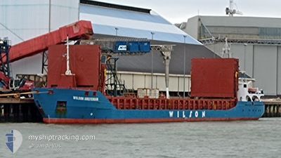
WILSON AMSTERDAM
General Cargo
Current Trip
| Time Travelled | 46 mins |
|---|---|
| Remaining Time | --- |
| Distance Travelled | 4.84 nm |
| Remaining Distance | --- |
| AVG Speed | 9.6 Knots |
| MAX Speed | 9.7 Knots |
| AVG Wind | 8.7 knots |
| MAX Wind | 10 knots |
| MIN Temp | 10.7°C / 51.26°F |
| MAX Temp | 11.7°C / 53.06°F |
| Draught | 5 m |
| Position Received | Now |
Current Position
| Longitude | -8.86464° |
|---|---|
| Latitude | 42.35321° |
| Status | Under way using engine |
| Speed | 9.7 Knots |
| Course | 230.7° |
| Area | North Atlantic Ocean |
| Station | T-AIS |
| Position Received | Now |
Info
Information
The current position of WILSON AMSTERDAM is in North Atlantic Ocean with coordinates 42.35321° / -8.86464° as reported on 2024-04-24 21:00 by AIS to our vessel tracker app. The vessel's current speed is 9.7 Knots
The vessel WILSON AMSTERDAM (IMO: 9313735, MMSI: 314602000) is a General Cargo that was built in 2009 ( 15 years old ). It's sailing under the flag of [BB] Barbados.
In this page you can find informations about the vessels current position, last detected port calls, and current voyage information. If the vessels is not in coverage by AIS you will find the latest position.
The current position of WILSON AMSTERDAM is detected by our AIS receivers and we are not responsible for the reliability of the data. The last position was recorded while the vessel was in Coverage by the Ais receivers of our vessel tracking app.
The current draught of WILSON AMSTERDAM as reported by AIS is 5 meters
Weather
| Temperature | 12.1°C / 53.78°F |
|---|---|
| Wind Speed | 10 knots |
| Direction | 6° N |
| Pressure | 1018 hPa |
| Humidity | 69.6 % |
| Cloud Coverage | 49 % |
Featured Company
Last Port Calls
| Port | Arrival | Departure | Time In Port |
|---|---|---|---|
| 2024-04-24 07:43 | 2024-04-24 20:14 | 12 h | |
| 2024-04-22 21:05 | 2024-04-23 15:48 | 18 h | |
| 2024-04-15 09:45 | 2024-04-16 21:39 | 1 d | |
| 2024-04-11 03:22 | 2024-04-12 14:17 | 1 d | |
| 2024-04-03 06:19 | 2024-04-08 20:55 | 5 d | |
| 2024-03-26 08:43 | 2024-03-30 06:49 | 3 d | |
| 2024-03-17 07:09 | 2024-03-18 17:18 | 1 d | |
| 2024-03-13 16:54 | 2024-03-16 07:27 | 2 d | |
| 2024-03-07 02:39 | 2024-03-08 18:33 | 1 d | |
| 2024-03-03 23:24 | 2024-03-05 20:22 | 1 d |
Last Trips
| Origin | Departure | Destination | Arrival | Distance | |
|---|---|---|---|---|---|
| 2024-04-23 16:48 | 2024-04-24 09:43 | 123.42 nm | |||
| 2024-04-16 23:39 | 2024-04-22 22:05 | 1245.76 nm | |||
| 2024-04-12 16:17 | 2024-04-15 11:45 | 157.71 nm | |||
| 2024-04-08 21:55 | 2024-04-11 05:22 | 375.69 nm | |||
| 2024-03-30 08:49 | 2024-04-03 07:19 | 803.61 nm | |||
| 2024-03-18 17:18 | 2024-03-26 10:43 | 1644.55 nm | |||
| 2024-03-16 07:27 | 2024-03-17 07:09 | 215.79 nm | |||
| 2024-03-08 18:33 | 2024-03-13 16:54 | 944.23 nm | |||
| 2024-03-05 20:22 | 2024-03-07 02:39 | 210.06 nm | |||
| 2024-03-01 19:22 | 2024-03-03 23:24 | 457.32 nm |
Events
| Time | Event | Details | Position / Dest | Info |
|---|---|---|---|---|
| 2024-04-24 20:43 | Draught Changed | 5 3 |
42.36598 / -8.80655
GRCLK
|
Speed: 9.7 kn Course: 259.2° |
| 2024-04-24 20:43 | Destination Changed | GRCLK ESMPG |
42.36598 / -8.80655
GRCLK
|
Speed: 9.7 kn Course: 259.2° |
| 2024-04-24 20:43 | ETA Changed | 2024/05/05 08:00 2024/04/24 05:00 |
42.36598 / -8.80655
GRCLK
|
Speed: 9.7 kn Course: 259.2° |
| 2024-04-24 20:22 | Status Changed | Under way using engine Default |
42.39107 / -8.74095
ESMPG
|
Speed: 9.7 kn Course: 248° |
| 2024-04-24 20:19 | IN Coverage |
42.39107 / -8.74095
North Atlantic Ocean
|
Speed: 9.9 kn Course: 248.7° |
|
| 2024-04-24 20:14 | START Moving | 0.49 nm, West of MARIN |
42.39953 / -8.71204
ESMPG
|
Speed: 8.2 kn Course: 246° |
| 2024-04-24 20:14 | PORT DEPARTURE |
|
42.39953 / -8.71204
ESMPG
|
Speed: 1.2 kn Course: 215° |
| 2024-04-24 07:43 | STOP Moving |
42.39896 / -8.70116
[ES] MARIN
|
Speed: Course: 189° |
|
| 2024-04-24 07:43 | PORT ARRIVAL |
|
42.39896 / -8.70116
[ES] MARIN
|
Speed: 2.7 kn Course: 167° |
| 2024-04-24 06:57 | OUT of Coverage |
42.36883 / -8.77477
North Atlantic Ocean
[ES] MARIN
|
Speed: 10 kn Course: 51.2° |