
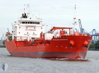
WILHELMINE ESSBERGER
Oil/Chemical Tanker
Current Trip
| Time Travelled | 1 day |
|---|---|
| Remaining Time | --- |
| Distance Travelled | 321.97 nm |
| Remaining Distance | --- |
| AVG Speed | 11.2 Knots |
| MAX Speed | 13.4 Knots |
| AVG Wind | 18.4 knots |
| MAX Wind | 40.7 knots |
| MIN Temp | 9.4°C / 48.92°F |
| MAX Temp | 13.3°C / 55.94°F |
| Draught | 7.4 m |
| Position Received | 9 h, 31 m ago |
Current Position
| Longitude | --- |
|---|---|
| Latitude | --- |
| Status | Under way using engine |
| Speed | 7.5 Knots |
| Course | 73.4° |
| Area | English Channel |
| Station | T-AIS |
| Position Received | 9 h, 31 m ago |
Info
Information
The current position of WILHELMINE ESSBERGER is in English Channel with coordinates 49.90028° / -4.51423° as reported on 2025-12-09 02:27 by AIS to our vessel tracker app. The vessel's current speed is 7.5 Knots
The vessel WILHELMINE ESSBERGER (IMO: 9295440, MMSI: 255916284) is a Oil/Chemical Tanker that was built in 2005 ( 20 years old ). It's sailing under the flag of [PT] Portugal.
In this page you can find informations about the vessels current position, last detected port calls, and current voyage information. If the vessels is not in coverage by AIS you will find the latest position.
The current position of WILHELMINE ESSBERGER is detected by our AIS receivers and we are not responsible for the reliability of the data. The last position was recorded while the vessel was in Coverage by the Ais receivers of our vessel tracking app.
The current draught of WILHELMINE ESSBERGER as reported by AIS is 7.4 meters
Weather
| Temperature | 13.2°C / 55.76°F |
|---|---|
| Wind Speed | 41 knots |
| Direction | 188° S |
| Pressure | 1001.2 hPa |
| Humidity | 88.3 % |
| Cloud Coverage | 100 % |
Featured Company
Last Port Calls
| Port | Arrival | Departure | Time In Port |
|---|---|---|---|
| 2025-12-05 11:27 | 2025-12-07 12:24 | 2 d | |
| 2025-12-04 10:27 | 2025-12-05 08:12 | 21 h | |
| 2025-11-28 18:49 | 2025-12-01 22:32 | 3 d | |
| 2025-11-28 01:34 | 2025-11-28 18:26 | 16 h | |
| 2025-11-25 06:26 | 2025-11-26 12:39 | 1 d | |
| 2025-11-25 01:16 | 2025-11-25 03:24 | 2 h | |
| 2025-11-21 15:16 | 2025-11-23 08:25 | 1 d | |
| 2025-11-11 20:44 | 2025-11-18 14:43 | 6 d | |
| 2025-10-20 10:24 | 2025-10-21 04:22 | 17 h | |
| 2025-10-16 22:56 | 2025-10-17 16:50 | 17 h |
Last Trips
| Origin | Departure | Destination | Arrival | Distance | |
|---|---|---|---|---|---|
| 2025-12-01 22:32 | 2025-12-05 11:27 | 584.39 nm | |||
| 2025-12-01 22:32 | 2025-12-04 10:27 | 556.78 nm | |||
| 2025-11-28 18:26 | 2025-11-28 18:49 | 1.25 nm | |||
| 2025-11-26 12:39 | 2025-11-28 01:34 | 320.76 nm | |||
| 2025-11-25 03:24 | 2025-11-25 06:26 | 36.87 nm | |||
| 2025-11-23 08:25 | 2025-11-25 01:16 | 401.68 nm | |||
| 2025-11-18 14:43 | 2025-11-21 15:16 | 821.32 nm | |||
| 2025-10-21 04:22 | 2025-11-11 20:44 | 4365.43 nm | |||
| 2025-10-17 16:50 | 2025-10-20 10:24 | 442.01 nm | |||
| 2025-10-09 04:17 | 2025-10-16 22:56 | 1922.67 nm |
Events
| Time | Event | Details | Position / Dest | Info |
|---|---|---|---|---|
| 2025-12-09 02:27 | OUT of Coverage |
49.90028 / -4.51423
English Channel
ESBCN
|
Speed: 7.5 kn Course: 73.4° |
|
| 2025-12-09 02:27 | Change Sea Area | United Kingdom part of the English Channel United Kingdom part of the Celtic Sea |
49.90028 / -4.51423
English Channel
ESBCN
|
Speed: 7.5 kn Course: 73.4° |
| 2025-12-09 02:27 | IN Coverage |
49.90028 / -4.51423
English Channel
ESBCN
|
Speed: 7.5 kn Course: 73.4° |
|
| 2025-12-08 14:07 | OUT of Coverage |
50.84094 / -6.01434
Celtic Sea
ESBCN
|
Speed: 10.4 kn Course: 178.8° |
|
| 2025-12-08 13:04 | Change Sea Area | United Kingdom part of the Celtic Sea United Kingdom part of the Irish Sea and St. George's Channel |
51.02337 / -6.01786
Celtic Sea
ESBCN
|
Speed: 10 kn Course: 180.9° |
| 2025-12-08 13:03 | IN Coverage |
51.02337 / -6.01786
Celtic Sea
ESBCN
|
Speed: 10 kn Course: 180.9° |
|
| 2025-12-08 04:56 | OUT of Coverage |
52.10149 / -5.75479
Irish Sea and St. George's Channel
ESBCN
|
Speed: 9.1 kn Course: 201.9° |
|
| 2025-12-08 03:44 | Detected in Sea | United Kingdom part of the Irish Sea and St. George's Channel |
52.27630 / -5.64385
Irish Sea and St. George's Channel
ESBCN
|
Speed: 9.7 kn Course: 201.9° |
| 2025-12-08 03:19 | Change Sea Area | Irish part of the Irish Sea and St. George's Channel United Kingdom part of the Irish Sea and St. George's Channel |
52.34041 / -5.60248
Irish Sea and St. George's Channel
ESBCN
|
Speed: 10.1 kn Course: 200.6° |
| 2025-12-08 03:18 | IN Coverage |
52.34041 / -5.60248
Irish Sea and St. George's Channel
ESBCN
|
Speed: 10.1 kn Course: 200.6° |