
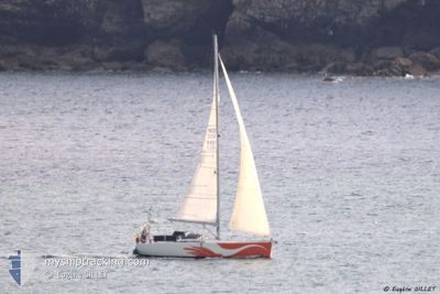
WESTWIND
Pleasure Craft
Current Trip
Unknown
| Time Travelled | 9 days |
|---|---|
| Remaining Time | --- |
| Distance Travelled | 10.34 nm |
| Remaining Distance | --- |
| AVG Speed | 5.5 Knots |
| MAX Speed | 6.6 Knots |
| AVG Wind | 7.5 knots |
| MAX Wind | 8 knots |
| MIN Temp | 22.8°C / 73.04°F |
| MAX Temp | 23.4°C / 74.12°F |
| Draught | 0 m |
| Position Received | 9 d ago |
Current Position
| Longitude | 9.37112° |
|---|---|
| Latitude | 39.16347° |
| Status | Default |
| Speed | 5.1 Knots |
| Course | 164.3° |
| Area | Tyrrhenian Sea |
| Station | T-AIS |
| Position Received | 9 d ago |
Info
Information
The current position of WESTWIND is in Tyrrhenian Sea with coordinates 39.16347° / 9.37112° as reported on 2024-04-15 14:53 by AIS to our vessel tracker app. The vessel's current speed is 5.1 Knots
The vessel WESTWIND (MMSI: 244740574) is a Pleasure Craft It's sailing under the flag of [NL] Netherlands.
In this page you can find informations about the vessels current position, last detected port calls, and current voyage information. If the vessels is not in coverage by AIS you will find the latest position.
The current position of WESTWIND is detected by our AIS receivers and we are not responsible for the reliability of the data. The last position was recorded while the vessel was in Coverage by the Ais receivers of our vessel tracking app.
Weather
| Temperature | 23.4°C / 74.12°F |
|---|---|
| Wind Speed | 8 knots |
| Direction | 172° S |
| Pressure | 1015.3 hPa |
| Humidity | 39.5 % |
| Cloud Coverage | 53 % |
Featured Company
Last Port Calls
Most Visited Ports (Last year)
| Port | Arrivals | |
|---|---|---|
| 15 | ||
| 8 | ||
| 6 | ||
| 5 | ||
| 5 | ||
| 5 |
Last Trips
Events
| Time | Event | Details | Position / Dest | Info |
|---|---|---|---|---|
| 2024-04-15 14:53 | OUT of Coverage |
39.16347 / 9.37112
Tyrrhenian Sea
|
Speed: 5.1 kn Course: 164.3° |
|
| 2024-04-15 13:00 | IN Coverage |
39.17438 / 9.15733
Tyrrhenian Sea
|
Speed: 5.8 kn Course: 103.1° |
|
| 2024-04-15 12:30 | PORT DEPARTURE |
|
39.17438 / 9.15733
|
Speed: 3.8 kn Course: 144.8° |
| 2024-04-15 11:48 | OUT of Coverage |
39.20048 / 9.10527
Tyrrhenian Sea
[IT] CAGLIARI
|
Speed: 3.8 kn Course: 144.8° |
|
| 2024-04-15 11:46 | START Moving |
39.20124 / 9.10707
[IT] CAGLIARI
|
Speed: 4.2 kn Course: 299.6° |
|
| 2024-04-15 11:26 | IN Coverage |
39.21128 / 9.11402
Tyrrhenian Sea
[IT] CAGLIARI
|
Speed: Course: 64.7° |
|
| 2024-04-15 10:08 | OUT of Coverage |
39.21126 / 9.11399
Tyrrhenian Sea
[IT] CAGLIARI
|
Speed: Course: 0° |
|
| 2024-04-15 07:02 | IN Coverage |
39.21118 / 9.11396
Tyrrhenian Sea
[IT] CAGLIARI
|
Speed: Course: 0° |
|
| 2024-04-15 05:02 | OUT of Coverage |
39.21120 / 9.11395
Tyrrhenian Sea
[IT] CAGLIARI
|
Speed: Course: 0° |
|
| 2024-04-15 04:02 | OUT of Coverage |
39.21121 / 9.11397
Tyrrhenian Sea
[IT] CAGLIARI
|
Speed: Course: 0° |