
WESTERN PARIS
Cargo
Current Trip
| Time Travelled | 6 days |
|---|---|
| Remaining Time | 1 day |
| Distance Travelled | 1817.56 nm |
| Remaining Distance | 449.52 nm |
| AVG Speed | 10.4 Knots |
| MAX Speed | 13.4 Knots |
| AVG Wind | 14.2 knots |
| MAX Wind | 32 knots |
| MIN Temp | 10.5°C / 50.9°F |
| MAX Temp | 20°C / 68°F |
| Draught | 7.4 m |
| Position Received | 1 m ago |
Current Position
| Longitude | -5.87278° |
|---|---|
| Latitude | 48.42616° |
| Status | Under way using engine |
| Speed | 11.4 Knots |
| Course | 27.7° |
| Area | Celtic Sea |
| Station | T-AIS |
| Position Received | 1 m ago |
Info
Information
The current position of WESTERN PARIS is in Celtic Sea with coordinates 48.42616° / -5.87278° as reported on 2024-04-19 06:28 by AIS to our vessel tracker app. The vessel's current speed is 11.4 Knots and is heading at the port of ANTWERP. The estimated time of arrival as calculated by MyShipTracking vessel tracking app is 2024-04-20 20:28 LT
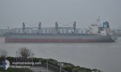
The vessel WESTERN PARIS (IMO: 9703423, MMSI: 548928000) is a Cargo It's sailing under the flag of [PH] Philippines.
In this page you can find informations about the vessels current position, last detected port calls, and current voyage information. If the vessels is not in coverage by AIS you will find the latest position.
The current position of WESTERN PARIS is detected by our AIS receivers and we are not responsible for the reliability of the data. The last position was recorded while the vessel was in Coverage by the Ais receivers of our vessel tracking app.
The current draught of WESTERN PARIS as reported by AIS is 7.4 meters
Weather
| Temperature | 10.7°C / 51.26°F |
|---|---|
| Wind Speed | 11 knots |
| Direction | 317° NW |
| Pressure | 1024.1 hPa |
| Humidity | 81.3 % |
| Cloud Coverage | 16 % |
Featured Company
Most Visited Ports (Last year)
| Port | Arrivals | |
|---|---|---|
| 2 | ||
| 2 | ||
| 1 | ||
| 1 | ||
| 1 | ||
| 1 |
Last Trips
Events
| Time | Event | Details | Position / Dest | Info |
|---|---|---|---|---|
| 2024-04-19 05:45 | Draught Changed | 7.4 7.5 |
48.30439 / -5.97040
BE ANR
|
Speed: 12 kn Course: 19.2° |
| 2024-04-19 04:28 | Status Changed | Under way using engine Default |
48.08287 / -6.14546
BE ANR
|
Speed: 11.7 kn Course: 22° |
| 2024-04-19 04:28 | IN Coverage |
48.08394 / -6.14471
Celtic Sea
BE ANR
|
Speed: 11.7 kn Course: 35.8° |
|
| 2024-04-19 04:06 | Status Changed | Default Under way using engine |
48.02072 / -6.18928
BE ANR
|
Speed: 11.9 kn Course: 26.4° |
| 2024-04-19 03:14 | OUT of Coverage |
47.86702 / -6.29941
Celtic Sea
BE ANR
|
Speed: 11.9 kn Course: 26.4° |
|
| 2024-04-19 02:03 | Status Changed | Under way using engine Default |
47.65910 / -6.47348
BE ANR
|
Speed: 12.5 kn Course: 40° |
| 2024-04-19 01:56 | Status Changed | Default Under way using engine |
47.63618 / -6.49115
BE ANR
|
Speed: 12.2 kn Course: 36.1° |
| 2024-04-19 01:32 | Detected in Sea | French part of the Celtic Sea |
47.56676 / -6.55259
Celtic Sea
BE ANR
|
Speed: 12.4 kn Course: 38° |
| 2024-04-19 01:32 | Status Changed | Under way using engine Default |
47.56676 / -6.55259
BE ANR
|
Speed: 12.2 kn Course: 18° |
| 2024-04-19 01:32 | IN Coverage |
47.56676 / -6.55259
Celtic Sea
BE ANR
|
Speed: 12.4 kn Course: 38° |