
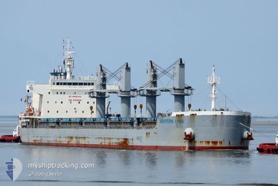
WESTERN LIMA
Cargo
Current Trip
| Time Travelled | 2 days |
|---|---|
| Remaining Time | --- |
| Distance Travelled | 590.41 nm |
| Remaining Distance | --- |
| AVG Speed | 9.3 Knots |
| MAX Speed | 13 Knots |
| AVG Wind | 3.9 knots |
| MAX Wind | 8 knots |
| MIN Temp | 25.4°C / 77.72°F |
| MAX Temp | 31.2°C / 88.16°F |
| Draught | 10.4 m |
| Position Received | 1 d ago |
Current Position
| Longitude | 101.02189° |
|---|---|
| Latitude | 2.85165° |
| Status | Under way using engine |
| Speed | 10 Knots |
| Course | 302.8° |
| Area | Malacca Strait |
| Station | T-AIS |
| Position Received | 1 d ago |
Info
Information
The current position of WESTERN LIMA is in Malacca Strait with coordinates 2.85165° / 101.02189° as reported on 2024-04-23 10:38 by AIS to our vessel tracker app. The vessel's current speed is 10 Knots and is heading at the port of NEW ORLEANS. The estimated time of arrival as calculated by MyShipTracking vessel tracking app is 2024-06-06 06:30 LT
The vessel WESTERN LIMA (IMO: 9700029, MMSI: 548910000) is a Cargo It's sailing under the flag of [PH] Philippines.
In this page you can find informations about the vessels current position, last detected port calls, and current voyage information. If the vessels is not in coverage by AIS you will find the latest position.
The current position of WESTERN LIMA is detected by our AIS receivers and we are not responsible for the reliability of the data. The last position was recorded while the vessel was in Coverage by the Ais receivers of our vessel tracking app.
The current draught of WESTERN LIMA as reported by AIS is 10.4 meters
Weather
| Temperature | 29.6°C / 85.28°F |
|---|---|
| Wind Speed | 1 knots |
| Direction | 119° ESE |
| Pressure | 1008 hPa |
| Humidity | 72.8 % |
| Cloud Coverage | 100 % |
Featured Company
Last Port Calls
| Port | Arrival | Departure | Time In Port |
|---|---|---|---|
| 2024-03-29 09:13 | 2024-04-21 22:57 | 23 d | |
| 2024-03-19 00:17 | 2024-03-20 17:56 | 1 d | |
| 2024-02-18 20:20 | 2024-02-23 19:17 | 4 d | |
| 2024-02-01 06:07 | 2024-02-04 04:44 | 2 d |
Most Visited Ports (Last year)
| Port | Arrivals | |
|---|---|---|
| 2 | ||
| 1 | ||
| 1 | ||
| 1 | ||
| 1 | ||
| 1 |
Last Trips
| Origin | Departure | Destination | Arrival | Distance | |
|---|---|---|---|---|---|
| 2024-03-21 01:56 | 2024-03-29 17:13 | 1718.37 nm | |||
| 2024-02-23 11:17 | 2024-03-19 08:17 | 6225.67 nm | |||
| 2024-02-03 23:44 | 2024-02-18 12:20 | 3581.60 nm | |||
| 2024-01-28 05:13 | 2024-02-01 01:07 | 1025.50 nm |
Events
| Time | Event | Details | Position / Dest | Info |
|---|---|---|---|---|
| 2024-04-23 10:44 | Status Changed | Default Under way using engine |
2.86124 / 101.00687
SGSIN> USMSY
|
Speed: 10 kn Course: 302.8° |
| 2024-04-23 10:38 | OUT of Coverage |
2.85165 / 101.02189
Malacca Strait
|
Speed: 10 kn Course: 302.8° |
|
| 2024-04-23 07:37 | Status Changed | Under way using engine Default |
2.59201 / 101.46827
SGSIN> USMSY
|
Speed: 11.4 kn Course: 309° |
| 2024-04-23 07:10 | Status Changed | Default Under way using engine |
2.53667 / 101.53500
SGSIN> USMSY
|
Speed: 12 kn Course: 303.3° |
| 2024-04-23 06:54 | Change Sea Area | Malaysian part of the Malacca Strait Malaysian part of the Singapore Strait |
2.50764 / 101.58090
Malacca Strait
|
Speed: 12.4 kn Course: 299.5° |
| 2024-04-23 06:53 | Status Changed | Under way using engine Default |
2.50535 / 101.58492
SGSIN> USMSY
|
Speed: 12 kn Course: 300° |
| 2024-04-23 06:40 | IN Coverage |
2.50764 / 101.58090
Malacca Strait
|
Speed: 12.4 kn Course: 299.5° |
|
| 2024-04-22 19:00 | Status Changed | Default Under way using engine |
1.22408 / 103.46292
SGSIN> USMSY
|
Speed: 11.1 kn Course: 282.9° |
| 2024-04-22 18:55 | OUT of Coverage |
1.21994 / 103.47897
Singapore Strait
|
Speed: 11.1 kn Course: 282.9° |
|
| 2024-04-22 18:49 | Status Changed | Under way using engine Default |
1.21553 / 103.49587
SGSIN> USMSY
|
Speed: 11.1 kn Course: 283° |