
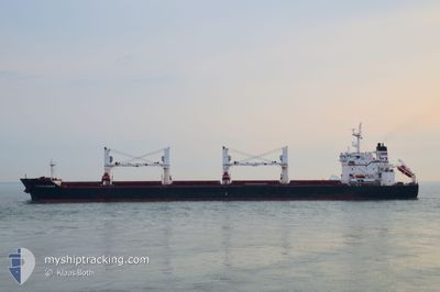
WESTERN BOHEME
Bulk Carrier
Current Trip
| Time Travelled | 25 days |
|---|---|
| Remaining Time | --- |
| Distance Travelled | 5195.71 nm |
| Remaining Distance | --- |
| AVG Speed | 10.1 Knots |
| MAX Speed | 14.3 Knots |
| AVG Wind | 15.6 knots |
| MAX Wind | 41 knots |
| MIN Temp | 11.1°C / 51.98°F |
| MAX Temp | 30.2°C / 86.36°F |
| Draught | 10.6 m |
| Position Received | 1 d ago |
Current Position
| Longitude | -44.28688° |
|---|---|
| Latitude | -2.39847° |
| Status | At anchor |
| Speed | 0.1 Knots |
| Course | 229° |
| Area | South Atlantic Ocean |
| Station | T-AIS |
| Position Received | 1 d ago |
Info
Information
The current position of WESTERN BOHEME is in South Atlantic Ocean with coordinates -2.39847° / -44.28688° as reported on 2024-04-17 11:42 by AIS to our vessel tracker app. The vessel's current speed is 0.1 Knots and is heading at the port of ITAQUI. The estimated time of arrival as calculated by MyShipTracking vessel tracking app is 2024-04-12 14:30 LT
The vessel WESTERN BOHEME (IMO: 9609691, MMSI: 210261000) is a Bulk Carrier that was built in 2012 ( 12 years old ). It's sailing under the flag of [CY] Cyprus.
In this page you can find informations about the vessels current position, last detected port calls, and current voyage information. If the vessels is not in coverage by AIS you will find the latest position.
The current position of WESTERN BOHEME is detected by our AIS receivers and we are not responsible for the reliability of the data. The last position was recorded while the vessel was in Coverage by the Ais receivers of our vessel tracking app.
The current draught of WESTERN BOHEME as reported by AIS is 10.6 meters
Weather
| Temperature | 27.8°C / 82.04°F |
|---|---|
| Wind Speed | 6 knots |
| Direction | 51° NE |
| Pressure | 1008.2 hPa |
| Humidity | 81.6 % |
| Cloud Coverage | 98 % |
Featured Company
Last Port Calls
| Port | Arrival | Departure | Time In Port |
|---|---|---|---|
| 2024-03-19 22:20 | 2024-03-24 04:01 | 4 d | |
| 2024-02-20 22:46 | 2024-03-09 20:30 | 17 d | |
| 2024-02-08 21:27 | 2024-02-11 05:13 | 2 d | |
| 2024-02-05 03:22 | 2024-02-07 07:17 | 2 d |
Most Visited Ports (Last year)
| Port | Arrivals | |
|---|---|---|
| 2 | ||
| 2 | ||
| 2 | ||
| 2 | ||
| 1 | ||
| 1 |
Last Trips
| Origin | Departure | Destination | Arrival | Distance | |
|---|---|---|---|---|---|
| 2024-03-09 21:30 | 2024-03-20 00:20 | 930.57 nm | |||
| 2024-02-11 06:13 | 2024-02-20 23:46 | 2718.64 nm | |||
| 2024-02-07 08:17 | 2024-02-08 22:27 | 109.04 nm | |||
| 2023-12-11 06:35 | 2024-02-05 04:22 | 4386.65 nm |
Events
| Time | Event | Details | Position / Dest | Info |
|---|---|---|---|---|
| 2024-04-17 11:45 | Status Changed | Default At anchor |
-2.39845 / -44.28695
BRITQ
|
Speed: 0.1 kn Course: 229° |
| 2024-04-17 11:42 | OUT of Coverage |
-2.39847 / -44.28688
South Atlantic Ocean
|
Speed: 0.1 kn Course: 288° |
|
| 2024-04-17 11:21 | Status Changed | At anchor Default |
-2.39866 / -44.28674
BRITQ
|
Speed: 0.2 kn Course: 219° |
| 2024-04-17 11:12 | IN Coverage |
-2.39866 / -44.28674
South Atlantic Ocean
|
Speed: 0.1 kn Course: 80.5° |
|
| 2024-04-16 01:48 | Status Changed | Default At anchor |
-2.40213 / -44.28981
BRITQ
|
Speed: Course: 34° |
| 2024-04-16 01:42 | OUT of Coverage |
-2.40209 / -44.28973
South Atlantic Ocean
|
Speed: Course: 119.1° |
|
| 2024-04-16 01:12 | Status Changed | At anchor Default |
-2.40183 / -44.28954
BRITQ
|
Speed: Course: 30° |
| 2024-04-16 01:12 | IN Coverage |
-2.40183 / -44.28954
South Atlantic Ocean
|
Speed: 0.1 kn Course: 283.1° |
|
| 2024-04-15 15:27 | Status Changed | Default At anchor |
-2.40145 / -44.28715
BRITQ
|
Speed: 0.5 kn Course: 3° |
| 2024-04-15 15:03 | OUT of Coverage |
-2.40178 / -44.28898
South Atlantic Ocean
|
Speed: 0.5 kn Course: 126.5° |