
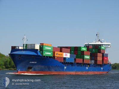
ELBWATER
Container Ship
Current Trip
| Time Travelled | 3 days |
|---|---|
| Remaining Time | 2 days |
| Distance Travelled | 514.86 nm |
| Remaining Distance | 1134.80 nm |
| AVG Speed | 13.6 Knots |
| MAX Speed | 17 Knots |
| AVG Wind | 10.9 knots |
| MAX Wind | 20 knots |
| MIN Temp | -2.3°C / 27.86°F |
| MAX Temp | 6.3°C / 43.34°F |
| Draught | 8.1 m |
| Position Received | 1 m ago |
Current Position
| Longitude | 23.26864° |
|---|---|
| Latitude | 59.62817° |
| Status | Under way using engine |
| Speed | 16.4 Knots |
| Course | 255.3° |
| Area | Gulf of Finland |
| Station | T-AIS |
| Position Received | 1 m ago |
Info
Information
The current position of ELBWATER is in Gulf of Finland with coordinates 59.62817° / 23.26864° as reported on 2024-04-20 02:08 by AIS to our vessel tracker app. The vessel's current speed is 16.4 Knots and is heading at the port of HAMBURG. The estimated time of arrival as calculated by MyShipTracking vessel tracking app is 2024-04-22 23:38 LT
The vessel ELBWATER (IMO: 9504073, MMSI: 210359000) is a Container Ship that was built in 2012 ( 12 years old ). It's sailing under the flag of [CY] Cyprus.
In this page you can find informations about the vessels current position, last detected port calls, and current voyage information. If the vessels is not in coverage by AIS you will find the latest position.
The current position of ELBWATER is detected by our AIS receivers and we are not responsible for the reliability of the data. The last position was recorded while the vessel was in Coverage by the Ais receivers of our vessel tracking app.
The current draught of ELBWATER as reported by AIS is 8.1 meters
Weather
| Temperature | -1.5°C / 29.3°F |
|---|---|
| Wind Speed | 10 knots |
| Direction | 329° NNW |
| Pressure | 1003.8 hPa |
| Humidity | 87.8 % |
| Cloud Coverage | 100 % |
Featured Company
Last Port Calls
| Port | Arrival | Departure | Time In Port |
|---|---|---|---|
| 2024-04-16 04:54 | 2024-04-16 16:58 | 12 h | |
| 2024-04-13 00:23 | 2024-04-14 09:39 | 1 d | |
| 2024-04-12 06:44 | 2024-04-12 14:31 | 7 h | |
| 2024-04-11 14:05 | 2024-04-11 14:42 | 36 m | |
| 2024-04-10 03:01 | 2024-04-10 13:56 | 10 h | |
| 2024-04-09 10:26 | 2024-04-09 23:24 | 12 h | |
| 2024-04-03 19:40 | 2024-04-05 05:32 | 1 d | |
| 2024-04-02 20:09 | 2024-04-03 09:58 | 13 h | |
| 2024-04-02 04:22 | 2024-04-02 05:01 | 39 m | |
| 2024-03-30 13:35 | 2024-03-31 13:48 | 1 d |
Most Visited Ports (Last year)
| Port | Arrivals | |
|---|---|---|
| 36 | ||
| 35 | ||
| 24 | ||
| 10 | ||
| 10 | ||
| 9 |
Last Trips
| Origin | Departure | Destination | Arrival | Distance | |
|---|---|---|---|---|---|
| 2024-04-14 11:39 | 2024-04-16 06:54 | 559.39 nm | |||
| 2024-04-12 16:31 | 2024-04-13 02:23 | 112.42 nm | |||
| 2024-04-11 16:42 | 2024-04-12 08:44 | 126.34 nm | |||
| 2024-04-10 15:56 | 2024-04-11 16:05 | 360.93 nm | |||
| 2024-04-10 01:24 | 2024-04-10 05:01 | 19.01 nm | |||
| 2024-04-05 07:32 | 2024-04-09 12:26 | 1004.41 nm | |||
| 2024-04-03 11:58 | 2024-04-03 21:40 | 119.05 nm | |||
| 2024-04-02 07:01 | 2024-04-02 22:09 | 131.78 nm | |||
| 2024-03-31 16:48 | 2024-04-02 06:22 | 621.45 nm | |||
| 2024-03-28 21:52 | 2024-03-30 15:35 | 624.69 nm |
Events
| Time | Event | Details | Position / Dest | Info |
|---|---|---|---|---|
| 2024-04-20 00:39 | Status Changed | Under way using engine Default |
59.73687 / 24.02640
DEHAM VIA KIEL CANAL
|
Speed: 16.3 kn Course: 254° |
| 2024-04-20 00:32 | Status Changed | Default Under way using engine |
59.74587 / 24.08632
DEHAM VIA KIEL CANAL
|
Speed: 16.3 kn Course: 254.6° |
| 2024-04-19 23:20 | Change Sea Area | Finnish part of the Gulf of Finland Estonian part of the Gulf of Finland |
59.82003 / 24.72338
Gulf of Finland
DEHAM VIA KIEL CANAL
|
Speed: 16.3 kn Course: 258.3° |
| 2024-04-19 22:08 | Change Sea Area | Estonian part of the Gulf of Finland Finnish part of the Gulf of Finland |
59.87949 / 25.36163
Gulf of Finland
DEHAM VIA KIEL CANAL
|
Speed: 16.1 kn Course: 262.5° |
| 2024-04-19 20:25 | Status Changed | Under way using engine Default |
60.06855 / 26.15138
DEHAM VIA KIEL CANAL
|
Speed: 16.4 kn Course: 228° |
| 2024-04-19 20:24 | Status Changed | Default Under way using engine |
60.07192 / 26.15906
DEHAM VIA KIEL CANAL
|
Speed: 16.3 kn Course: 229.1° |
| 2024-04-19 18:39 | Destination Changed | DEHAM VIA KIEL CANAL DEHAM VIA H |
60.37905 / 26.76186
DEHAM VIA KIEL CANAL
|
Speed: 16.2 kn Course: 249.4° |
| 2024-04-19 18:17 | START Moving | 3.83 nm, South of KOTKA |
60.41796 / 26.92053
DEHAM VIA H
|
Speed: 5 kn Course: 238° |
| 2024-04-19 18:14 | STOP Moving | 3.71 nm, South of KOTKA |
60.41942 / 26.92394
DEHAM VIA H
|
Speed: 0.2 kn Course: 233° |
| 2024-04-19 18:06 | START Moving | 3.68 nm, South of KOTKA |
60.42190 / 26.91214
DEHAM VIA H
|
Speed: 3.1 kn Course: 310° |