
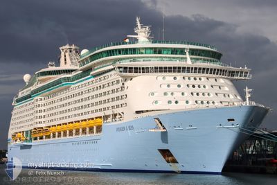
VOYAGER OF THE SEAS
Passengers Ship
Current Trip
| Time Travelled | 6 h, 43 mins |
|---|---|
| Remaining Time | 1 day |
| Distance Travelled | 111.84 nm |
| Remaining Distance | 722.29 nm |
| AVG Speed | 15.7 Knots |
| MAX Speed | 20.1 Knots |
| AVG Wind | 16.3 knots |
| MAX Wind | 20.2 knots |
| MIN Temp | 21.9°C / 71.42°F |
| MAX Temp | 22.6°C / 72.68°F |
| Draught | 9.1 m |
| Position Received | 1 m ago |
Current Position
| Longitude | -93.05010° |
|---|---|
| Latitude | 28.30098° |
| Status | Under way using engine |
| Speed | 20.1 Knots |
| Course | 124.9° |
| Area | Gulf of Mexico |
| Station | T-AIS |
| Position Received | 1 m ago |
Info
Information
The current position of VOYAGER OF THE SEAS is in Gulf of Mexico with coordinates 28.30098° / -93.05010° as reported on 2024-04-16 04:07 by AIS to our vessel tracker app. The vessel's current speed is 20.1 Knots and is heading at the port of COSTA MAYA. The estimated time of arrival as calculated by MyShipTracking vessel tracking app is 2024-04-17 16:35 LT
The vessel VOYAGER OF THE SEAS (IMO: 9161716, MMSI: 311317000) is a Passengers Ship that was built in 1999 ( 25 years old ). It's sailing under the flag of [BS] Bahamas.
In this page you can find informations about the vessels current position, last detected port calls, and current voyage information. If the vessels is not in coverage by AIS you will find the latest position.
The current position of VOYAGER OF THE SEAS is detected by our AIS receivers and we are not responsible for the reliability of the data. The last position was recorded while the vessel was in Coverage by the Ais receivers of our vessel tracking app.
The current draught of VOYAGER OF THE SEAS as reported by AIS is 9.1 meters
Weather
| Temperature | 22.6°C / 72.68°F |
|---|---|
| Wind Speed | 19 knots |
| Direction | 146° SE |
| Pressure | 1014.1 hPa |
| Humidity | 88.5 % |
| Cloud Coverage | 100 % |
Featured Company
Last Port Calls
| Port | Arrival | Departure | Time In Port |
|---|---|---|---|
| 2024-04-15 11:39 | 2024-04-15 21:25 | 9 h | |
| 2024-04-13 12:36 | 2024-04-13 22:59 | 10 h | |
| 2024-04-11 11:39 | 2024-04-11 21:26 | 9 h | |
| 2024-04-09 11:36 | 2024-04-09 22:08 | 10 h | |
| 2024-04-08 16:36 | 2024-04-09 00:09 | 7 h | |
| 2024-04-06 11:42 | 2024-04-06 21:11 | 9 h | |
| 2024-04-04 11:40 | 2024-04-04 22:16 | 10 h | |
| 2024-04-03 16:26 | 2024-04-04 00:08 | 7 h | |
| 2024-04-01 11:24 | 2024-04-01 21:40 | 10 h | |
| 2024-03-30 12:41 | 2024-03-30 22:47 | 10 h |
Last Trips
| Origin | Departure | Destination | Arrival | Distance | |
|---|---|---|---|---|---|
| 2024-04-13 17:59 | 2024-04-15 06:39 | 721.04 nm | |||
| 2024-04-11 16:26 | 2024-04-13 07:36 | 719.25 nm | |||
| 2024-04-09 17:08 | 2024-04-11 06:39 | 720.92 nm | |||
| 2024-04-08 19:09 | 2024-04-09 06:36 | 126.04 nm | |||
| 2024-04-06 16:11 | 2024-04-08 11:36 | 837.84 nm | |||
| 2024-04-04 17:16 | 2024-04-06 06:42 | 719.57 nm | |||
| 2024-04-03 19:08 | 2024-04-04 06:40 | 124.69 nm | |||
| 2024-04-01 16:40 | 2024-04-03 11:26 | 836.62 nm | |||
| 2024-03-30 17:47 | 2024-04-01 06:24 | 720.26 nm | |||
| 2024-03-28 16:06 | 2024-03-30 07:41 | 720.86 nm |
Events
| Time | Event | Details | Position / Dest | Info |
|---|---|---|---|---|
| 2024-04-16 01:14 | Status Changed | Under way using engine Default |
28.85192 / -93.92608
COSTA MAYA
|
Speed: 19.2 kn Course: 124° |
| 2024-04-16 01:13 | Status Changed | Default Under way using engine |
28.85651 / -93.93362
COSTA MAYA
|
Speed: 19.6 kn Course: 124° |
| 2024-04-16 01:08 | Status Changed | Under way using engine Default |
28.87282 / -93.96053
COSTA MAYA
|
Speed: 19.6 kn Course: 124° |
| 2024-04-16 01:01 | Status Changed | Default Under way using engine |
28.89346 / -93.99463
COSTA MAYA
|
Speed: 18 kn Course: 125° |
| 2024-04-16 00:49 | Status Changed | Under way using engine Default |
28.92844 / -94.05133
COSTA MAYA
|
Speed: 16.7 kn Course: 126° |
| 2024-04-16 00:33 | IN Coverage |
28.92844 / -94.05133
Gulf of Mexico
COSTA MAYA
|
Speed: 16.7 kn Course: 125.2° |
|
| 2024-04-15 21:53 | Status Changed | Default Under way using engine |
29.34306 / -94.70078
COSTA MAYA
|
Speed: 12.9 kn Course: 79° |
| 2024-04-15 21:46 | OUT of Coverage |
29.34564 / -94.72960
Gulf of Mexico
COSTA MAYA
|
Speed: 12.9 kn Course: 79° |
|
| 2024-04-15 21:25 | PORT DEPARTURE |
|
29.32176 / -94.78059
COSTA MAYA
|
Speed: 5.9 kn Course: 30° |
| 2024-04-15 21:24 | START Moving |
29.31988 / -94.78165
[US] GALVESTON
|
Speed: 4.7 kn Course: 31° |