
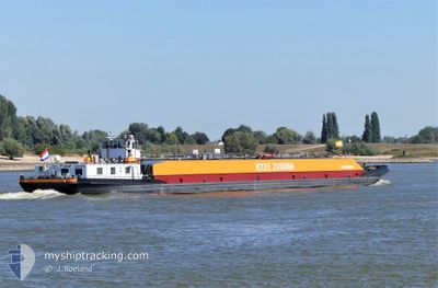
VOLHARDING 9
Tanker
Current Trip
| Time Travelled | 4 h, 27 mins |
|---|---|
| Remaining Time | 4 h, 33 mins |
| Distance Travelled | 27.15 nm |
| Remaining Distance | 41.92 nm |
| AVG Speed | 7.4 Knots |
| MAX Speed | 8.8 Knots |
| AVG Wind | 18 knots |
| MAX Wind | 20.4 knots |
| MIN Temp | 9°C / 48.2°F |
| MAX Temp | 10.3°C / 50.54°F |
| Draught | 2.5 m |
| Position Received | 1 m ago |
Current Position
| Longitude | 4.44424° |
|---|---|
| Latitude | 51.69842° |
| Status | Under way using engine |
| Speed | 8.4 Knots |
| Course | 106.7° |
| Area | North Sea |
| Station | T-AIS |
| Position Received | 1 m ago |
Info
Information
The current position of VOLHARDING 9 is in North Sea with coordinates 51.69842° / 4.44424° as reported on 2024-04-16 17:08 by AIS to our vessel tracker app. The vessel's current speed is 8.4 Knots and is heading at the port of NIEUWEGEIN. The estimated time of arrival as calculated by MyShipTracking vessel tracking app is 2024-04-16 21:42 LT
The vessel VOLHARDING 9 (MMSI: 244710874) is a Tanker It's sailing under the flag of [NL] Netherlands.
In this page you can find informations about the vessels current position, last detected port calls, and current voyage information. If the vessels is not in coverage by AIS you will find the latest position.
The current position of VOLHARDING 9 is detected by our AIS receivers and we are not responsible for the reliability of the data. The last position was recorded while the vessel was in Coverage by the Ais receivers of our vessel tracking app.
The current draught of VOLHARDING 9 as reported by AIS is 2.5 meters
Weather
| Temperature | 9.6°C / 49.28°F |
|---|---|
| Wind Speed | 12 knots |
| Direction | 348° NNW |
| Pressure | 1008.4 hPa |
| Humidity | 71.6 % |
| Cloud Coverage | 95 % |
Featured Company
Last Port Calls
| Port | Arrival | Departure | Time In Port |
|---|---|---|---|
| 2024-04-15 21:47 | 2024-04-16 12:42 | 14 h | |
| 2024-04-15 21:08 | 2024-04-15 21:30 | 22 m | |
| 2024-04-15 18:57 | 2024-04-15 19:54 | 56 m | |
| 2024-04-15 18:14 | 2024-04-15 18:38 | 23 m | |
| 2024-04-14 21:25 | 2024-04-14 22:10 | 44 m | |
| 2024-04-13 12:53 | 2024-04-14 12:05 | 23 h | |
| 2024-04-13 03:16 | 2024-04-13 11:55 | 8 h | |
| 2024-04-12 15:49 | 2024-04-13 02:55 | 11 h | |
| 2024-04-11 11:16 | 2024-04-12 15:18 | 1 d | |
| 2024-04-10 17:03 | 2024-04-11 10:58 | 17 h |
Most Visited Ports (Last year)
| Port | Arrivals | |
|---|---|---|
| 43 | ||
| 41 | ||
| 37 | ||
| 36 | ||
| 34 | ||
| 30 |
Last Trips
| Origin | Departure | Destination | Arrival | Distance | |
|---|---|---|---|---|---|
| 2024-04-15 23:30 | 2024-04-15 23:47 | 2.26 nm | |||
| 2024-04-15 21:54 | 2024-04-15 23:08 | 10.81 nm | |||
| 2024-04-15 20:38 | 2024-04-15 20:57 | 2.39 nm | |||
| 2024-04-15 00:10 | 2024-04-15 20:14 | 27.13 nm | |||
| 2024-04-14 14:05 | 2024-04-14 23:25 | 65.34 nm | |||
| 2024-04-13 13:55 | 2024-04-13 14:53 | 9.86 nm | |||
| 2024-04-13 04:55 | 2024-04-13 05:16 | 2.85 nm | |||
| 2024-04-12 17:18 | 2024-04-12 17:49 | 4.96 nm | |||
| 2024-04-11 12:58 | 2024-04-11 13:16 | 1.82 nm | |||
| 2024-04-10 18:36 | 2024-04-10 19:03 | 4.03 nm |
Events
| Time | Event | Details | Position / Dest | Info |
|---|---|---|---|---|
| 2024-04-16 16:59 | START Moving | 0.97 nm, West of WILLEMSTAD |
51.69382 / 4.41405
AMERIKAHAVEN
|
Speed: 7.1 kn Course: 53.3° |
| 2024-04-16 16:39 | STOP Moving | 1.19 nm, West of WILLEMSTAD |
51.69096 / 4.40843
AMERIKAHAVEN
|
Speed: Course: 511° |
| 2024-04-16 15:12 | START Moving | 2.71 nm, East of BRUINISSE |
51.66194 / 4.16240
AMERIKAHAVEN
|
Speed: 5.4 kn Course: 86.1° |
| 2024-04-16 14:45 | STOP Moving | 2.6 nm, East of BRUINISSE |
51.66190 / 4.15929
AMERIKAHAVEN
|
Speed: 0.3 kn Course: 511° |
| 2024-04-16 12:42 | PORT DEPARTURE |
|
51.50689 / 4.00923
AMERIKAHAVEN
|
Speed: 5.1 kn Course: 39° |
| 2024-04-16 12:42 | START Moving |
51.50612 / 4.00828
[NL] WEMELDINGE
|
Speed: 5 kn Course: 40° |
|
| 2024-04-16 12:41 | Draught Changed | 2.5 1.6 |
51.50463 / 4.00572
[NL] WEMELDINGE
|
Speed: 3.2 kn Course: 57.6° |
| 2024-04-16 12:41 | Destination Changed | AMERIKAHAVEN WEMELDINGE |
51.50463 / 4.00572
[NL] WEMELDINGE
|
Speed: 3.2 kn Course: 57.6° |
| 2024-04-16 12:41 | ETA Changed | 2024/04/17 11:15 2024/04/16 07:31 |
51.50463 / 4.00572
[NL] WEMELDINGE
|
Speed: 3.2 kn Course: 57.6° |
| 2024-04-16 12:36 | Status Changed | Under way using engine Default |
51.50567 / 4.00504
[NL] WEMELDINGE
|
Speed: Course: -1° |