
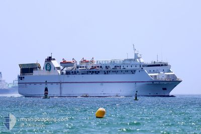
VOLCAN DE TAUCE
Ro-Ro/Passenger Ship
Current Trip
| Time Travelled | 2 h, 3 mins |
|---|---|
| Remaining Time | --- |
| Distance Travelled | 30.35 nm |
| Remaining Distance | --- |
| AVG Speed | 16.1 Knots |
| MAX Speed | 16.4 Knots |
| AVG Wind | 3.7 knots |
| MAX Wind | 5.1 knots |
| MIN Temp | 14.5°C / 58.1°F |
| MAX Temp | 17.8°C / 64.04°F |
| Draught | 4.4 m |
| Position Received | 1 m ago |
Current Position
| Longitude | -4.14242° |
|---|---|
| Latitude | 36.52347° |
| Status | Under way using engine |
| Speed | 16.4 Knots |
| Course | 252.8° |
| Area | Alboran Sea |
| Station | T-AIS |
| Position Received | 1 m ago |
Info
Information
The current position of VOLCAN DE TAUCE is in Alboran Sea with coordinates 36.52347° / -4.14242° as reported on 2024-04-18 13:57 by AIS to our vessel tracker app. The vessel's current speed is 16.4 Knots
The vessel VOLCAN DE TAUCE (IMO: 9081588, MMSI: 224761000) is a Ro-Ro/Passenger Ship that was built in 1995 ( 29 years old ). It's sailing under the flag of [ES] Spain.
In this page you can find informations about the vessels current position, last detected port calls, and current voyage information. If the vessels is not in coverage by AIS you will find the latest position.
The current position of VOLCAN DE TAUCE is detected by our AIS receivers and we are not responsible for the reliability of the data. The last position was recorded while the vessel was in Coverage by the Ais receivers of our vessel tracking app.
The current draught of VOLCAN DE TAUCE as reported by AIS is 4.4 meters
Weather
| Temperature | 17.8°C / 64.04°F |
|---|---|
| Wind Speed | 3 knots |
| Direction | 115° ESE |
| Pressure | 1015.4 hPa |
| Humidity | 81.2 % |
| Cloud Coverage | 100 % |
Featured Company
Last Port Calls
| Port | Arrival | Departure | Time In Port |
|---|---|---|---|
| 2024-04-18 07:07 | 2024-04-18 11:56 | 4 h | |
| 2024-04-17 19:19 | 2024-04-18 00:15 | 4 h | |
| 2024-04-17 07:01 | 2024-04-17 11:43 | 4 h | |
| 2024-04-16 20:09 | 2024-04-17 00:14 | 4 h | |
| 2024-04-16 06:55 | 2024-04-16 12:30 | 5 h | |
| 2024-04-15 19:35 | 2024-04-16 00:05 | 4 h | |
| 2024-04-15 07:28 | 2024-04-15 12:07 | 4 h | |
| 2024-04-14 19:00 | 2024-04-15 00:35 | 5 h | |
| 2024-04-14 08:07 | 2024-04-14 11:48 | 3 h | |
| 2024-04-13 19:11 | 2024-04-14 00:03 | 4 h |
Most Visited Ports (Last year)
| Port | Arrivals | |
|---|---|---|
| 509 | ||
| 331 | ||
| 199 | ||
| 1 |
Last Trips
| Origin | Departure | Destination | Arrival | Distance | |
|---|---|---|---|---|---|
| 2024-04-18 01:15 | 2024-04-18 09:07 | 109.91 nm | |||
| 2024-04-17 13:43 | 2024-04-17 20:19 | 113.08 nm | |||
| 2024-04-17 01:14 | 2024-04-17 09:01 | 109.97 nm | |||
| 2024-04-16 14:30 | 2024-04-16 21:09 | 111.22 nm | |||
| 2024-04-16 01:05 | 2024-04-16 08:55 | 110.66 nm | |||
| 2024-04-15 14:07 | 2024-04-15 20:35 | 111.33 nm | |||
| 2024-04-15 01:35 | 2024-04-15 09:28 | 109.50 nm | |||
| 2024-04-14 13:48 | 2024-04-14 20:00 | 111.50 nm | |||
| 2024-04-14 00:03 | 2024-04-14 10:07 | 112.58 nm | |||
| 2024-04-13 13:36 | 2024-04-13 19:11 | 112.94 nm |
Events
| Time | Event | Details | Position / Dest | Info |
|---|---|---|---|---|
| 2024-04-18 13:15 | Status Changed | Under way using engine Default |
36.58896 / -3.92002
MAPTM<>ESMOT
|
Speed: 16 kn Course: 244° |
| 2024-04-18 12:57 | IN Coverage |
36.58608 / -3.92747
Alboran Sea
MAPTM<>ESMOT
|
Speed: 16 kn Course: 244.7° |
|
| 2024-04-18 12:10 | Status Changed | Default Under way using engine |
36.68167 / -3.58167
MAPTM<>ESMOT
|
Speed: 16 kn Course: 246.6° |
| 2024-04-18 12:03 | Status Changed | Under way using engine Default |
36.69541 / -3.54549
MAPTM<>ESMOT
|
Speed: 15.8 kn Course: 246° |
| 2024-04-18 12:03 | OUT of Coverage |
36.69541 / -3.54549
Alboran Sea
MAPTM<>ESMOT
|
Speed: 16 kn Course: 246.6° |
|
| 2024-04-18 11:57 | Status Changed | Default Under way using engine |
36.70678 / -3.51769
MAPTM<>ESMOT
|
Speed: 6.3 kn Course: 131° |
| 2024-04-18 11:56 | PORT DEPARTURE |
|
36.70678 / -3.51769
MAPTM<>ESMOT
|
Speed: 6.3 kn Course: 131° |
| 2024-04-18 11:53 | START Moving |
36.71477 / -3.51494
[ES] MOTRIL
|
Speed: 6.3 kn Course: 131° |
|
| 2024-04-18 11:33 | Draught Changed | 4.4 5 |
36.72340 / -3.52399
[ES] MOTRIL
|
Speed: Course: 295° |
| 2024-04-18 11:32 | Status Changed | Under way using engine Default |
36.72340 / -3.52399
[ES] MOTRIL
|
Speed: Course: 295° |