
VOLA
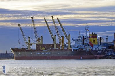
Bulk Carrier
Current Trip
| Time Travelled | 18 days |
|---|---|
| Remaining Time | --- |
| Distance Travelled | 3892.21 nm |
| Remaining Distance | --- |
| AVG Speed | 9.6 Knots |
| MAX Speed | 12.1 Knots |
| AVG Wind | 16.3 knots |
| MAX Wind | 36.1 knots |
| MIN Temp | -0.5°C / 31.1°F |
| MAX Temp | 17.8°C / 64.04°F |
| Draught | 10.6 m |
| Position Received | 2 d ago |
Current Position
| Longitude | -30.73995° |
|---|---|
| Latitude | 38.36175° |
| Status | Under way using engine |
| Speed | 10.6 Knots |
| Course | 250.2° |
| Area | North Atlantic Ocean |
| Station | T-AIS |
| Position Received | 2 d ago |
Info
Information
The current position of VOLA is in North Atlantic Ocean with coordinates 38.36175° / -30.73995° as reported on 2024-04-21 13:14 by AIS to our vessel tracker app. The vessel's current speed is 10.6 Knots and is heading at the port of CRISTOBAL. The estimated time of arrival as calculated by MyShipTracking vessel tracking app is 2024-05-03 04:00 LT
The vessel VOLA (IMO: 9621895, MMSI: 229010000) is a Bulk Carrier that was built in 2012 ( 12 years old ). It's sailing under the flag of [MT] Malta.
In this page you can find informations about the vessels current position, last detected port calls, and current voyage information. If the vessels is not in coverage by AIS you will find the latest position.
The current position of VOLA is detected by our AIS receivers and we are not responsible for the reliability of the data. The last position was recorded while the vessel was in Coverage by the Ais receivers of our vessel tracking app.
The current draught of VOLA as reported by AIS is 10.6 meters
Weather
| Temperature | 17.7°C / 63.86°F |
|---|---|
| Wind Speed | 15 knots |
| Direction | 49° NE |
| Pressure | 1027.2 hPa |
| Humidity | 67.6 % |
| Cloud Coverage | 27 % |
Featured Company
Last Port Calls
| Port | Arrival | Departure | Time In Port |
|---|---|---|---|
| 2024-03-31 15:34 | 2024-04-05 19:38 | 5 d | |
| 2024-03-01 06:08 | 2024-03-14 06:40 | 13 d | |
| 2024-03-01 05:51 | 2024-03-01 06:00 | 9 m | |
| 2024-02-09 14:02 | 2024-03-01 05:27 | 20 d |
Most Visited Ports (Last year)
| Port | Arrivals | |
|---|---|---|
| 4 | ||
| 3 | ||
| 2 | ||
| 2 | ||
| 1 | ||
| 1 |
Events
| Time | Event | Details | Position / Dest | Info |
|---|---|---|---|---|
| 2024-04-21 13:19 | Status Changed | Default Under way using engine |
38.35667 / -30.75667
CRISTOBAL
|
Speed: 10.6 kn Course: 250.2° |
| 2024-04-21 13:14 | OUT of Coverage |
38.36175 / -30.73995
North Atlantic Ocean
CRISTOBAL
|
Speed: 10.6 kn Course: 250.2° |
|
| 2024-04-20 22:11 | ETA Changed | 2024/05/03 04:00 2024/05/04 04:00 |
39.65493 / -27.89951
CRISTOBAL
|
Speed: 9.3 kn Course: 234.5° |
| 2024-04-20 21:56 | Status Changed | Under way using engine Default |
39.67952 / -27.85520
CRISTOBAL
|
Speed: 9 kn Course: 233° |
| 2024-04-20 21:52 | Status Changed | Default Under way using engine |
39.68333 / -27.84667
CRISTOBAL
|
Speed: 9.6 kn Course: 232.4° |
| 2024-04-20 21:46 | Status Changed | Under way using engine Default |
39.69331 / -27.83113
CRISTOBAL
|
Speed: 9 kn Course: 234° |
| 2024-04-20 21:34 | Status Changed | Default Under way using engine |
39.71275 / -27.79829
CRISTOBAL
|
Speed: 9.6 kn Course: 231.9° |
| 2024-04-20 21:31 | Status Changed | Under way using engine Default |
39.71892 / -27.78811
CRISTOBAL
|
Speed: 9 kn Course: 231° |
| 2024-04-20 21:25 | IN Coverage |
39.71892 / -27.78811
North Atlantic Ocean
CRISTOBAL
|
Speed: 9.6 kn Course: 231.9° |
|
| 2024-04-20 19:46 | OUT of Coverage |
39.89441 / -27.49030
North Atlantic Ocean
CRISTOBAL
|
Speed: 10.1 kn Course: 230.5° |