
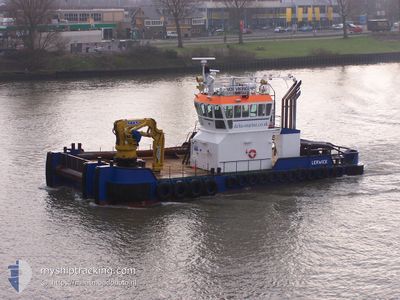
VOE VIKING
Tug
Current Trip
| Time Travelled | 9 h, 57 mins |
|---|---|
| Remaining Time | 1 day |
| Distance Travelled | 45.49 nm |
| Remaining Distance | 105.82 nm |
| AVG Speed | 6.2 Knots |
| MAX Speed | 8.7 Knots |
| AVG Wind | 11.6 knots |
| MAX Wind | 20 knots |
| MIN Temp | 5.2°C / 41.36°F |
| MAX Temp | 9.1°C / 48.38°F |
| Draught | 2.5 m |
| Position Received | 2 m ago |
Current Position
| Longitude | 3.27966° |
|---|---|
| Latitude | 52.06644° |
| Status | Restricted manoeuverability |
| Speed | 3.3 Knots |
| Course | 259.9° |
| Area | North Sea |
| Station | T-AIS |
| Position Received | 2 m ago |
Info
Information
The current position of VOE VIKING is in North Sea with coordinates 52.06644° / 3.27966° as reported on 2024-04-25 15:36 by AIS to our vessel tracker app. The vessel's current speed is 3.3 Knots and is heading at the port of SHEERNESS. The estimated time of arrival as calculated by MyShipTracking vessel tracking app is 2024-04-26 23:33 LT
The vessel VOE VIKING (IMO: 933113900, MMSI: 235008930) is a Tug It's sailing under the flag of [GB] United Kingdom.
In this page you can find informations about the vessels current position, last detected port calls, and current voyage information. If the vessels is not in coverage by AIS you will find the latest position.
The current position of VOE VIKING is detected by our AIS receivers and we are not responsible for the reliability of the data. The last position was recorded while the vessel was in Coverage by the Ais receivers of our vessel tracking app.
The current draught of VOE VIKING as reported by AIS is 2.5 meters
Weather
| Temperature | 9.1°C / 48.38°F |
|---|---|
| Wind Speed | 20 knots |
| Direction | 242° WSW |
| Pressure | 1000.9 hPa |
| Humidity | 76.2 % |
| Cloud Coverage | 100 % |
Featured Company
Last Port Calls
| Port | Arrival | Departure | Time In Port |
|---|---|---|---|
| 2024-04-24 14:26 | 2024-04-25 05:42 | 15 h | |
| 2024-04-24 01:58 | 2024-04-24 14:22 | 12 h | |
| 2024-03-31 13:08 | 2024-04-23 12:26 | 22 d | |
| 2024-03-26 06:44 | 2024-03-30 21:12 | 4 d | |
| 2024-03-25 14:48 |
Most Visited Ports (Last year)
| Port | Arrivals | |
|---|---|---|
| 42 | ||
| 12 | ||
| 12 | ||
| 6 | ||
| 6 | ||
| 5 |
Last Trips
| Origin | Departure | Destination | Arrival | Distance | |
|---|---|---|---|---|---|
| 2024-04-24 16:22 | 2024-04-24 16:26 | 0.21 nm | |||
| 2024-04-23 14:26 | 2024-04-24 03:58 | 113.31 nm | |||
| 2024-03-30 22:12 | 2024-03-31 15:08 | 98.92 nm | |||
| 2024-03-25 15:48 | 2024-03-26 07:44 | 128.89 nm |
Events
| Time | Event | Details | Position / Dest | Info |
|---|---|---|---|---|
| 2024-04-25 15:19 | Status Changed | Restricted manoeuverability Default |
52.06826 / 3.29945
TOWING GBSHS
|
Speed: 2 kn Course: -1° |
| 2024-04-25 14:50 | Status Changed | Default Restricted manoeuverability |
52.07003 / 3.33104
TOWING GBSHS
|
Speed: 1.9 kn Course: 511° |
| 2024-04-25 14:45 | Status Changed | Restricted manoeuverability Default |
52.07016 / 3.33549
TOWING GBSHS
|
Speed: 1.8 kn Course: -1° |
| 2024-04-25 14:24 | Status Changed | Default Restricted manoeuverability |
52.07096 / 3.35682
TOWING GBSHS
|
Speed: 3.5 kn Course: 264.2° |
| 2024-04-25 14:23 | Status Changed | Restricted manoeuverability Default |
52.07107 / 3.35797
TOWING GBSHS
|
Speed: 3.3 kn Course: -1° |
| 2024-04-25 14:08 | IN Coverage |
52.07107 / 3.35797
North Sea
TOWING GBSHS
|
Speed: 3.5 kn Course: 264.2° |
|
| 2024-04-25 10:52 | Status Changed | Default Restricted manoeuverability |
52.06885 / 3.71779
TOWING GBSHS
|
Speed: 5 kn Course: 283.6° |
| 2024-04-25 10:49 | OUT of Coverage |
52.06801 / 3.72497
North Sea
TOWING GBSHS
|
Speed: 5 kn Course: 283.6° |
|
| 2024-04-25 05:42 | PORT DEPARTURE |
|
51.90155 / 4.41818
TOWING GBSHS
|
Speed: 5.4 kn Course: 270.5° |
| 2024-04-25 05:41 | START Moving |
51.90138 / 4.42068
[NL] ROTTERDAM WAALHAVEN
|
Speed: 3.2 kn Course: 281.2° |