
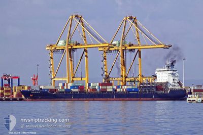
VIOLETA B
Cargo A
Current Trip
DAKAR
| Time Travelled | 2 days |
|---|---|
| Remaining Time | --- |
| Distance Travelled | 623.44 nm |
| Remaining Distance | --- |
| AVG Speed | 10.9 Knots |
| MAX Speed | 15.6 Knots |
| AVG Wind | 9.8 knots |
| MAX Wind | 14.1 knots |
| MIN Temp | 20.6°C / 69.08°F |
| MAX Temp | 28.8°C / 83.84°F |
| Draught | 9.4 m |
| Position Received | 4 d ago |
Current Position
| Longitude | -17.30947° |
|---|---|
| Latitude | 14.59517° |
| Status | At anchor |
| Speed | |
| Course | 321° |
| Area | North Atlantic Ocean |
| Station | T-AIS |
| Position Received | 4 d ago |
Info
Information
The current position of VIOLETA B is in North Atlantic Ocean with coordinates 14.59517° / -17.30947° as reported on 2024-04-21 01:55 by AIS to our vessel tracker app. The vessel's current speed is 0 Knots
The vessel VIOLETA B (IMO: 9673666, MMSI: 212417000) is a Cargo A It's sailing under the flag of [CY] Cyprus.
In this page you can find informations about the vessels current position, last detected port calls, and current voyage information. If the vessels is not in coverage by AIS you will find the latest position.
The current position of VIOLETA B is detected by our AIS receivers and we are not responsible for the reliability of the data. The last position was recorded while the vessel was in Coverage by the Ais receivers of our vessel tracking app.
The current draught of VIOLETA B as reported by AIS is 9.4 meters
Weather
| Temperature | 28.8°C / 83.84°F |
|---|---|
| Wind Speed | 7 knots |
| Direction | 299° WNW |
| Pressure | 1010.6 hPa |
| Humidity | 74.9 % |
| Cloud Coverage | 22 % |
Featured Company
Last Port Calls
| Port | Arrival | Departure | Time In Port |
|---|---|---|---|
| 2024-04-22 09:18 | 2024-04-22 22:54 | 13 h | |
| 2024-04-12 17:55 | 2024-04-13 01:39 | 7 h | |
| 2024-04-07 03:33 | 2024-04-08 17:30 | 1 d | |
| 2024-03-26 01:15 | 2024-03-27 02:11 | 1 d | |
| 2024-03-05 05:16 | 2024-03-06 05:23 | 1 d | |
| 2024-03-03 06:28 | 2024-03-03 17:43 | 11 h | |
| 2024-02-20 03:27 | 2024-02-21 00:05 | 20 h | |
| 2024-02-18 07:21 | 2024-02-19 12:30 | 1 d | |
| 2024-02-09 20:00 | 2024-02-10 20:20 | 1 d |
Last Trips
| Origin | Departure | Destination | Arrival | Distance | |
|---|---|---|---|---|---|
| 2024-04-13 03:39 | 2024-04-22 09:18 | 1575.00 nm | |||
| 2024-04-08 19:30 | 2024-04-12 19:55 | 434.83 nm | |||
| 2024-03-27 02:11 | 2024-04-07 05:33 | 3130.66 nm | |||
| 2024-03-06 06:23 | 2024-03-26 01:15 | 3757.33 nm | |||
| 2024-03-03 18:43 | 2024-03-05 06:16 | 405.46 nm | |||
| 2024-02-21 00:05 | 2024-03-03 07:28 | 2831.42 nm | |||
| 2024-02-19 12:30 | 2024-02-20 03:27 | 170.30 nm | |||
| 2024-02-10 20:20 | 2024-02-18 07:21 | 1667.35 nm | |||
| 2024-01-30 16:52 | 2024-02-09 20:00 | 1953.69 nm |
Events
| Time | Event | Details | Position / Dest | Info |
|---|---|---|---|---|
| 2024-04-22 22:54 | PORT DEPARTURE |
|
14.67776 / -17.41331
DAKAR
|
Speed: 5.8 kn Course: 89° |
| 2024-04-22 22:38 | START Moving |
14.68329 / -17.42659
[SN] DAKAR
|
Speed: 3.9 kn Course: 325° |
|
| 2024-04-22 09:34 | STOP Moving |
14.68641 / -17.42755
[SN] DAKAR
|
Speed: 0.3 kn Course: 331° |
|
| 2024-04-22 09:18 | PORT ARRIVAL |
|
14.67962 / -17.42348
[SN] DAKAR
|
Speed: 4.5 kn Course: 282° |
| 2024-04-22 07:34 | START Moving | 6.49 nm, South East of GOREE |
14.60027 / -17.31215
DAKAR
|
Speed: 5.1 kn Course: 325° |
| 2024-04-21 02:01 | Status Changed | Default At anchor |
14.59511 / -17.30957
DAKAR
|
Speed: Course: 321° |
| 2024-04-21 01:55 | Status Changed | At anchor Default |
14.59517 / -17.30947
DAKAR
|
Speed: 0.1 kn Course: 318° |
| 2024-04-21 01:55 | OUT of Coverage |
14.59517 / -17.30947
North Atlantic Ocean
|
Speed: Course: 165.8° |
|
| 2024-04-21 01:46 | IN Coverage |
14.59517 / -17.30947
North Atlantic Ocean
|
Speed: Course: 165.8° |
|
| 2024-04-20 22:22 | OUT of Coverage |
14.59494 / -17.31014
North Atlantic Ocean
|
Speed: 0.2 kn Course: 308.4° |