
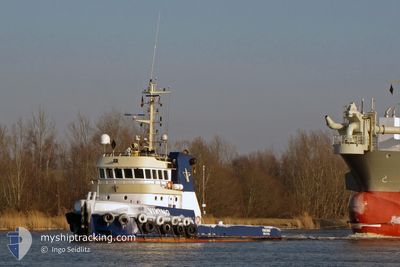
KOOLE 31
Tug
Current Trip
| Time Travelled | 61 days |
|---|---|
| Remaining Time | --- |
| Distance Travelled | 295.21 nm |
| Remaining Distance | --- |
| AVG Speed | 4.1 Knots |
| MAX Speed | 9.1 Knots |
| AVG Wind | 10.4 knots |
| MAX Wind | 21.8 knots |
| MIN Temp | 23°C / 73.4°F |
| MAX Temp | 30°C / 86°F |
| Draught | 3.5 m |
| Position Received | 2023-12-23 15:13 |
Current Position
| Longitude | 56.05776° |
|---|---|
| Latitude | 26.10669° |
| Status | Restricted manoeuverability |
| Speed | 5.3 Knots |
| Course | 24.7° |
| Area | Persian Gulf |
| Station | T-AIS |
| Position Received | 2023-12-23 15:13 |
Info
Information
The current position of KOOLE 31 is in Persian Gulf with coordinates 26.10669° / 56.05776° as reported on 2023-12-23 15:13 by AIS to our vessel tracker app. The vessel's current speed is 5.3 Knots
The vessel KOOLE 31 (IMO: 9431903, MMSI: 245039000) is a Tug that was built in 2008 ( 16 years old ). It's sailing under the flag of [NL] Netherlands.
In this page you can find informations about the vessels current position, last detected port calls, and current voyage information. If the vessels is not in coverage by AIS you will find the latest position.
The current position of KOOLE 31 is detected by our AIS receivers and we are not responsible for the reliability of the data. The last position was recorded while the vessel was in Coverage by the Ais receivers of our vessel tracking app.
The current draught of KOOLE 31 as reported by AIS is 3.5 meters
Weather
| Temperature | 28.4°C / 83.12°F |
|---|---|
| Wind Speed | 4 knots |
| Direction | 354° N |
| Pressure | 1009.1 hPa |
| Humidity | 70.9 % |
| Cloud Coverage | 89 % |
Featured Company
Events
| Time | Event | Details | Position / Dest | Info |
|---|---|---|---|---|
| 2024-04-24 10:00 | STOP Moving |
16.41833 / 72.91500
MUMBAI
|
Speed: Course: -1° |
|
| 2024-04-24 08:51 | START Moving |
16.41843 / 72.91515
MUMBAI
|
Speed: 4 kn Course: 299° |
|
| 2024-04-22 13:09 | STOP Moving |
16.41667 / 72.91666
MUMBAI
|
Speed: Course: -1° |
|
| 2024-04-22 12:51 | START Moving |
16.42167 / 72.90833
MUMBAI
|
Speed: 4 kn Course: -1° |
|
| 2024-04-17 08:42 | STOP Moving |
16.42833 / 72.91167
MUMBAI
|
Speed: Course: -1° |
|
| 2024-04-17 04:36 | START Moving |
16.42667 / 72.91167
MUMBAI
|
Speed: 6 kn Course: 223° |
|
| 2024-04-16 20:50 | STOP Moving |
16.41239 / 72.92043
MUMBAI
|
Speed: 0.3 kn Course: 316° |
|
| 2024-04-16 10:12 | START Moving | 7.59 nm, West of VIJAYDURG |
16.55167 / 73.20667
MUMBAI
|
Speed: 8 kn Course: 246° |
| 2024-04-16 09:03 | STOP Moving | 8.18 nm, West of VIJAYDURG |
16.54667 / 73.19666
MUMBAI
|
Speed: Course: -1° |
| 2024-04-16 08:51 | START Moving | 7.77 nm, West of VIJAYDURG |
16.55500 / 73.20333
MUMBAI
|
Speed: 4 kn Course: -1° |