
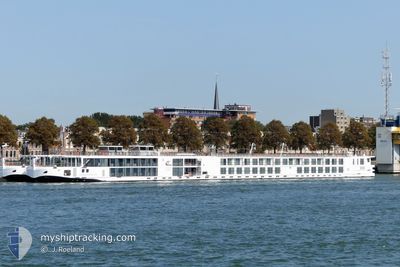
VIKING FJORGYN
Passenger
Current Trip
| Time Travelled | 1 day |
|---|---|
| Remaining Time | 2 h, 43 mins |
| Distance Travelled | 94.83 nm |
| Remaining Distance | --- |
| AVG Speed | 9.5 Knots |
| MAX Speed | 11.1 Knots |
| AVG Wind | 6.8 knots |
| MAX Wind | 10.9 knots |
| MIN Temp | --- |
| MAX Temp | 10.7°C / 51.26°F |
| Draught | 1.8 m |
| Position Received | 10 m ago |
Current Position
| Longitude | 1.24273° |
|---|---|
| Latitude | 49.31168° |
| Status | Under way using engine |
| Speed | |
| Course | 291° |
| Area | North Sea |
| Station | T-AIS |
| Position Received | 10 m ago |
Info
Information
The current position of VIKING FJORGYN is in North Sea with coordinates 49.31168° / 1.24273° as reported on 2024-04-24 06:39 by AIS to our vessel tracker app. The vessel's current speed is 0 Knots and is heading at the port of ROUEN. The estimated time of arrival as calculated by MyShipTracking vessel tracking app is 2024-04-24 09:33 LT
The vessel VIKING FJORGYN (IMO: 7002138, MMSI: 269057743) is a Passenger It's sailing under the flag of [CH] Switzerland.
In this page you can find informations about the vessels current position, last detected port calls, and current voyage information. If the vessels is not in coverage by AIS you will find the latest position.
The current position of VIKING FJORGYN is detected by our AIS receivers and we are not responsible for the reliability of the data. The last position was recorded while the vessel was in Coverage by the Ais receivers of our vessel tracking app.
The current draught of VIKING FJORGYN as reported by AIS is 1.8 meters
Weather
| Temperature | 4.1°C / 39.38°F |
|---|---|
| Wind Speed | 5 knots |
| Direction | 289° WNW |
| Pressure | 1017.2 hPa |
| Humidity | 87 % |
| Cloud Coverage | 93 % |
Featured Company
Most Visited Ports (Last year)
| Port | Arrivals | |
|---|---|---|
| 43 | ||
| 34 | ||
| 3 | ||
| 1 |
Events
| Time | Event | Details | Position / Dest | Info |
|---|---|---|---|---|
| 2024-04-24 06:42 | Status Changed | Default Under way using engine |
49.31167 / 1.24333
ROUEN
|
Speed: Course: 291° |
| 2024-04-24 06:39 | STOP Moving | 7.11 nm, East of MARTOT |
49.31168 / 1.24274
ROUEN
|
Speed: 0.3 kn Course: 291° |
| 2024-04-24 05:26 | Status Changed | Under way using engine Default |
49.20843 / 1.27471
ROUEN
|
Speed: 9 kn Course: 261° |
| 2024-04-24 05:14 | IN Coverage |
49.20586 / 1.26958
North Sea
|
Speed: 9 kn Course: 243.3° |
|
| 2024-04-24 04:26 | Status Changed | Default Under way using engine |
49.20167 / 1.34333
ROUEN
|
Speed: 9.6 kn Course: 315.6° |
| 2024-04-24 04:19 | OUT of Coverage |
49.18547 / 1.33877
North Sea
|
Speed: 9.6 kn Course: 315.6° |
|
| 2024-04-24 04:19 | Status Changed | Under way using engine Default |
49.18512 / 1.33929
ROUEN
|
Speed: 1 kn Course: -1° |
| 2024-04-24 04:19 | START Moving | 7.86 nm, North West of VERNON |
49.18512 / 1.33929
ROUEN
|
Speed: 9.7 kn Course: 313.1° |
| 2024-04-24 04:19 | IN Coverage |
49.18547 / 1.33877
North Sea
|
Speed: 9.6 kn Course: 315.6° |
|
| 2024-04-24 03:56 | STOP Moving | 5.82 nm, North West of VERNON |
49.16833 / 1.38667
ROUEN
|
Speed: Course: -1° |