
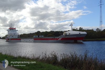
VICTORIABORG
General Cargo
Current Trip
| Time Travelled | 5 days |
|---|---|
| Remaining Time | --- |
| Distance Travelled | 1336.43 nm |
| Remaining Distance | --- |
| AVG Speed | 11 Knots |
| MAX Speed | 12.3 Knots |
| AVG Wind | 11.2 knots |
| MAX Wind | 33.5 knots |
| MIN Temp | 1.1°C / 33.98°F |
| MAX Temp | 7.5°C / 45.5°F |
| Draught | 7.8 m |
| Position Received | 1 h, 36 m ago |
Current Position
| Longitude | 4.15543° |
|---|---|
| Latitude | 53.05968° |
| Status | Under way using engine |
| Speed | 9.9 Knots |
| Course | 231.3° |
| Area | North Sea |
| Station | T-AIS |
| Position Received | 1 h, 36 m ago |
Info
Information
The current position of VICTORIABORG is in North Sea with coordinates 53.05968° / 4.15543° as reported on 2024-04-20 01:13 by AIS to our vessel tracker app. The vessel's current speed is 9.9 Knots and is heading at the port of MERSIN. The estimated time of arrival as calculated by MyShipTracking vessel tracking app is 2024-05-04 08:00 LT
The vessel VICTORIABORG (IMO: 9234276, MMSI: 246029000) is a General Cargo that was built in 2001 ( 23 years old ). It's sailing under the flag of [NL] Netherlands.
In this page you can find informations about the vessels current position, last detected port calls, and current voyage information. If the vessels is not in coverage by AIS you will find the latest position.
The current position of VICTORIABORG is detected by our AIS receivers and we are not responsible for the reliability of the data. The last position was recorded while the vessel was in Coverage by the Ais receivers of our vessel tracking app.
The current draught of VICTORIABORG as reported by AIS is 7.8 meters
Weather
| Temperature | 7.2°C / 44.96°F |
|---|---|
| Wind Speed | 26 knots |
| Direction | 347° NNW |
| Pressure | 1019.2 hPa |
| Humidity | 66.3 % |
| Cloud Coverage | 100 % |
Featured Company
Last Port Calls
| Port | Arrival | Departure | Time In Port |
|---|---|---|---|
| 2024-04-13 21:30 | 2024-04-14 16:18 | 18 h | |
| 2024-03-29 15:45 | 2024-04-12 21:22 | 14 d | |
| 2024-03-26 12:17 | 2024-03-29 06:03 | 2 d | |
| 2024-03-19 21:25 | 2024-03-21 10:40 | 1 d | |
| 2024-03-17 16:45 | 2024-03-19 20:53 | 2 d | |
| 2024-03-07 21:24 | |||
| 2024-02-14 01:25 | 2024-02-14 18:04 | 16 h | |
| 2024-02-05 13:12 | 2024-02-06 15:20 | 1 d | |
| 2024-02-03 14:01 |
Most Visited Ports (Last year)
| Port | Arrivals | |
|---|---|---|
| 3 | ||
| 3 | ||
| 2 | ||
| 2 | ||
| 2 | ||
| 2 |
Last Trips
| Origin | Departure | Destination | Arrival | Distance | |
|---|---|---|---|---|---|
| 2024-04-13 00:22 | 2024-04-13 23:30 | 257.14 nm | |||
| 2024-03-29 08:03 | 2024-03-29 17:45 | 73.10 nm | |||
| 2024-03-21 11:40 | 2024-03-26 14:17 | 1256.00 nm | |||
| 2024-03-19 21:53 | 2024-03-19 22:25 | 1.75 nm | |||
| 2024-03-07 22:24 | 2024-03-17 17:45 | 1199.29 nm | |||
| 2024-02-06 16:20 | 2024-02-14 01:25 | 1468.20 nm | |||
| 2024-02-03 15:01 | 2024-02-05 14:12 | 546.94 nm |
Events
| Time | Event | Details | Position / Dest | Info |
|---|---|---|---|---|
| 2024-04-20 01:22 | Status Changed | Default Under way using engine |
53.04281 / 4.12313
MERSIN
|
Speed: 9.9 kn Course: 231.3° |
| 2024-04-20 01:13 | OUT of Coverage |
53.05968 / 4.15543
North Sea
MERSIN
|
Speed: 9.9 kn Course: 231.3° |
|
| 2024-04-20 00:23 | Status Changed | Under way using engine Default |
53.14895 / 4.33730
MERSIN
|
Speed: 10 kn Course: 229° |
| 2024-04-20 00:11 | Status Changed | Default Under way using engine |
53.17166 / 4.37833
MERSIN
|
Speed: 10.2 kn Course: 223.7° |
| 2024-04-20 00:05 | Change Sea Area | Dutch part of the North Sea Danish part of the North Sea |
53.18498 / 4.40105
North Sea
MERSIN
|
Speed: 10.2 kn Course: 219.7° |
| 2024-04-20 00:02 | Status Changed | Under way using engine Default |
53.19212 / 4.40892
MERSIN
|
Speed: 11.1 kn Course: 202° |
| 2024-04-19 23:57 | IN Coverage |
53.18498 / 4.40105
North Sea
MERSIN
|
Speed: 10.2 kn Course: 219.7° |
|
| 2024-04-19 07:03 | OUT of Coverage |
55.88473 / 6.84735
North Sea
MERSIN
|
Speed: 9.5 kn Course: 215.5° |
|
| 2024-04-18 21:59 | Detected in Sea | Danish part of the North Sea |
57.20603 / 8.45215
North Sea
MERSIN
|
Speed: 11.5 kn Course: 235.9° |
| 2024-04-18 17:55 | Draught Changed | 7.8 7.9 |
57.64625 / 9.68960
MERSIN
|
Speed: 11.7 kn Course: 236° |