
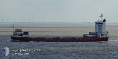
VICTORIA
Container Ship
Current Trip
| Time Travelled | 1 day |
|---|---|
| Remaining Time | 2 days |
| Distance Travelled | 649.36 nm |
| Remaining Distance | 816.82 nm |
| AVG Speed | 14.7 Knots |
| MAX Speed | 15.5 Knots |
| AVG Wind | 11.4 knots |
| MAX Wind | 23 knots |
| MIN Temp | -0.4°C / 31.28°F |
| MAX Temp | 7.4°C / 45.32°F |
| Draught | 5.2 m |
| Position Received | 1 m ago |
Current Position
| Longitude | 13.60533° |
|---|---|
| Latitude | 54.97033° |
| Status | Under way using engine |
| Speed | 15 Knots |
| Course | 252° |
| Area | Baltic Sea |
| Station | T-AIS |
| Position Received | 1 m ago |
Info
Information
The current position of VICTORIA is in Baltic Sea with coordinates 54.97033° / 13.60533° as reported on 2024-04-24 16:51 by AIS to our vessel tracker app. The vessel's current speed is 15 Knots and is heading at the port of ROTTERDAM. The estimated time of arrival as calculated by MyShipTracking vessel tracking app is 2024-04-26 22:39 LT
The vessel VICTORIA (IMO: 9165308, MMSI: 277550000) is a Container Ship that was built in 1998 ( 26 years old ). It's sailing under the flag of [LT] Lithuania.
In this page you can find informations about the vessels current position, last detected port calls, and current voyage information. If the vessels is not in coverage by AIS you will find the latest position.
The current position of VICTORIA is detected by our AIS receivers and we are not responsible for the reliability of the data. The last position was recorded while the vessel was in Coverage by the Ais receivers of our vessel tracking app.
The current draught of VICTORIA as reported by AIS is 5.2 meters
Weather
| Temperature | 5.6°C / 42.08°F |
|---|---|
| Wind Speed | 15 knots |
| Direction | 95° E |
| Pressure | 1006.2 hPa |
| Humidity | 76 % |
| Cloud Coverage | 20 % |
Featured Company
Last Port Calls
| Port | Arrival | Departure | Time In Port |
|---|---|---|---|
| 2024-04-22 05:08 | 2024-04-22 18:52 | 13 h | |
| 2024-04-19 11:32 | 2024-04-19 11:34 | 2 m | |
| 2024-04-17 21:07 | 2024-04-18 01:59 | 4 h | |
| 2024-04-17 20:56 | |||
| 2024-04-10 03:45 | 2024-04-10 18:54 | 15 h | |
| 2024-04-07 04:04 | 2024-04-07 04:09 | 5 m | |
| 2024-04-05 11:50 | 2024-04-05 19:11 | 7 h | |
| 2024-03-19 16:08 | 2024-03-20 03:04 | 10 h | |
| 2024-03-19 15:59 | 2024-03-19 16:06 | 7 m | |
| 2024-03-16 00:17 | 2024-03-16 06:14 | 5 h |
Most Visited Ports (Last year)
| Port | Arrivals | |
|---|---|---|
| 24 | ||
| 22 | ||
| 21 | ||
| 10 | ||
| 8 | ||
| 8 |
Last Trips
| Origin | Departure | Destination | Arrival | Distance | |
|---|---|---|---|---|---|
| 2024-04-19 13:34 | 2024-04-22 08:08 | 789.50 nm | |||
| 2024-04-18 03:59 | 2024-04-19 13:32 | 331.06 nm | |||
| 2024-04-10 21:54 | 2024-04-17 23:07 | 1440.63 nm | |||
| 2024-04-10 21:54 | 2024-04-17 22:56 | 1440.29 nm | |||
| 2024-04-07 06:09 | 2024-04-10 06:45 | 788.90 nm | |||
| 2024-04-05 21:11 | 2024-04-07 06:04 | 330.47 nm | |||
| 2024-03-19 23:04 | 2024-04-05 13:50 | 4635.42 nm | |||
| 2024-03-19 12:06 | 2024-03-19 12:08 | 0.30 nm | |||
| 2024-03-16 02:14 | 2024-03-19 11:59 | 577.38 nm | |||
| 2024-03-15 20:16 | 2024-03-15 20:17 | 0.21 nm |
Events
| Time | Event | Details | Position / Dest | Info |
|---|---|---|---|---|
| 2024-04-24 16:20 | Change Sea Area | German part of the Baltic Sea Swedish part of the Baltic Sea |
55.01100 / 13.81917
Baltic Sea
NLRTM
|
Speed: 15.1 kn Course: 252° |
| 2024-04-24 13:20 | Change Sea Area | Swedish part of the Baltic Sea Danish part of the Kattegat |
55.49767 / 14.74233
Baltic Sea
NLRTM
|
Speed: 14.9 kn Course: 240° |
| 2024-04-24 12:08 | Change Sea Area | Danish part of the Kattegat Swedish part of the Baltic Sea |
55.65067 / 15.19350
Kattegat
NLRTM
|
Speed: 14.9 kn Course: 240° |
| 2024-04-24 07:35 | Status Changed | Under way using engine Default |
56.22683 / 16.90100
NLRTM
|
Speed: 14.7 kn Course: 233° |
| 2024-04-24 07:12 | Status Changed | Default Under way using engine |
56.28217 / 17.03050
NLRTM
|
Speed: 14.8 kn Course: 233° |
| 2024-04-24 07:05 | Detected in Sea | Swedish part of the Baltic Sea |
56.30050 / 17.07417
Baltic Sea
NLRTM
|
Speed: 14.8 kn Course: 233° |
| 2024-04-24 07:05 | Status Changed | Under way using engine Default |
56.30050 / 17.07417
NLRTM
|
Speed: 14.8 kn Course: 233° |
| 2024-04-24 07:04 | IN Coverage |
56.30050 / 17.07417
Baltic Sea
NLRTM
|
Speed: 14.8 kn Course: 233° |
|
| 2024-04-23 13:02 | OUT of Coverage |
59.44633 / 22.38383
Baltic Sea
NLRTM
|
Speed: 13.6 kn Course: 229° |
|
| 2024-04-23 11:16 | Detected in Sea | Finnish part of the Baltic Sea |
59.58983 / 23.09967
Baltic Sea
NLRTM
|
Speed: 13.2 kn Course: 254° |