
VATERLAND
Wing in ground
Current Trip
| Time Travelled | 10 h, 37 mins |
|---|---|
| Remaining Time | --- |
| Distance Travelled | 3.88 nm |
| Remaining Distance | --- |
| AVG Speed | 5.6 Knots |
| MAX Speed | 6.5 Knots |
| AVG Wind | 12 knots |
| MAX Wind | 12 knots |
| MIN Temp | 10.5°C / 50.9°F |
| MAX Temp | 11.5°C / 52.7°F |
| Draught | 0 m |
| Position Received | 9 h, 55 m ago |
Current Position
| Longitude | 7.68018° |
|---|---|
| Latitude | 52.04237° |
| Status | Under way using engine |
| Speed | 4.7 Knots |
| Course | 28.9° |
| Area | North Sea |
| Station | T-AIS |
| Position Received | 9 h, 55 m ago |
Info
Information
The current position of VATERLAND is in North Sea with coordinates 52.04237° / 7.68018° as reported on 2024-04-18 15:37 by AIS to our vessel tracker app. The vessel's current speed is 4.7 Knots and is heading at the port of HAMM.
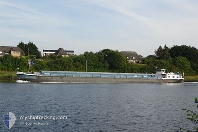
The vessel VATERLAND (MMSI: 211190840) is a Wing in ground It's sailing under the flag of [DE] Germany.
In this page you can find informations about the vessels current position, last detected port calls, and current voyage information. If the vessels is not in coverage by AIS you will find the latest position.
The current position of VATERLAND is detected by our AIS receivers and we are not responsible for the reliability of the data. The last position was recorded while the vessel was in Coverage by the Ais receivers of our vessel tracking app.
Weather
| Temperature | 11.4°C / 52.52°F |
|---|---|
| Wind Speed | 12 knots |
| Direction | 294° WNW |
| Pressure | 1017.8 hPa |
| Humidity | 48.4 % |
| Cloud Coverage | 89 % |
Featured Company
Last Port Calls
| Port | Arrival | Departure | Time In Port |
|---|---|---|---|
| 2024-04-18 14:35 | 2024-04-18 14:56 | 20 m | |
| 2024-04-16 12:32 | 2024-04-17 19:04 | 1 d | |
| 2024-04-10 16:29 | 2024-04-11 04:16 | 11 h | |
| 2024-04-09 12:08 | 2024-04-10 09:00 | 20 h | |
| 2024-04-09 09:02 | 2024-04-09 10:01 | 58 m | |
| 2024-04-08 16:35 | 2024-04-09 08:41 | 16 h | |
| 2024-04-08 12:34 | 2024-04-08 13:11 | 37 m | |
| 2024-04-07 09:07 | 2024-04-07 10:01 | 53 m | |
| 2024-04-07 06:31 | 2024-04-07 06:58 | 27 m | |
| 2024-04-06 18:07 | 2024-04-07 05:06 | 10 h |
Last Trips
| Origin | Departure | Destination | Arrival | Distance | |
|---|---|---|---|---|---|
| 2024-04-17 21:04 | 2024-04-18 16:35 | 44.03 nm | |||
| 2024-04-11 06:16 | 2024-04-16 14:32 | 62.93 nm | |||
| 2024-04-10 11:00 | 2024-04-10 18:29 | 53.93 nm | |||
| 2024-04-09 12:01 | 2024-04-09 14:08 | 20.28 nm | |||
| 2024-04-09 10:41 | 2024-04-09 11:02 | 1.81 nm | |||
| 2024-04-08 15:11 | 2024-04-08 18:35 | 28.44 nm | |||
| 2024-04-07 12:01 | 2024-04-08 14:34 | 113.11 nm | |||
| 2024-04-07 08:58 | 2024-04-07 11:07 | 12.16 nm | |||
| 2024-04-07 07:06 | 2024-04-07 08:31 | 8.93 nm | |||
| 2024-04-06 06:43 | 2024-04-06 20:07 | 53.65 nm |
Events
| Time | Event | Details | Position / Dest | Info |
|---|---|---|---|---|
| 2024-04-18 15:37 | OUT of Coverage |
52.04237 / 7.68018
North Sea
|
Speed: 4.7 kn Course: 28.9° |
|
| 2024-04-18 14:56 | PORT DEPARTURE |
|
51.98060 / 7.66108
DEHMM03913CITYX00330
|
Speed: 4.3 kn Course: 357.2° |
| 2024-04-18 14:56 | START Moving |
51.98022 / 7.66113
[DE] MUNSTER
|
Speed: 3.9 kn Course: 356° |
|
| 2024-04-18 14:54 | Status Changed | Under way using engine Moored |
51.97863 / 7.66147
[DE] MUNSTER
|
Speed: Course: 511° |
| 2024-04-18 14:36 | STOP Moving |
51.97832 / 7.66156
[DE] MUNSTER
|
Speed: 0.3 kn Course: 511° |
|
| 2024-04-18 14:35 | Status Changed | Moored Under way using engine |
51.97830 / 7.66157
[DE] MUNSTER
|
Speed: 0.7 kn Course: 511° |
| 2024-04-18 14:35 | PORT ARRIVAL |
|
51.97830 / 7.66157
[DE] MUNSTER
|
Speed: 0.7 kn Course: 511° |
| 2024-04-18 13:55 | IN Coverage |
51.93606 / 7.63815
North Sea
|
Speed: 5 kn Course: 353.5° |
|
| 2024-04-18 03:57 | OUT of Coverage |
51.49289 / 6.85721
North Sea
|
Speed: 5.8 kn Course: 67.1° |
|
| 2024-04-18 03:46 | IN Coverage |
51.48681 / 6.83405
North Sea
|
Speed: 5.1 kn Course: 67.4° |