
VALUE
Cargo B
Current Trip
| Trip Time | 4 days |
|---|---|
| Trip Distance | 717.74 nm |
| AVG Speed | 12.6 Knots |
| MAX Speed | 17.1 Knots |
| Draught | 12.9 m |
| AVG Wind | 12.9 knots |
| MAX Wind | 28.6 knots |
| MIN Temp | 14°C / 57.2°F |
| MAX Temp | 23.4°C / 74.12°F |
| Position Received | 3 h, 33 m ago |
Current Position
| Longitude | 14.54422° |
|---|---|
| Latitude | 35.82128° |
| Status | Moored |
| Speed | |
| Course | 136° |
| Area | Mediterranean Sea - Eastern Basin |
| Station | T-AIS |
| Position Received | 3 h, 33 m ago |
Info
Information
The current position of VALUE is in Mediterranean Sea - Eastern Basin with coordinates 35.82128° / 14.54422° as reported on 2024-04-19 06:21 by AIS to our vessel tracker app. The vessel's current speed is 0 Knots and is currently inside the port of MARSAXLOKK.
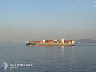
The vessel VALUE (IMO: 9628166, MMSI: 229467000) is a Cargo B It's sailing under the flag of [MT] Malta.
In this page you can find informations about the vessels current position, last detected port calls, and current voyage information. If the vessels is not in coverage by AIS you will find the latest position.
The current position of VALUE is detected by our AIS receivers and we are not responsible for the reliability of the data. The last position was recorded while the vessel was in Coverage by the Ais receivers of our vessel tracking app.
The current draught of VALUE as reported by AIS is 12.9 meters
Weather
| Temperature | 14°C / 57.2°F |
|---|---|
| Wind Speed | 21 knots |
| Direction | 295° WNW |
| Pressure | 1013.5 hPa |
| Humidity | 85.7 % |
| Cloud Coverage | 66 % |
Featured Company
Last Port Calls
| Port | Arrival | Departure | Time In Port |
|---|---|---|---|
| 2024-04-18 20:51 | |||
| 2024-04-12 04:28 | 2024-04-14 04:05 | 1 d | |
| 2024-04-07 14:26 | 2024-04-09 03:06 | 1 d | |
| 2024-02-28 17:12 | 2024-02-29 18:24 | 1 d | |
| 2024-02-25 04:51 | 2024-02-26 12:10 | 1 d | |
| 2024-02-16 08:04 | 2024-02-17 08:06 | 1 d |
Last Trips
| Origin | Departure | Destination | Arrival | Distance | |
|---|---|---|---|---|---|
| 2024-04-14 07:05 | 2024-04-18 22:51 | 717.74 nm | |||
| 2024-04-09 05:06 | 2024-04-12 07:28 | 1269.62 nm | |||
| 2024-02-29 22:24 | 2024-04-07 16:26 | 11610.37 nm | |||
| 2024-02-26 15:10 | 2024-02-28 21:12 | 344.67 nm | |||
| 2024-02-17 12:06 | 2024-02-25 07:51 | 356.95 nm | |||
| 2024-01-04 08:58 | 2024-02-16 12:04 | 12348.50 nm |
Events
| Time | Event | Details | Position / Dest | Info |
|---|---|---|---|---|
| 2024-04-19 06:21 | OUT of Coverage |
35.82128 / 14.54422
Mediterranean Sea - Eastern Basin
[MT] MARSAXLOKK
|
Speed: Course: 5° |
|
| 2024-04-19 06:21 | IN Coverage |
35.82128 / 14.54422
Mediterranean Sea - Eastern Basin
[MT] MARSAXLOKK
|
Speed: Course: 5° |
|
| 2024-04-18 20:51 | PORT ARRIVAL |
|
35.82128 / 14.54422
[MT] MARSAXLOKK
|
Speed: 5.5 kn Course: 315.2° |
| 2024-04-18 20:46 | OUT of Coverage |
35.81972 / 14.55385
Mediterranean Sea - Eastern Basin
|
Speed: 5.5 kn Course: 315.2° |
|
| 2024-04-18 20:15 | START Moving | 3.7 nm, South East of MARSAXLOKK |
35.78271 / 14.60356
MTMAR
|
Speed: 5.3 kn Course: 345.2° |
| 2024-04-18 20:10 | STOP Moving | 3.9 nm, South East of MARSAXLOKK |
35.77839 / 14.60418
MTMAR
|
Speed: 0.3 kn Course: 355° |
| 2024-04-18 18:17 | IN Coverage |
35.72379 / 14.79349
Mediterranean Sea - Eastern Basin
|
Speed: 12.7 kn Course: 289.7° |
|
| 2024-04-16 21:47 | STOP Moving |
35.73637 / 15.04618
MTMAR
|
Speed: 0.3 kn Course: 39° |
|
| 2024-04-16 20:57 | Status Changed | Default Restricted manoeuverability |
35.73157 / 15.05047
MTMAR
|
Speed: 0.5 kn Course: 29° |
| 2024-04-16 20:47 | OUT of Coverage |
35.73063 / 15.05145
Mediterranean Sea - Eastern Basin
MTMAR
|
Speed: 0.5 kn Course: 320.2° |