
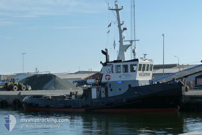
VALDEMAR
Tug
Current Trip
THYBEROEN
| Time Travelled | 6 days |
|---|---|
| Remaining Time | --- |
| Distance Travelled | 428.32 nm |
| Remaining Distance | --- |
| AVG Speed | 4 Knots |
| MAX Speed | 9 Knots |
| AVG Wind | 17.4 knots |
| MAX Wind | 32.3 knots |
| MIN Temp | 9.6°C / 49.28°F |
| MAX Temp | 17.4°C / 63.32°F |
| Draught | 4.2 m |
| Position Received | 5 h, 28 m ago |
Current Position
| Longitude | -5.14397° |
|---|---|
| Latitude | 48.27719° |
| Status | Restricted manoeuverability |
| Speed | 4.2 Knots |
| Course | 308° |
| Area | Celtic Sea |
| Station | T-AIS |
| Position Received | 5 h, 28 m ago |
Info
Information
The current position of VALDEMAR is in Celtic Sea with coordinates 48.27719° / -5.14397° as reported on 2024-04-24 20:06 by AIS to our vessel tracker app. The vessel's current speed is 4.2 Knots
The vessel VALDEMAR (IMO: 8108121, MMSI: 219025221) is a Tug that was built in 1981 ( 43 years old ). It's sailing under the flag of [DK] Denmark.
In this page you can find informations about the vessels current position, last detected port calls, and current voyage information. If the vessels is not in coverage by AIS you will find the latest position.
The current position of VALDEMAR is detected by our AIS receivers and we are not responsible for the reliability of the data. The last position was recorded while the vessel was in Coverage by the Ais receivers of our vessel tracking app.
The current draught of VALDEMAR as reported by AIS is 4.2 meters
Weather
| Temperature | 10.1°C / 50.18°F |
|---|---|
| Wind Speed | 11 knots |
| Direction | 328° NNW |
| Pressure | 1012.9 hPa |
| Humidity | 73.4 % |
| Cloud Coverage | 84 % |
Featured Company
Last Port Calls
| Port | Arrival | Departure | Time In Port |
|---|---|---|---|
| 2024-04-15 06:23 | 2024-04-18 10:46 | 3 d | |
| 2024-03-25 12:11 | 2024-04-06 11:39 | 11 d | |
| 2024-02-26 14:42 | 2024-03-14 09:03 | 16 d | |
| 2024-02-24 08:47 | 2024-02-25 07:15 | 22 h | |
| 2024-02-13 09:13 | 2024-02-13 21:33 | 12 h | |
| 2024-02-03 09:28 |
Most Visited Ports (Last year)
| Port | Arrivals | |
|---|---|---|
| 5 | ||
| 4 | ||
| 3 | ||
| 3 | ||
| 3 | ||
| 3 |
Last Trips
| Origin | Departure | Destination | Arrival | Distance | |
|---|---|---|---|---|---|
| 2024-04-06 13:39 | 2024-04-15 08:23 | 816.77 nm | |||
| 2024-03-14 11:03 | 2024-03-25 13:11 | 1213.48 nm | |||
| 2024-02-25 08:15 | 2024-02-26 16:42 | 227.96 nm | |||
| 2024-02-13 22:33 | 2024-02-24 09:47 | 1108.57 nm | |||
| 2024-02-03 10:28 | 2024-02-13 10:13 | 974.82 nm |
Events
| Time | Event | Details | Position / Dest | Info |
|---|---|---|---|---|
| 2024-04-24 20:20 | Status Changed | Default Restricted manoeuverability |
48.28167 / -5.16333
THYBEROEN
|
Speed: 4.2 kn Course: 308° |
| 2024-04-24 20:06 | OUT of Coverage |
48.27719 / -5.14397
Celtic Sea
THYBEROEN
|
Speed: 4.2 kn Course: 295° |
|
| 2024-04-24 13:03 | ETA Changed | 2024/04/29 14:00 2024/04/15 14:00 |
48.18191 / -4.48742
THYBEROEN
|
Speed: 3.9 kn Course: 220° |
| 2024-04-24 13:02 | START Moving | 8.36 nm, North West of DOUARNENEZ |
48.18322 / -4.48586
THYBEROEN
|
Speed: 3.3 kn Course: 221° |
| 2024-04-24 12:45 | Status Changed | Restricted manoeuverability At anchor |
48.19025 / -4.47994
THYBEROEN
|
Speed: 0.6 kn Course: 289° |
| 2024-04-24 12:20 | Status Changed | At anchor Default |
48.18980 / -4.47931
THYBEROEN
|
Speed: Course: -1° |
| 2024-04-24 12:14 | Status Changed | Default At anchor |
48.18833 / -4.47833
THYBEROEN
|
Speed: 0.4 kn Course: 263° |
| 2024-04-24 09:35 | Status Changed | At anchor Default |
48.18973 / -4.47946
THYBEROEN
|
Speed: Course: -1° |
| 2024-04-24 09:29 | Status Changed | Default At anchor |
48.18833 / -4.47833
THYBEROEN
|
Speed: 0.2 kn Course: 306° |
| 2024-04-24 07:17 | Status Changed | At anchor Restricted manoeuverability |
48.19020 / -4.48023
THYBEROEN
|
Speed: 0.5 kn Course: 277° |