
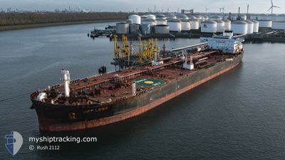
LR2 OLIVIA
Tanker
Current Trip
| Time Travelled | 8 days |
|---|---|
| Remaining Time | --- |
| Distance Travelled | 2773.52 nm |
| Remaining Distance | 24.25 nm |
| AVG Speed | 13 Knots |
| MAX Speed | 16 Knots |
| AVG Wind | 9.3 knots |
| MAX Wind | 18.8 knots |
| MIN Temp | 8.7°C / 47.66°F |
| MAX Temp | 30.1°C / 86.18°F |
| Draught | 10.7 m |
| Position Received | 7 d ago |
Current Position
| Longitude | 105.47810° |
|---|---|
| Latitude | 3.37253° |
| Status | Under way using engine |
| Speed | 13.8 Knots |
| Course | 32.1° |
| Area | South China Sea |
| Station | T-AIS |
| Position Received | 7 d ago |
Info
Information
The current position of LR2 OLIVIA is in South China Sea with coordinates 3.37253° / 105.47810° as reported on 2024-04-15 19:00 by AIS to our vessel tracker app. The vessel's current speed is 13.8 Knots and is heading at the port of DALIAN. The estimated time of arrival as calculated by MyShipTracking vessel tracking app is 2024-04-23 16:00 LT
The vessel LR2 OLIVIA (IMO: 9740469, MMSI: 477118700) is a Tanker It's sailing under the flag of [HK] Hong Kong.
In this page you can find informations about the vessels current position, last detected port calls, and current voyage information. If the vessels is not in coverage by AIS you will find the latest position.
The current position of LR2 OLIVIA is detected by our AIS receivers and we are not responsible for the reliability of the data. The last position was recorded while the vessel was in Coverage by the Ais receivers of our vessel tracking app.
The current draught of LR2 OLIVIA as reported by AIS is 10.7 meters
Weather
| Temperature | 8.7°C / 47.66°F |
|---|---|
| Wind Speed | 6 knots |
| Direction | 178° S |
| Pressure | 1006.9 hPa |
| Humidity | 94.8 % |
| Cloud Coverage | 100 % |
Featured Company
Last Port Calls
| Port | Arrival | Departure | Time In Port |
|---|---|---|---|
| 2024-04-11 21:13 | 2024-04-15 01:27 | 3 d | |
| 2024-04-02 00:01 | 2024-04-04 19:03 | 2 d | |
| 2024-02-04 06:31 | 2024-02-07 19:24 | 3 d |
Most Visited Ports (Last year)
| Port | Arrivals | |
|---|---|---|
| 5 | ||
| 3 | ||
| 2 | ||
| 1 | ||
| 1 | ||
| 1 |
Last Trips
| Origin | Departure | Destination | Arrival | Distance | |
|---|---|---|---|---|---|
| 2024-04-05 03:03 | 2024-04-12 05:13 | 1707.07 nm | |||
| 2024-02-07 22:24 | 2024-04-02 08:01 | 8614.13 nm | |||
| 2023-11-29 15:31 | 2024-02-04 09:31 | 10485.33 nm |
Events
| Time | Event | Details | Position / Dest | Info |
|---|---|---|---|---|
| 2024-04-15 19:01 | Status Changed | Default Under way using engine |
3.37333 / 105.47833
CN DALIAN
|
Speed: 13.8 kn Course: 32.1° |
| 2024-04-15 19:00 | OUT of Coverage |
3.37253 / 105.47810
South China Sea
CN DALIAN
|
Speed: 13.8 kn Course: 32.1° |
|
| 2024-04-15 18:59 | Status Changed | Under way using engine Default |
3.36925 / 105.47607
CN DALIAN
|
Speed: 13.7 kn Course: 32° |
| 2024-04-15 18:43 | Status Changed | Default Under way using engine |
3.31500 / 105.44334
CN DALIAN
|
Speed: 13.6 kn Course: 29.1° |
| 2024-04-15 18:37 | Status Changed | Under way using engine Default |
3.29732 / 105.43249
CN DALIAN
|
Speed: 13 kn Course: 23° |
| 2024-04-15 18:19 | Status Changed | Default Under way using engine |
3.23333 / 105.40166
CN DALIAN
|
Speed: 13.6 kn Course: 23.5° |
| 2024-04-15 18:15 | Status Changed | Under way using engine Default |
3.22142 / 105.39758
CN DALIAN
|
Speed: 13 kn Course: 23° |
| 2024-04-15 18:10 | Status Changed | Default Under way using engine |
3.20167 / 105.38834
CN DALIAN
|
Speed: 13.6 kn Course: 23.7° |
| 2024-04-15 17:47 | Change Sea Area | Indonesian part of the South China Sea Malaysian part of the Singapore Strait |
3.12365 / 105.35661
South China Sea
CN DALIAN
|
Speed: 13.5 kn Course: 21.5° |
| 2024-04-15 17:46 | Status Changed | Under way using engine Default |
3.12014 / 105.35522
CN DALIAN
|
Speed: 13 kn Course: 21° |