
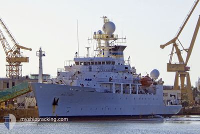
USNS BRUCE HEEZEN
Research/Survey Vessel
Current Trip
0000
| Time Travelled | 35 days |
|---|---|
| Remaining Time | --- |
| Distance Travelled | 2937.92 nm |
| Remaining Distance | --- |
| AVG Speed | 10.5 Knots |
| MAX Speed | 15 Knots |
| AVG Wind | 18.6 knots |
| MAX Wind | 44 knots |
| MIN Temp | 4°C / 39.2°F |
| MAX Temp | 17.8°C / 64.04°F |
| Draught | 0 m |
| Position Received | 8 d ago |
Current Position
| Longitude | -6.48372° |
|---|---|
| Latitude | 51.23377° |
| Status | Under way using engine |
| Speed | 10.6 Knots |
| Course | 203.8° |
| Area | Celtic Sea |
| Station | T-AIS |
| Position Received | 8 d ago |
Info
Information
The current position of USNS BRUCE HEEZEN is in Celtic Sea with coordinates 51.23377° / -6.48372° as reported on 2024-04-11 09:46 by AIS to our vessel tracker app. The vessel's current speed is 10.6 Knots
The vessel USNS BRUCE HEEZEN (IMO: 9117272, MMSI: 338934000) is a Research/Survey Vessel that was built in 2000 ( 24 years old ). It's sailing under the flag of [US] USA.
In this page you can find informations about the vessels current position, last detected port calls, and current voyage information. If the vessels is not in coverage by AIS you will find the latest position.
The current position of USNS BRUCE HEEZEN is detected by our AIS receivers and we are not responsible for the reliability of the data. The last position was recorded while the vessel was in Coverage by the Ais receivers of our vessel tracking app.
Weather
| Temperature | 11°C / 51.8°F |
|---|---|
| Wind Speed | 14 knots |
| Direction | 210° SSW |
| Pressure | 1027.2 hPa |
| Humidity | 96.4 % |
| Cloud Coverage | 100 % |
Featured Company
Events
| Time | Event | Details | Position / Dest | Info |
|---|---|---|---|---|
| 2024-04-11 09:46 | OUT of Coverage |
51.23377 / -6.48372
Celtic Sea
|
Speed: 10.6 kn Course: 203.8° |
|
| 2024-04-11 08:59 | Detected in Sea | United Kingdom part of the Celtic Sea |
51.36019 / -6.40527
Celtic Sea
|
Speed: 9.9 kn Course: 202.3° |
| 2024-04-11 08:44 | Status Changed | Under way using engine Default |
51.39725 / -6.38215
0000
|
Speed: 9.9 kn Course: 204° |
| 2024-04-11 08:43 | Status Changed | Default Under way using engine |
51.40063 / -6.38006
0000
|
Speed: 9.7 kn Course: 204° |
| 2024-04-11 08:32 | Status Changed | Under way using engine Default |
51.42792 / -6.36292
0000
|
Speed: 9.2 kn Course: 205° |
| 2024-04-11 08:24 | Status Changed | Default Under way using engine |
51.44665 / -6.35114
0000
|
Speed: 9 kn Course: 203.3° |
| 2024-04-11 08:17 | Status Changed | Under way using engine Default |
51.46450 / -6.33937
0000
|
Speed: 8.9 kn Course: 201° |
| 2024-04-11 08:12 | Status Changed | Default Under way using engine |
51.47526 / -6.33230
0000
|
Speed: 9 kn Course: 199.9° |
| 2024-04-11 07:58 | Status Changed | Under way using engine Default |
51.50710 / -6.31167
0000
|
Speed: 9.2 kn Course: 200° |
| 2024-04-11 07:51 | Status Changed | Default Under way using engine |
51.52317 / -6.30128
0000
|
Speed: 9 kn Course: 202.8° |