
US GOV VESSEL 8
Military ops
Current Trip
| Trip Time | 3 days |
|---|---|
| Trip Distance | 353.35 nm |
| AVG Speed | 4.7 Knots |
| MAX Speed | 4.7 Knots |
| Draught | 0 m |
| AVG Wind | 6.9 knots |
| MAX Wind | 14.7 knots |
| MIN Temp | 15.5°C / 59.9°F |
| MAX Temp | 17.9°C / 64.22°F |
| Position Received | 12 m ago |
Current Position
| Longitude | --- |
|---|---|
| Latitude | --- |
| Status | Under way using engine |
| Speed | |
| Course | 55° |
| Area | North Pacific Ocean |
| Station | T-AIS |
| Position Received | 12 m ago |
Info
Information
The current position of US GOV VESSEL 8 is in North Pacific Ocean with coordinates 32.67842° / -117.12737° as reported on 2025-12-07 07:37 by AIS to our vessel tracker app. The vessel's current speed is 0 Knots and is currently inside the port of SAN DIEGO.
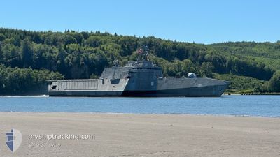
The vessel US GOV VESSEL 8 (MMSI: 369970910) is a Military ops It's sailing under the flag of [US] USA.
In this page you can find informations about the vessels current position, last detected port calls, and current voyage information. If the vessels is not in coverage by AIS you will find the latest position.
The current position of US GOV VESSEL 8 is detected by our AIS receivers and we are not responsible for the reliability of the data. The last position was recorded while the vessel was in Coverage by the Ais receivers of our vessel tracking app.
Weather
| Temperature | 16.3°C / 61.34°F |
|---|---|
| Wind Speed | 1 knots |
| Direction | 217° SW |
| Pressure | 1018.2 hPa |
| Humidity | 78.7 % |
| Cloud Coverage | --- |
Featured Company
Most Visited Ports (Last year)
| Port | Arrivals | |
|---|---|---|
| 4 |
Events
| Time | Event | Details | Position / Dest | Info |
|---|---|---|---|---|
| 2025-12-07 03:58 | IN Coverage |
32.67841 / -117.12742
North Pacific Ocean
[US] SAN DIEGO
|
Speed: Course: 324.4° |
|
| 2025-12-07 02:54 | OUT of Coverage |
32.67846 / -117.12735
North Pacific Ocean
[US] SAN DIEGO
|
Speed: Course: 324.4° |
|
| 2025-12-07 02:50 | IN Coverage |
32.67846 / -117.12736
North Pacific Ocean
[US] SAN DIEGO
|
Speed: Course: 324.4° |
|
| 2025-12-06 07:15 | OUT of Coverage |
32.67840 / -117.12736
North Pacific Ocean
[US] SAN DIEGO
|
Speed: Course: 69.9° |
|
| 2025-12-06 03:54 | IN Coverage |
32.67842 / -117.12739
North Pacific Ocean
[US] SAN DIEGO
|
Speed: Course: 69.9° |
|
| 2025-12-05 19:12 | OUT of Coverage |
32.67840 / -117.12736
North Pacific Ocean
[US] SAN DIEGO
|
Speed: Course: 69.9° |
|
| 2025-12-05 18:32 | STOP Moving |
32.67846 / -117.12739
[US] SAN DIEGO
|
Speed: Course: 55° |
|
| 2025-12-05 17:22 | PORT ARRIVAL |
|
32.67789 / -117.22958
[US] SAN DIEGO
|
Speed: 10.2 kn Course: 353° |
| 2025-12-04 23:40 | Change Sea Area | United States part of the North Pacific Ocean Mexican part of the North Pacific Ocean |
32.62394 / -117.78344
North Pacific Ocean
|
Speed: 6.1 kn Course: 319.6° |
| 2025-12-04 19:35 | Change Sea Area | Mexican part of the North Pacific Ocean United States part of the North Pacific Ocean |
32.59039 / -117.83971
North Pacific Ocean
|
Speed: 4.6 kn Course: 81.1° |