
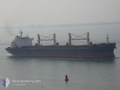
UM ELHANAYA
Bulk Carrier
Current Trip
BAYUQUAN
| Time Travelled | 1 day |
|---|---|
| Remaining Time | --- |
| Distance Travelled | 287.60 nm |
| Remaining Distance | --- |
| AVG Speed | 10.4 Knots |
| MAX Speed | 11.4 Knots |
| AVG Wind | 12.1 knots |
| MAX Wind | 17.9 knots |
| MIN Temp | 6.8°C / 44.24°F |
| MAX Temp | 14.7°C / 58.46°F |
| Draught | 12.9 m |
| Position Received | 1 d ago |
Current Position
| Longitude | 118.79850° |
|---|---|
| Latitude | 38.77990° |
| Status | Under way using engine |
| Speed | 8.9 Knots |
| Course | 98.1° |
| Area | Yellow Sea |
| Station | T-AIS |
| Position Received | 1 d ago |
Info
Information
The current position of UM ELHANAYA is in Yellow Sea with coordinates 38.77990° / 118.79850° as reported on 2024-04-15 09:50 by AIS to our vessel tracker app. The vessel's current speed is 8.9 Knots
The vessel UM ELHANAYA (IMO: 9427330, MMSI: 636018698) is a Bulk Carrier that was built in 2010 ( 14 years old ). It's sailing under the flag of [LR] Liberia.
In this page you can find informations about the vessels current position, last detected port calls, and current voyage information. If the vessels is not in coverage by AIS you will find the latest position.
The current position of UM ELHANAYA is detected by our AIS receivers and we are not responsible for the reliability of the data. The last position was recorded while the vessel was in Coverage by the Ais receivers of our vessel tracking app.
The current draught of UM ELHANAYA as reported by AIS is 12.9 meters
Weather
| Temperature | 10.2°C / 50.36°F |
|---|---|
| Wind Speed | 4 knots |
| Direction | 5° N |
| Pressure | 1015.7 hPa |
| Humidity | 74 % |
| Cloud Coverage | --- |
Featured Company
Most Visited Ports (Last year)
| Port | Arrivals | |
|---|---|---|
| 2 | ||
| 2 | ||
| 2 | ||
| 1 | ||
| 1 | ||
| 1 |
Last Trips
Events
| Time | Event | Details | Position / Dest | Info |
|---|---|---|---|---|
| 2024-04-15 09:54 | Status Changed | Default Under way using engine |
38.77831 / 118.81217
BAYUQUAN
|
Speed: 8.9 kn Course: 98.1° |
| 2024-04-15 09:50 | OUT of Coverage |
38.77990 / 118.79850
Yellow Sea
|
Speed: 8.9 kn Course: 98.1° |
|
| 2024-04-15 08:59 | Detected in Sea | Chinese part of the Yellow Sea |
38.79922 / 118.63732
Yellow Sea
|
Speed: 8.7 kn Course: 99.1° |
| 2024-04-15 08:58 | Status Changed | Under way using engine Default |
38.79963 / 118.63425
BAYUQUAN
|
Speed: 8.8 kn Course: 99° |
| 2024-04-15 08:45 | IN Coverage |
38.79922 / 118.63732
Yellow Sea
|
Speed: 8.7 kn Course: 99.1° |
|
| 2024-04-15 04:54 | PORT DEPARTURE |
|
38.95675 / 117.87930
BAYUQUAN
|
Speed: 8.3 kn Course: 102° |
| 2024-04-15 04:10 | START Moving |
38.97458 / 117.76592
[CN] TIANJIN
|
Speed: 4.7 kn Course: 105° |
|
| 2024-04-07 00:05 | STOP Moving |
38.98003 / 117.76175
[CN] TIANJIN
|
Speed: 0.1 kn Course: 357° |
|
| 2024-04-07 00:05 | PORT ARRIVAL |
|
38.98003 / 117.76175
[CN] TIANJIN
|
Speed: 1.1 kn Course: 14° |
| 2024-04-06 22:03 | START Moving | 12.47 nm, East of TIANJIN |
38.94915 / 118.01131
BAYUQUAN
|
Speed: 3.1 kn Course: 239° |