
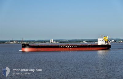
ULTRA LION
Cargo
Current Trip
| Time Travelled | 5 days |
|---|---|
| Remaining Time | --- |
| Distance Travelled | 1645.95 nm |
| Remaining Distance | --- |
| AVG Speed | 11.5 Knots |
| MAX Speed | 16 Knots |
| AVG Wind | 15.6 knots |
| MAX Wind | 33 knots |
| MIN Temp | 0.5°C / 32.9°F |
| MAX Temp | 9.7°C / 49.46°F |
| Draught | 14.2 m |
| Position Received | 5 d ago |
Current Position
| Longitude | -127.17829° |
|---|---|
| Latitude | 48.89125° |
| Status | Under way using engine |
| Speed | 11.1 Knots |
| Course | 284.3° |
| Area | North Pacific Ocean |
| Station | T-AIS |
| Position Received | 5 d ago |
Info
Information
The current position of ULTRA LION is in North Pacific Ocean with coordinates 48.89125° / -127.17829° as reported on 2024-04-13 07:48 by AIS to our vessel tracker app. The vessel's current speed is 11.1 Knots and is heading at the port of SAMCHEONPO. The estimated time of arrival as calculated by MyShipTracking vessel tracking app is 2024-04-27 18:00 LT
The vessel ULTRA LION (IMO: 9676113, MMSI: 636019715) is a Cargo It's sailing under the flag of [LR] Liberia.
In this page you can find informations about the vessels current position, last detected port calls, and current voyage information. If the vessels is not in coverage by AIS you will find the latest position.
The current position of ULTRA LION is detected by our AIS receivers and we are not responsible for the reliability of the data. The last position was recorded while the vessel was in Coverage by the Ais receivers of our vessel tracking app.
The current draught of ULTRA LION as reported by AIS is 14.2 meters
Weather
| Temperature | 0.5°C / 32.9°F |
|---|---|
| Wind Speed | 27 knots |
| Direction | 335° NNW |
| Pressure | 1003.4 hPa |
| Humidity | 91.3 % |
| Cloud Coverage | 100 % |
Featured Company
Last Port Calls
| Port | Arrival | Departure | Time In Port |
|---|---|---|---|
| 2024-04-10 07:57 | 2024-04-12 13:12 | 2 d | |
| 2024-03-13 21:16 | 2024-03-19 03:32 | 5 d |
Last Trips
| Origin | Departure | Destination | Arrival | Distance | |
|---|---|---|---|---|---|
| 2024-03-19 12:32 | 2024-04-10 00:57 | 4234.63 nm | |||
| 2024-01-02 00:51 | 2024-03-14 06:16 | 1935.80 nm |
Events
| Time | Event | Details | Position / Dest | Info |
|---|---|---|---|---|
| 2024-04-13 07:55 | Status Changed | Default Under way using engine |
48.89691 / -127.21174
KR SCP
|
Speed: 11.1 kn Course: 284.3° |
| 2024-04-13 07:48 | Status Changed | Under way using engine Default |
48.89125 / -127.17829
KR SCP
|
Speed: 11 kn Course: 286° |
| 2024-04-13 07:48 | OUT of Coverage |
48.89125 / -127.17829
North Pacific Ocean
KR SCP
|
Speed: 11.1 kn Course: 284.3° |
|
| 2024-04-13 07:39 | Status Changed | Default Under way using engine |
48.88334 / -127.13333
KR SCP
|
Speed: 11 kn Course: 285.3° |
| 2024-04-13 00:02 | ETA Changed | 2024/04/27 18:00 2024/04/01 19:00 |
48.51013 / -125.15480
KR SCP
|
Speed: 10.4 kn Course: 273.7° |
| 2024-04-12 23:30 | Status Changed | Under way using engine Default |
48.50682 / -125.01773
KR SCP
|
Speed: 10.2 kn Course: 268° |
| 2024-04-12 23:27 | Status Changed | Default Under way using engine |
48.50707 / -125.00632
KR SCP
|
Speed: 10.2 kn Course: 264.3° |
| 2024-04-12 23:21 | Change Sea Area | Canadian part of the North Pacific Ocean Canadian part of the The Coastal Waters of Southeast Alaska and British Columbia |
48.50849 / -124.98081
North Pacific Ocean
|
Speed: 10.2 kn Course: 264.4° |
| 2024-04-12 23:21 | Status Changed | Under way using engine Default |
48.50849 / -124.98081
KR SCP
|
Speed: 10 kn Course: 265° |
| 2024-04-12 22:07 | OUT of Coverage |
48.49547 / -124.67649
The Coastal Waters of Southeast Alaska and British Columbia
|
Speed: 9.9 kn Course: 292.5° |