
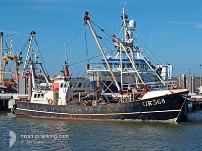
UK368 PETRONELLA
Fishing
Current Trip
CUXHAVEN
| Time Travelled | 3 days |
|---|---|
| Remaining Time | --- |
| Distance Travelled | 268.11 nm |
| Remaining Distance | --- |
| AVG Speed | 3.7 Knots |
| MAX Speed | 11.2 Knots |
| AVG Wind | 13.5 knots |
| MAX Wind | 27.7 knots |
| MIN Temp | 4.8°C / 40.64°F |
| MAX Temp | 7.9°C / 46.22°F |
| Draught | 0 m |
| Position Received | 4 h, 27 m ago |
Current Position
| Longitude | 8.11753° |
|---|---|
| Latitude | 54.55047° |
| Status | Engaged in Fishing |
| Speed | 3.9 Knots |
| Course | 153° |
| Area | North Sea |
| Station | T-AIS |
| Position Received | 4 h, 27 m ago |
Info
Information
The current position of UK368 PETRONELLA is in North Sea with coordinates 54.55047° / 8.11753° as reported on 2024-04-25 07:14 by AIS to our vessel tracker app. The vessel's current speed is 3.9 Knots
The vessel UK368 PETRONELLA (MMSI: 244157000) is a Fishing It's sailing under the flag of [NL] Netherlands.
In this page you can find informations about the vessels current position, last detected port calls, and current voyage information. If the vessels is not in coverage by AIS you will find the latest position.
The current position of UK368 PETRONELLA is detected by our AIS receivers and we are not responsible for the reliability of the data. The last position was recorded while the vessel was in Coverage by the Ais receivers of our vessel tracking app.
Weather
| Temperature | 6.1°C / 42.98°F |
|---|---|
| Wind Speed | 1 knots |
| Direction | 233° SW |
| Pressure | 1002.8 hPa |
| Humidity | 74 % |
| Cloud Coverage | 100 % |
Featured Company
Last Port Calls
| Port | Arrival | Departure | Time In Port |
|---|---|---|---|
| 2024-04-19 05:52 | 2024-04-22 02:22 | 2 d | |
| 2024-04-13 03:22 | 2024-04-16 09:41 | 3 d | |
| 2024-04-05 07:36 | 2024-04-08 02:05 | 2 d | |
| 2024-03-28 11:08 | 2024-04-01 18:30 | 4 d | |
| 2024-03-22 07:43 | 2024-03-25 03:38 | 2 d | |
| 2024-03-15 11:45 | 2024-03-18 09:47 | 2 d | |
| 2024-02-21 20:32 | 2024-03-11 11:27 | 18 d | |
| 2024-02-13 12:43 | 2024-02-19 10:05 | 5 d | |
| 2024-02-07 12:00 |
Most Visited Ports (Last year)
| Port | Arrivals | |
|---|---|---|
| 27 | ||
| 9 | ||
| 3 | ||
| 1 | ||
| 1 |
Last Trips
| Origin | Departure | Destination | Arrival | Distance | |
|---|---|---|---|---|---|
| 2024-04-16 11:41 | 2024-04-19 07:52 | 255.38 nm | |||
| 2024-04-08 04:05 | 2024-04-13 05:22 | 401.23 nm | |||
| 2024-04-01 20:30 | 2024-04-05 09:36 | 248.36 nm | |||
| 2024-03-25 04:38 | 2024-03-28 12:08 | 256.06 nm | |||
| 2024-03-18 10:47 | 2024-03-22 08:43 | 332.56 nm | |||
| 2024-03-11 12:27 | 2024-03-15 12:45 | 276.51 nm | |||
| 2024-02-19 11:05 | 2024-02-21 21:32 | 210.03 nm | |||
| 2024-02-07 13:00 | 2024-02-13 13:43 | 385.31 nm |
Events
| Time | Event | Details | Position / Dest | Info |
|---|---|---|---|---|
| 2024-04-25 07:14 | OUT of Coverage |
54.55047 / 8.11753
North Sea
|
Speed: 3.9 kn Course: 160.9° |
|
| 2024-04-24 11:39 | IN Coverage |
54.62703 / 7.95948
North Sea
|
Speed: 4.1 kn Course: 67.9° |
|
| 2024-04-24 10:23 | OUT of Coverage |
54.68494 / 7.97117
North Sea
|
Speed: 3.6 kn Course: 254.4° |
|
| 2024-04-23 08:23 | IN Coverage |
54.64347 / 8.05420
North Sea
|
Speed: 3.7 kn Course: 145.8° |
|
| 2024-04-23 04:53 | OUT of Coverage |
54.84119 / 7.93401
North Sea
|
Speed: 3.4 kn Course: 299.8° |
|
| 2024-04-23 03:35 | IN Coverage |
54.78383 / 7.92180
North Sea
|
Speed: 3.3 kn Course: 9.6° |
|
| 2024-04-23 02:26 | OUT of Coverage |
54.82738 / 7.90536
North Sea
|
Speed: 3.5 kn Course: 21.7° |
|
| 2024-04-22 18:14 | START Moving | 6.52 nm, South West of HOERNUM |
54.69866 / 8.14271
CUXHAVEN
|
Speed: 3.4 kn Course: 96° |
| 2024-04-22 17:40 | STOP Moving | 7.32 nm, South West of HOERNUM |
54.68022 / 8.13813
CUXHAVEN
|
Speed: 0.3 kn Course: 356° |
| 2024-04-22 15:33 | IN Coverage |
54.66004 / 8.12009
North Sea
|
Speed: 2.8 kn Course: 112.9° |