
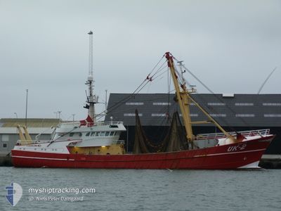
UK2 ADRIAANTJE
Trawler
Current Trip
| Trip Time | 4 days |
|---|---|
| Trip Distance | 134.80 nm |
| AVG Speed | 9.6 Knots |
| MAX Speed | 11.3 Knots |
| Draught | 5.2 m |
| AVG Wind | 16.5 knots |
| MAX Wind | 25.5 knots |
| MIN Temp | 5.8°C / 42.44°F |
| MAX Temp | 7.3°C / 45.14°F |
| Position Received | Now |
Current Position
| Longitude | 8.22340° |
|---|---|
| Latitude | 56.70299° |
| Status | Engaged in Fishing |
| Speed | |
| Course | 261° |
| Area | North Sea |
| Station | T-AIS |
| Position Received | Now |
Info
Information
The current position of UK2 ADRIAANTJE is in North Sea with coordinates 56.70299° / 8.22340° as reported on 2024-04-20 01:54 by AIS to our vessel tracker app. The vessel's current speed is 0 Knots and is currently inside the port of THYBORON.
The vessel UK2 ADRIAANTJE (IMO: 9013907, MMSI: 244381000) is a Trawler that was built in 1990 ( 34 years old ). It's sailing under the flag of [NL] Netherlands.
In this page you can find informations about the vessels current position, last detected port calls, and current voyage information. If the vessels is not in coverage by AIS you will find the latest position.
The current position of UK2 ADRIAANTJE is detected by our AIS receivers and we are not responsible for the reliability of the data. The last position was recorded while the vessel was in Coverage by the Ais receivers of our vessel tracking app.
The current draught of UK2 ADRIAANTJE as reported by AIS is 5.2 meters
Weather
| Temperature | 3.9°C / 39.02°F |
|---|---|
| Wind Speed | 5 knots |
| Direction | 28° NNE |
| Pressure | 1013.6 hPa |
| Humidity | 68.2 % |
| Cloud Coverage | 64 % |
Featured Company
Last Port Calls
| Port | Arrival | Departure | Time In Port |
|---|---|---|---|
| 2024-04-19 11:58 | |||
| 2024-04-12 10:23 | 2024-04-15 04:19 | 2 d | |
| 2024-04-05 14:49 | 2024-04-08 04:55 | 2 d | |
| 2024-03-29 06:23 | 2024-04-01 23:50 | 3 d | |
| 2024-03-22 11:16 | 2024-03-25 05:15 | 2 d | |
| 2024-03-15 04:45 | 2024-03-18 01:04 | 2 d | |
| 2024-03-08 04:54 | 2024-03-11 00:17 | 2 d | |
| 2024-03-01 04:12 | 2024-03-04 00:15 | 2 d | |
| 2024-02-23 14:34 | 2024-02-26 00:14 | 2 d | |
| 2024-02-09 13:25 | 2024-02-19 00:38 | 9 d |
Last Trips
| Origin | Departure | Destination | Arrival | Distance | |
|---|---|---|---|---|---|
| 2024-04-15 06:19 | 2024-04-19 13:58 | 134.80 nm | |||
| 2024-04-08 06:55 | 2024-04-12 12:23 | 564.30 nm | |||
| 2024-04-02 01:50 | 2024-04-05 16:49 | 407.89 nm | |||
| 2024-03-25 06:15 | 2024-03-29 07:23 | 134.34 nm | |||
| 2024-03-18 02:04 | 2024-03-22 12:16 | 343.23 nm | |||
| 2024-03-11 01:17 | 2024-03-15 05:45 | 406.24 nm | |||
| 2024-03-04 01:15 | 2024-03-08 05:54 | 454.78 nm | |||
| 2024-02-26 01:14 | 2024-03-01 05:12 | 711.83 nm | |||
| 2024-02-19 01:38 | 2024-02-23 15:34 | 96.77 nm | |||
| 2024-02-05 01:19 | 2024-02-09 14:25 | 52.38 nm |
Events
| Time | Event | Details | Position / Dest | Info |
|---|---|---|---|---|
| 2024-04-19 12:02 | STOP Moving |
56.70246 / 8.22150
[DK] THYBORON
|
Speed: 0.3 kn Course: 240° |
|
| 2024-04-19 11:58 | PORT ARRIVAL |
|
56.70000 / 8.22569
[DK] THYBORON
|
Speed: 7.1 kn Course: 267.2° |
| 2024-04-19 10:21 | IN Coverage |
56.79277 / 7.75636
North Sea
|
Speed: 10.9 kn Course: 112.8° |
|
| 2024-04-17 18:55 | OUT of Coverage |
56.48903 / 6.53675
North Sea
|
Speed: 6.3 kn Course: 184.6° |
|
| 2024-04-17 18:55 | IN Coverage |
56.48903 / 6.53675
North Sea
|
Speed: 6.3 kn Course: 184.6° |
|
| 2024-04-16 15:30 | OUT of Coverage |
56.59249 / 6.49610
North Sea
|
Speed: 6.3 kn Course: 346.1° |
|
| 2024-04-16 14:27 | START Moving |
56.63468 / 6.41959
THYB0RON
|
Speed: 6.2 kn Course: 301.3° |
|
| 2024-04-16 14:03 | STOP Moving |
56.61281 / 6.47154
THYB0RON
|
Speed: 0.2 kn Course: 340° |
|
| 2024-04-16 13:48 | IN Coverage |
56.59571 / 6.48704
North Sea
|
Speed: 6.1 kn Course: 335.8° |
|
| 2024-04-15 08:00 | OUT of Coverage |
56.61827 / 7.17364
North Sea
|
Speed: 6.2 kn Course: 260.4° |