
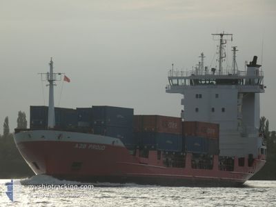
A2B PROUD
Container Ship
Current Trip
| Time Travelled | 14 h, 7 mins |
|---|---|
| Remaining Time | 5 h, 21 mins |
| Distance Travelled | 188.14 nm |
| Remaining Distance | 70.92 nm |
| AVG Speed | 12 Knots |
| MAX Speed | 15.8 Knots |
| AVG Wind | 18 knots |
| MAX Wind | 26.8 knots |
| MIN Temp | 8.1°C / 46.58°F |
| MAX Temp | 9.7°C / 49.46°F |
| Draught | 6.5 m |
| Position Received | Now |
Current Position
| Longitude | 0.24813° |
|---|---|
| Latitude | 53.89339° |
| Status | Under way using engine |
| Speed | 14 Knots |
| Course | 323.6° |
| Area | North Sea |
| Station | T-AIS |
| Position Received | Now |
Info
Information
The current position of A2B PROUD is in North Sea with coordinates 53.89339° / 0.24813° as reported on 2024-04-19 06:54 by AIS to our vessel tracker app. The vessel's current speed is 14 Knots and is heading at the port of TEES. The estimated time of arrival as calculated by MyShipTracking vessel tracking app is 2024-04-19 12:16 LT
The vessel A2B PROUD (IMO: 9122239, MMSI: 245502000) is a Container Ship that was built in 1995 ( 29 years old ). It's sailing under the flag of [NL] Netherlands.
In this page you can find informations about the vessels current position, last detected port calls, and current voyage information. If the vessels is not in coverage by AIS you will find the latest position.
The current position of A2B PROUD is detected by our AIS receivers and we are not responsible for the reliability of the data. The last position was recorded while the vessel was in Coverage by the Ais receivers of our vessel tracking app.
The current draught of A2B PROUD as reported by AIS is 6.5 meters
Weather
| Temperature | 8.3°C / 46.94°F |
|---|---|
| Wind Speed | 25 knots |
| Direction | 312° NW |
| Pressure | 1011 hPa |
| Humidity | 81.1 % |
| Cloud Coverage | 59 % |
Featured Company
Last Port Calls
| Port | Arrival | Departure | Time In Port |
|---|---|---|---|
| 2024-04-18 16:13 | 2024-04-18 16:48 | 34 m | |
| 2024-04-18 08:17 | 2024-04-18 16:13 | 7 h | |
| 2024-04-18 07:21 | 2024-04-18 08:02 | 41 m | |
| 2024-04-17 04:08 | 2024-04-17 12:59 | 8 h | |
| 2024-04-15 15:33 | 2024-04-15 21:39 | 6 h | |
| 2024-04-14 23:28 | 2024-04-15 12:10 | 12 h | |
| 2024-04-13 11:06 | 2024-04-14 07:28 | 20 h | |
| 2024-04-12 04:49 | 2024-04-12 17:18 | 12 h | |
| 2024-04-11 07:40 | 2024-04-11 15:01 | 7 h | |
| 2024-04-10 05:11 | 2024-04-10 15:27 | 10 h |
Last Trips
| Origin | Departure | Destination | Arrival | Distance | |
|---|---|---|---|---|---|
| 2024-04-18 18:13 | 2024-04-18 18:13 | 0.42 nm | |||
| 2024-04-18 10:02 | 2024-04-18 10:17 | 0.55 nm | |||
| 2024-04-17 13:59 | 2024-04-18 09:21 | 258.00 nm | |||
| 2024-04-15 23:39 | 2024-04-17 05:08 | 267.38 nm | |||
| 2024-04-15 14:10 | 2024-04-15 17:33 | 35.37 nm | |||
| 2024-04-14 08:28 | 2024-04-15 01:28 | 217.39 nm | |||
| 2024-04-12 19:18 | 2024-04-13 12:06 | 217.76 nm | |||
| 2024-04-11 16:01 | 2024-04-12 06:49 | 172.15 nm | |||
| 2024-04-10 17:27 | 2024-04-11 08:40 | 170.59 nm | |||
| 2024-04-09 12:43 | 2024-04-10 07:11 | 220.51 nm |
Events
| Time | Event | Details | Position / Dest | Info |
|---|---|---|---|---|
| 2024-04-19 06:08 | IN Coverage |
53.74188 / .39740
North Sea
GBTEE
|
Speed: 14 kn Course: 325.5° |
|
| 2024-04-19 03:09 | OUT of Coverage |
53.16406 / .86561
North Sea
GBTEE
|
Speed: 12.1 kn Course: 310.4° |
|
| 2024-04-18 23:04 | ETA Changed | 2024/04/19 14:00 2024/04/18 09:00 |
52.71328 / 2.16416
GBTEE
|
Speed: 14.2 kn Course: 302.4° |
| 2024-04-18 21:58 | Change Sea Area | United Kingdom part of the North Sea Dutch part of the North Sea |
52.57603 / 2.51117
North Sea
|
Speed: 13.5 kn Course: 302.7° |
| 2024-04-18 21:58 | IN Coverage |
52.57603 / 2.51117
North Sea
|
Speed: 13.5 kn Course: 302.7° |
|
| 2024-04-18 18:28 | OUT of Coverage |
52.13228 / 3.55358
North Sea
|
Speed: 14.2 kn Course: 302.2° |
|
| 2024-04-18 16:48 | PORT DEPARTURE |
|
51.96803 / 4.11923
GBTEE
|
Speed: 13.4 kn Course: 303° |
| 2024-04-18 16:13 | PORT ARRIVAL |
|
51.90724 / 4.22563
[NL] ROTTERDAM
|
Speed: 8.1 kn Course: 348.2° |
| 2024-04-18 16:13 | PORT DEPARTURE |
|
51.90608 / 4.22601
GBTEE
|
Speed: 7.8 kn Course: 348° |
| 2024-04-18 16:03 | Draught Changed | 6.5 4.9 |
51.89547 / 4.23679
[NL] ROZENBURG
|
Speed: 3.5 kn Course: 282° |