
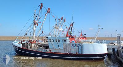
UK166 LIMANDA
Fishing
Current Trip
Unknown
| Time Travelled | 3 days |
|---|---|
| Remaining Time | --- |
| Distance Travelled | 231.41 nm |
| Remaining Distance | --- |
| AVG Speed | 3.4 Knots |
| MAX Speed | 11.5 Knots |
| AVG Wind | 13.8 knots |
| MAX Wind | 25.9 knots |
| MIN Temp | 4.8°C / 40.64°F |
| MAX Temp | 7.9°C / 46.22°F |
| Draught | 0 m |
| Position Received | Now |
Current Position
| Longitude | 8.24996° |
|---|---|
| Latitude | 54.47705° |
| Status | Engaged in Fishing |
| Speed | 3.4 Knots |
| Course | 96° |
| Area | North Sea |
| Station | T-AIS |
| Position Received | Now |
Info
Information
The current position of UK166 LIMANDA is in North Sea with coordinates 54.47705° / 8.24996° as reported on 2024-04-25 12:12 by AIS to our vessel tracker app. The vessel's current speed is 3.4 Knots
The vessel UK166 LIMANDA (IMO: 8431619, MMSI: 245262000) is a Fishing It's sailing under the flag of [NL] Netherlands.
In this page you can find informations about the vessels current position, last detected port calls, and current voyage information. If the vessels is not in coverage by AIS you will find the latest position.
The current position of UK166 LIMANDA is detected by our AIS receivers and we are not responsible for the reliability of the data. The last position was recorded while the vessel was in Coverage by the Ais receivers of our vessel tracking app.
Weather
| Temperature | 5.9°C / 42.62°F |
|---|---|
| Wind Speed | 6 knots |
| Direction | 251° WSW |
| Pressure | 1002.7 hPa |
| Humidity | 80.2 % |
| Cloud Coverage | 100 % |
Featured Company
Last Port Calls
| Port | Arrival | Departure | Time In Port |
|---|---|---|---|
| 2024-04-19 07:24 | 2024-04-22 02:17 | 2 d | |
| 2024-04-13 01:50 | 2024-04-16 09:27 | 3 d | |
| 2024-04-05 07:41 | 2024-04-08 02:13 | 2 d | |
| 2024-03-28 11:09 | 2024-04-01 17:13 | 4 d | |
| 2024-03-22 08:23 | 2024-03-25 03:35 | 2 d | |
| 2024-03-15 12:00 | 2024-03-18 09:47 | 2 d | |
| 2024-02-21 20:44 | 2024-03-11 11:25 | 18 d | |
| 2024-02-13 13:24 | 2024-02-19 10:05 | 5 d | |
| 2024-02-07 12:05 |
Most Visited Ports (Last year)
| Port | Arrivals | |
|---|---|---|
| 27 | ||
| 9 | ||
| 3 | ||
| 1 | ||
| 1 | ||
| 1 |
Last Trips
| Origin | Departure | Destination | Arrival | Distance | |
|---|---|---|---|---|---|
| 2024-04-16 11:27 | 2024-04-19 09:24 | 242.27 nm | |||
| 2024-04-08 04:13 | 2024-04-13 03:50 | 373.74 nm | |||
| 2024-04-01 19:13 | 2024-04-05 09:41 | 225.23 nm | |||
| 2024-03-25 04:35 | 2024-03-28 12:09 | 262.19 nm | |||
| 2024-03-18 10:47 | 2024-03-22 09:23 | 317.46 nm | |||
| 2024-03-11 12:25 | 2024-03-15 13:00 | 257.85 nm | |||
| 2024-02-19 11:05 | 2024-02-21 21:44 | 204.19 nm | |||
| 2024-02-07 13:05 | 2024-02-13 14:24 | 382.02 nm |
Events
| Time | Event | Details | Position / Dest | Info |
|---|---|---|---|---|
| 2024-04-24 18:45 | START Moving | 14.39 nm, South West of HOERNUM |
54.60967 / 7.97547
|
Speed: 3.4 kn Course: 6° |
| 2024-04-24 18:39 | STOP Moving | 14.49 nm, South West of HOERNUM |
54.60790 / 7.97429
|
Speed: 0.3 kn Course: 352° |
| 2024-04-23 06:27 | IN Coverage |
54.78018 / 7.93064
North Sea
|
Speed: 2.5 kn Course: 32.3° |
|
| 2024-04-23 05:15 | OUT of Coverage |
54.84337 / 7.94875
North Sea
|
Speed: 2.6 kn Course: 16.6° |
|
| 2024-04-23 03:44 | IN Coverage |
54.77570 / 7.92943
North Sea
|
Speed: 3.6 kn Course: 271.3° |
|
| 2024-04-23 01:13 | OUT of Coverage |
54.77873 / 7.91223
North Sea
|
Speed: 4 kn Course: 281.3° |
|
| 2024-04-23 01:13 | IN Coverage |
54.77873 / 7.91223
North Sea
|
Speed: 4 kn Course: 281.3° |
|
| 2024-04-22 23:30 | OUT of Coverage |
54.84183 / 7.95111
North Sea
|
Speed: 3.3 kn Course: 20.9° |
|
| 2024-04-22 22:03 | IN Coverage |
54.76501 / 7.91636
North Sea
|
Speed: 3.3 kn Course: 9.6° |
|
| 2024-04-22 19:24 | OUT of Coverage |
54.74221 / 7.93367
North Sea
|
Speed: 2.6 kn Course: 16.7° |