
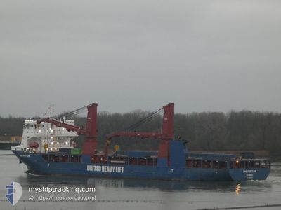
UHL FORTUNE
Cargo
Current Trip
| Time Travelled | 1 day |
|---|---|
| Remaining Time | 3 days |
| Distance Travelled | 494.46 nm |
| Remaining Distance | 1167.11 nm |
| AVG Speed | 13.3 Knots |
| MAX Speed | 14.9 Knots |
| AVG Wind | 17.9 knots |
| MAX Wind | 25.8 knots |
| MIN Temp | 15.1°C / 59.18°F |
| MAX Temp | 18.5°C / 65.3°F |
| Draught | 6.8 m |
| Position Received | 1 d ago |
Current Position
| Longitude | 24.00052° |
|---|---|
| Latitude | 36.45247° |
| Status | Under way using engine |
| Speed | 13 Knots |
| Course | 264.5° |
| Area | Aegean Sea |
| Station | T-AIS |
| Position Received | 1 d ago |
Info
Information
The current position of UHL FORTUNE is in Aegean Sea with coordinates 36.45247° / 24.00052° as reported on 2024-04-18 20:25 by AIS to our vessel tracker app. The vessel's current speed is 13 Knots and is heading at the port of ALGECIRAS. The estimated time of arrival as calculated by MyShipTracking vessel tracking app is 2024-04-23 15:26 LT
The vessel UHL FORTUNE (IMO: 9813242, MMSI: 255806221) is a Cargo It's sailing under the flag of [PT] Portugal.
In this page you can find informations about the vessels current position, last detected port calls, and current voyage information. If the vessels is not in coverage by AIS you will find the latest position.
The current position of UHL FORTUNE is detected by our AIS receivers and we are not responsible for the reliability of the data. The last position was recorded while the vessel was in Coverage by the Ais receivers of our vessel tracking app.
The current draught of UHL FORTUNE as reported by AIS is 6.8 meters
Weather
| Temperature | 15.4°C / 59.72°F |
|---|---|
| Wind Speed | 29 knots |
| Direction | 326° NW |
| Pressure | 1011 hPa |
| Humidity | 65.9 % |
| Cloud Coverage | 3 % |
Featured Company
Last Port Calls
| Port | Arrival | Departure | Time In Port |
|---|---|---|---|
| 2024-04-12 11:22 | 2024-04-18 03:40 | 5 d | |
| 2024-04-06 11:01 | 2024-04-10 13:44 | 4 d | |
| 2024-03-31 06:49 | 2024-03-31 19:30 | 12 h | |
| 2024-03-30 22:30 | 2024-03-31 06:11 | 7 h | |
| 2024-03-30 13:13 | 2024-03-30 22:00 | 8 h | |
| 2024-03-27 00:49 | 2024-03-29 06:58 | 2 d |
Most Visited Ports (Last year)
| Port | Arrivals | |
|---|---|---|
| 4 | ||
| 2 | ||
| 1 | ||
| 1 | ||
| 1 | ||
| 1 |
Last Trips
| Origin | Departure | Destination | Arrival | Distance | |
|---|---|---|---|---|---|
| 2024-04-10 15:44 | 2024-04-12 14:22 | 666.04 nm | |||
| 2024-03-31 20:30 | 2024-04-06 13:01 | 1980.83 nm | |||
| 2024-03-31 07:11 | 2024-03-31 07:49 | 4.46 nm | |||
| 2024-03-30 22:00 | 2024-03-30 22:30 | 3.08 nm | |||
| 2024-03-29 06:58 | 2024-03-30 13:13 | 3.41 nm | |||
| 2024-01-25 23:21 | 2024-03-27 00:49 | 13307.70 nm |
Events
| Time | Event | Details | Position / Dest | Info |
|---|---|---|---|---|
| 2024-04-18 20:25 | OUT of Coverage |
36.45247 / 24.00052
Aegean Sea
ES ALG
|
Speed: 13 kn Course: 264.5° |
|
| 2024-04-18 10:50 | ETA Changed | 2024/04/23 02:00 2024/04/22 18:00 |
36.46206 / 26.58936
ES ALG
|
Speed: 14 kn Course: 271.1° |
| 2024-04-18 06:08 | Change Sea Area | Greek part of the Aegean Sea Turkish part of the Aegean Sea |
36.49299 / 27.94070
Aegean Sea
ES ALG
|
Speed: 14.2 kn Course: 249.5° |
| 2024-04-18 04:59 | Change Sea Area | Turkish part of the Aegean Sea Turkish part of the Mediterranean Sea - Eastern Basin |
36.60711 / 28.24295
Aegean Sea
ES ALG
|
Speed: 12.5 kn Course: 240.1° |
| 2024-04-18 04:41 | Draught Changed | 6.8 6.7 |
36.65799 / 28.28655
ES ALG
|
Speed: 12.4 kn Course: 209.5° |
| 2024-04-18 04:41 | Destination Changed | ES ALG TR MRM |
36.65799 / 28.28655
ES ALG
|
Speed: 12.4 kn Course: 209.5° |
| 2024-04-18 04:41 | ETA Changed | 2024/04/22 18:00 2024/04/12 11:00 |
36.65799 / 28.28655
ES ALG
|
Speed: 12.4 kn Course: 209.5° |
| 2024-04-18 04:11 | Status Changed | Under way using engine Default |
36.74641 / 28.31826
TR MRM
|
Speed: 12.5 kn Course: 135° |
| 2024-04-18 04:01 | IN Coverage |
36.74025 / 28.32622
Mediterranean Sea - Eastern Basin
|
Speed: 12.7 kn Course: 133.8° |
|
| 2024-04-18 03:40 | PORT DEPARTURE |
|
36.77216 / 28.28554
TR MRM
|
Speed: 4 kn Course: -1° |