
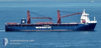
UHL FIERCE
Cargo
Current Trip
| Time Travelled | 23 days |
|---|---|
| Remaining Time | --- |
| Distance Travelled | 5603.91 nm |
| Remaining Distance | --- |
| AVG Speed | 15.3 Knots |
| MAX Speed | 20.5 Knots |
| AVG Wind | 10 knots |
| MAX Wind | 29 knots |
| MIN Temp | 16.5°C / 61.7°F |
| MAX Temp | 30.1°C / 86.18°F |
| Draught | 6.5 m |
| Position Received | 1 d ago |
Current Position
| Longitude | 17.44998° |
|---|---|
| Latitude | -33.89298° |
| Status | Under way using engine |
| Speed | 15.6 Knots |
| Course | 311.9° |
| Area | South Atlantic Ocean |
| Station | T-AIS |
| Position Received | 1 d ago |
Info
Information
The current position of UHL FIERCE is in South Atlantic Ocean with coordinates -33.89298° / 17.44998° as reported on 2024-04-17 07:27 by AIS to our vessel tracker app. The vessel's current speed is 15.6 Knots and is heading at the port of LAS PALMAS. The estimated time of arrival as calculated by MyShipTracking vessel tracking app is 2024-04-29 22:00 LT
The vessel UHL FIERCE (IMO: 9892509, MMSI: 255806356) is a Cargo It's sailing under the flag of [PT] Portugal.
In this page you can find informations about the vessels current position, last detected port calls, and current voyage information. If the vessels is not in coverage by AIS you will find the latest position.
The current position of UHL FIERCE is detected by our AIS receivers and we are not responsible for the reliability of the data. The last position was recorded while the vessel was in Coverage by the Ais receivers of our vessel tracking app.
The current draught of UHL FIERCE as reported by AIS is 6.5 meters
Weather
| Temperature | 19.5°C / 67.1°F |
|---|---|
| Wind Speed | 10 knots |
| Direction | 163° SSE |
| Pressure | 1017 hPa |
| Humidity | 79.2 % |
| Cloud Coverage | 100 % |
Featured Company
Last Port Calls
| Port | Arrival | Departure | Time In Port |
|---|---|---|---|
| 2024-03-22 11:56 | 2024-03-26 10:20 | 3 d | |
| 2024-03-15 09:09 | 2024-03-19 15:24 | 4 d | |
| 2024-02-29 04:16 | 2024-02-29 16:30 | 12 h | |
| 2024-02-08 21:01 | 2024-02-09 14:45 | 17 h |
Most Visited Ports (Last year)
| Port | Arrivals | |
|---|---|---|
| 3 | ||
| 2 | ||
| 2 | ||
| 2 | ||
| 1 | ||
| 1 |
Last Trips
| Origin | Departure | Destination | Arrival | Distance | |
|---|---|---|---|---|---|
| 2024-03-19 20:54 | 2024-03-22 17:26 | 6.12 nm | |||
| 2024-03-01 00:30 | 2024-03-15 14:39 | 3425.15 nm | |||
| 2024-02-09 16:45 | 2024-02-29 12:16 | 6544.05 nm | |||
| 2024-01-18 02:37 | 2024-02-08 23:01 | 7188.56 nm |
Events
| Time | Event | Details | Position / Dest | Info |
|---|---|---|---|---|
| 2024-04-17 07:34 | Status Changed | Default Under way using engine |
-33.87248 / 17.42274
ES LPA
|
Speed: 15.6 kn Course: 311.9° |
| 2024-04-17 07:27 | Status Changed | Under way using engine Default |
-33.89298 / 17.44998
ES LPA
|
Speed: 15.5 kn Course: 312° |
| 2024-04-17 07:27 | OUT of Coverage |
-33.89298 / 17.44998
South Atlantic Ocean
ES LPA
|
Speed: 15.6 kn Course: 311.9° |
|
| 2024-04-17 07:19 | IN Coverage |
-33.89298 / 17.44998
South Atlantic Ocean
ES LPA
|
Speed: 15.6 kn Course: 311.9° |
|
| 2024-04-17 05:44 | Status Changed | Default Under way using engine |
-34.19500 / 17.82667
ES LPA
|
Speed: 15.2 kn Course: 312.2° |
| 2024-04-17 05:41 | OUT of Coverage |
-34.20494 / 17.84023
South Atlantic Ocean
ES LPA
|
Speed: 15.2 kn Course: 312.2° |
|
| 2024-04-17 05:37 | Status Changed | Under way using engine Default |
-34.21854 / 17.85757
ES LPA
|
Speed: 15 kn Course: 313° |
| 2024-04-17 05:32 | Status Changed | Default Under way using engine |
-34.23000 / 17.87167
ES LPA
|
Speed: 15.2 kn Course: 313.7° |
| 2024-04-17 02:38 | Draught Changed | 6.5 6.6 |
-34.70117 / 18.56176
ES LPA
|
Speed: 15.4 kn Course: 281.3° |
| 2024-04-17 02:38 | Destination Changed | ES LPA LK CMB |
-34.70117 / 18.56176
ES LPA
|
Speed: 15.4 kn Course: 281.3° |