
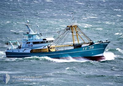
TX-38
Trawler
Current Trip
FISHINGGROUNDS
| Time Travelled | 2 days |
|---|---|
| Remaining Time | --- |
| Distance Travelled | 84.55 nm |
| Remaining Distance | --- |
| AVG Speed | 6.6 Knots |
| MAX Speed | 11.7 Knots |
| AVG Wind | 17 knots |
| MAX Wind | 22.1 knots |
| MIN Temp | 6.6°C / 43.88°F |
| MAX Temp | 8.8°C / 47.84°F |
| Draught | 5 m |
| Position Received | 14 h, 32 m ago |
Current Position
| Longitude | 2.45213° |
|---|---|
| Latitude | 51.68959° |
| Status | Under way using engine |
| Speed | 5.9 Knots |
| Course | 294.3° |
| Area | North Sea |
| Station | T-AIS |
| Position Received | 14 h, 32 m ago |
Info
Information
The current position of TX-38 is in North Sea with coordinates 51.68959° / 2.45213° as reported on 2024-04-23 12:43 by AIS to our vessel tracker app. The vessel's current speed is 5.9 Knots
The vessel TX-38 (IMO: 9225639, MMSI: 246485000) is a Trawler that was built in 2000 ( 24 years old ). It's sailing under the flag of [NL] Netherlands.
In this page you can find informations about the vessels current position, last detected port calls, and current voyage information. If the vessels is not in coverage by AIS you will find the latest position.
The current position of TX-38 is detected by our AIS receivers and we are not responsible for the reliability of the data. The last position was recorded while the vessel was in Coverage by the Ais receivers of our vessel tracking app.
The current draught of TX-38 as reported by AIS is 5 meters
Weather
| Temperature | 6.7°C / 44.06°F |
|---|---|
| Wind Speed | 12 knots |
| Direction | 272° W |
| Pressure | 1021.1 hPa |
| Humidity | 74.9 % |
| Cloud Coverage | 96 % |
Featured Company
Last Port Calls
| Port | Arrival | Departure | Time In Port |
|---|---|---|---|
| 2024-04-18 20:14 | 2024-04-21 20:20 | 3 d | |
| 2024-04-11 19:39 | 2024-04-14 20:46 | 3 d | |
| 2024-04-05 00:51 | 2024-04-07 20:24 | 2 d | |
| 2024-02-01 18:16 | 2024-04-01 21:47 |
Most Visited Ports (Last year)
| Port | Arrivals | |
|---|---|---|
| 42 |
Last Trips
| Origin | Departure | Destination | Arrival | Distance | |
|---|---|---|---|---|---|
| 2024-04-14 22:46 | 2024-04-18 22:14 | 172.13 nm | |||
| 2024-04-07 22:24 | 2024-04-11 21:39 | 141.60 nm | |||
| 2024-04-01 23:47 | 2024-04-05 02:51 | 474.22 nm | |||
| 2024-01-28 22:37 | 2024-02-01 19:16 | 114.10 nm |
Events
| Time | Event | Details | Position / Dest | Info |
|---|---|---|---|---|
| 2024-04-23 12:43 | OUT of Coverage |
51.68959 / 2.45213
North Sea
|
Speed: 5.9 kn Course: 294.3° |
|
| 2024-04-23 11:55 | Change Sea Area | Belgian part of the North Sea Dutch part of the North Sea |
51.68125 / 2.48664
North Sea
|
Speed: 6.4 kn Course: 116.5° |
| 2024-04-23 11:53 | IN Coverage |
51.68125 / 2.48664
North Sea
|
Speed: 6.4 kn Course: 116.5° |
|
| 2024-04-22 05:46 | OUT of Coverage |
51.77202 / 2.71384
North Sea
|
Speed: 5.6 kn Course: 98° |
|
| 2024-04-22 05:44 | Change Sea Area | Dutch part of the North Sea Belgian part of the North Sea |
51.77243 / 2.70680
North Sea
|
Speed: 5.9 kn Course: 107.7° |
| 2024-04-22 04:44 | START Moving |
51.73193 / 2.57635
FISHINGGROUNDS
|
Speed: 4.4 kn Course: 45° |
|
| 2024-04-22 04:41 | STOP Moving |
51.73051 / 2.57417
FISHINGGROUNDS
|
Speed: 0.3 kn Course: 52° |
|
| 2024-04-22 02:44 | START Moving |
51.59807 / 2.57244
FISHINGGROUNDS
|
Speed: 3.9 kn Course: 235° |
|
| 2024-04-22 02:42 | STOP Moving |
51.59831 / 2.57540
FISHINGGROUNDS
|
Speed: 0.3 kn Course: 303° |
|
| 2024-04-21 21:17 | Change Sea Area | Belgian part of the North Sea Dutch part of the North Sea |
51.41353 / 3.32414
North Sea
|
Speed: 11.1 kn Course: 270.7° |