
KAROLINE
General Cargo
Current Trip
SH SHM PLT
| Time Travelled | 9 days |
|---|---|
| Remaining Time | --- |
| Distance Travelled | 1769.35 nm |
| Remaining Distance | --- |
| AVG Speed | 9 Knots |
| MAX Speed | 13 Knots |
| AVG Wind | 12.8 knots |
| MAX Wind | 29 knots |
| MIN Temp | 14.9°C / 58.82°F |
| MAX Temp | 24.6°C / 76.28°F |
| Draught | 4.8 m |
| Position Received | 4 h, 11 m ago |
Current Position
| Longitude | -5.34053° |
|---|---|
| Latitude | -15.99651° |
| Status | Under way using engine |
| Speed | 9.7 Knots |
| Course | 109.3° |
| Area | South Atlantic Ocean |
| Station | T-AIS |
| Position Received | 4 h, 11 m ago |
Info
Information
The current position of KAROLINE is in South Atlantic Ocean with coordinates -15.99651° / -5.34053° as reported on 2024-04-18 20:59 by AIS to our vessel tracker app. The vessel's current speed is 9.7 Knots
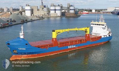
The vessel KAROLINE (IMO: 9375874, MMSI: 304924000) is a General Cargo that was built in 2006 ( 18 years old ). It's sailing under the flag of [AG] Antigua Barbuda.
In this page you can find informations about the vessels current position, last detected port calls, and current voyage information. If the vessels is not in coverage by AIS you will find the latest position.
The current position of KAROLINE is detected by our AIS receivers and we are not responsible for the reliability of the data. The last position was recorded while the vessel was in Coverage by the Ais receivers of our vessel tracking app.
The current draught of KAROLINE as reported by AIS is 4.8 meters
Weather
| Temperature | 24°C / 75.2°F |
|---|---|
| Wind Speed | 8 knots |
| Direction | 105° ESE |
| Pressure | 1014.8 hPa |
| Humidity | 80.7 % |
| Cloud Coverage | 15 % |
Featured Company
Last Port Calls
| Port | Arrival | Departure | Time In Port |
|---|---|---|---|
| 2024-04-03 20:05 | 2024-04-09 16:30 | 5 d | |
| 2024-03-29 06:34 | 2024-03-29 14:23 | 7 h | |
| 2024-03-26 05:28 | 2024-03-26 15:36 | 10 h | |
| 2024-03-04 23:36 | 2024-03-05 20:24 | 20 h | |
| 2024-02-05 04:06 | 2024-02-06 22:44 | 1 d | |
| 2024-02-02 15:44 | 2024-02-03 04:27 | 12 h |
Last Trips
| Origin | Departure | Destination | Arrival | Distance | |
|---|---|---|---|---|---|
| 2024-03-29 16:23 | 2024-04-03 22:05 | 502.98 nm | |||
| 2024-03-26 17:36 | 2024-03-29 08:34 | 259.31 nm | |||
| 2024-03-05 22:24 | 2024-03-26 07:28 | 4028.17 nm | |||
| 2024-02-07 00:44 | 2024-03-05 01:36 | 156.10 nm | |||
| 2024-02-03 06:27 | 2024-02-05 06:06 | 480.54 nm | |||
| 2024-01-24 06:24 | 2024-02-02 17:44 | 11.14 nm |
Events
| Time | Event | Details | Position / Dest | Info |
|---|---|---|---|---|
| 2024-04-18 21:05 | Status Changed | Default Under way using engine |
-16.00167 / -5.32333
SH SHM PLT
|
Speed: 9.7 kn Course: 109.3° |
| 2024-04-18 20:59 | OUT of Coverage |
-15.99651 / -5.34053
South Atlantic Ocean
|
Speed: 9.7 kn Course: 109.3° |
|
| 2024-04-18 19:38 | Status Changed | Under way using engine Default |
-15.92085 / -5.56048
SH SHM PLT
|
Speed: 9 kn Course: 110° |
| 2024-04-18 19:35 | Status Changed | Default Under way using engine |
-15.91833 / -5.56500
SH SHM PLT
|
Speed: 10 kn Course: 112.3° |
| 2024-04-18 18:28 | Status Changed | Under way using engine Moored |
-15.91602 / -5.71316
SH SHM PLT
|
Speed: 3.3 kn Course: 13° |
| 2024-04-18 18:28 | START Moving |
-15.91602 / -5.71316
SH SHM PLT
|
Speed: 4.7 kn Course: 326° |
|
| 2024-04-18 11:32 | Status Changed | Moored Default |
-15.91761 / -5.71418
SH SHM PLT
|
Speed: Course: -1° |
| 2024-04-18 11:20 | Status Changed | Default Moored |
-15.91667 / -5.71333
SH SHM PLT
|
Speed: Course: 31° |
| 2024-04-18 02:59 | Destination Changed | SH SHM PLT SH SHN |
-15.91764 / -5.71415
SH SHM PLT
|
Speed: Course: 31° |
| 2024-04-18 01:59 | Status Changed | Moored Default |
-15.91766 / -5.71414
SH SHN
|
Speed: Course: -1° |