
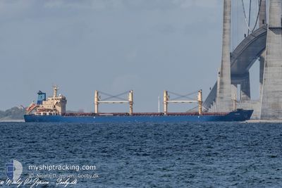
TULPAR
Bulk Carrier
Current Trip
| Time Travelled | 20 days |
|---|---|
| Remaining Time | --- |
| Distance Travelled | 5889.83 nm |
| Remaining Distance | --- |
| AVG Speed | 12 Knots |
| MAX Speed | 14.9 Knots |
| AVG Wind | 9.3 knots |
| MAX Wind | 31.9 knots |
| MIN Temp | 16.4°C / 61.52°F |
| MAX Temp | 29.2°C / 84.56°F |
| Draught | 9 m |
| Position Received | 2 h, 6 m ago |
Current Position
| Longitude | --- |
|---|---|
| Latitude | --- |
| Status | Under way using engine |
| Speed | 13.1 Knots |
| Course | 287.9° |
| Area | Mediterranean Sea - Eastern Basin |
| Station | T-AIS |
| Position Received | 2 h, 6 m ago |
Info
Information
The current position of TULPAR is in Mediterranean Sea - Eastern Basin with coordinates 34.47804° / 23.08926° as reported on 2024-12-11 12:29 by AIS to our vessel tracker app. The vessel's current speed is 13.1 Knots and is heading at the port of CORUNA. The estimated time of arrival as calculated by MyShipTracking vessel tracking app is 2024-12-18 01:00 LT
The vessel TULPAR (IMO: 9285407, MMSI: 538007583) is a Bulk Carrier that was built in 2003 ( 21 years old ). It's sailing under the flag of [MH] Marshall Is.
In this page you can find informations about the vessels current position, last detected port calls, and current voyage information. If the vessels is not in coverage by AIS you will find the latest position.
The current position of TULPAR is detected by our AIS receivers and we are not responsible for the reliability of the data. The last position was recorded while the vessel was in Coverage by the Ais receivers of our vessel tracking app.
The current draught of TULPAR as reported by AIS is 9 meters
Weather
| Temperature | 18.3°C / 64.94°F |
|---|---|
| Wind Speed | 6 knots |
| Direction | 327° NNW |
| Pressure | 1022.1 hPa |
| Humidity | 60 % |
| Cloud Coverage | 100 % |
Featured Company
Last Port Calls
| Port | Arrival | Departure | Time In Port |
|---|---|---|---|
| 2024-12-09 10:54 | 2024-12-09 20:49 | 9 h | |
| 2024-11-13 11:32 | 2024-11-21 05:44 | 7 d |
Most Visited Ports (Last year)
| Port | Arrivals | |
|---|---|---|
| 4 | ||
| 4 | ||
| 1 | ||
| 1 | ||
| 1 | ||
| 1 |
Last Trips
| Origin | Departure | Destination | Arrival | Distance | |
|---|---|---|---|---|---|
| 2024-11-21 05:44 | 2024-12-09 10:54 | 5287.06 nm | |||
| 2024-09-25 06:13 | 2024-11-13 11:32 | 2738.96 nm |
Events
| Time | Event | Details | Position / Dest | Info |
|---|---|---|---|---|
| 2024-12-11 12:29 | Status Changed | Default Under way using engine |
34.47844 / 23.08772
ESLCG
|
Speed: 13.1 kn Course: 287.9° |
| 2024-12-11 12:29 | OUT of Coverage |
34.47804 / 23.08926
Mediterranean Sea - Eastern Basin
ESLCG
|
Speed: 13.1 kn Course: 287.9° |
|
| 2024-12-11 11:49 | Status Changed | Under way using engine Default |
34.43554 / 23.25553
ESLCG
|
Speed: 12.6 kn Course: 289° |
| 2024-12-11 11:29 | Status Changed | Default Under way using engine |
34.41275 / 23.33723
ESLCG
|
Speed: 12.6 kn Course: 288.3° |
| 2024-12-11 11:13 | Detected in Sea | Greek part of the Mediterranean Sea - Eastern Basin |
34.39660 / 23.40065
Mediterranean Sea - Eastern Basin
ESLCG
|
Speed: 12.6 kn Course: 285.8° |
| 2024-12-11 11:12 | Status Changed | Under way using engine Default |
34.39532 / 23.40605
ESLCG
|
Speed: 12.6 kn Course: 285° |
| 2024-12-11 11:12 | IN Coverage |
34.39660 / 23.40065
Mediterranean Sea - Eastern Basin
ESLCG
|
Speed: 12.6 kn Course: 285.8° |
|
| 2024-12-09 19:01 | Status Changed | Default Under way using engine |
31.27995 / 32.36065
ESLCG
|
Speed: 11.1 kn Course: 15.1° |
| 2024-12-09 18:57 | OUT of Coverage |
31.26720 / 32.35698
Mediterranean Sea - Eastern Basin
ESLCG
|
Speed: 11.1 kn Course: 15.1° |
|
| 2024-12-09 18:55 | Detected in Sea | Egyptian part of the Mediterranean Sea - Eastern Basin |
31.26113 / 32.35524
Mediterranean Sea - Eastern Basin
ESLCG
|
Speed: 11.2 kn Course: 13.3° |