
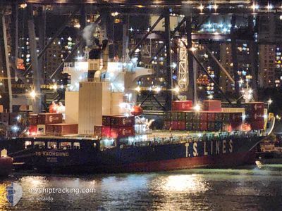
TS KAOHSIUNG
Cargo B
Current Trip
| Trip Time | 1 day |
|---|---|
| Trip Distance | 495.29 nm |
| AVG Speed | 13.1 Knots |
| MAX Speed | 18 Knots |
| Draught | 9.2 m |
| AVG Wind | 13.7 knots |
| MAX Wind | 26.7 knots |
| MIN Temp | 19.4°C / 66.92°F |
| MAX Temp | 26.6°C / 79.88°F |
| Position Received | 2 m ago |
Current Position
| Longitude | 121.75362° |
|---|---|
| Latitude | 25.14120° |
| Status | Moored |
| Speed | |
| Course | 238° |
| Area | Eastern China Sea |
| Station | T-AIS |
| Position Received | 2 m ago |
Info
Information
The current position of TS KAOHSIUNG is in Eastern China Sea with coordinates 25.14120° / 121.75362° as reported on 2024-04-24 23:43 by AIS to our vessel tracker app. The vessel's current speed is 0 Knots and is currently inside the port of KEELUNG.
The vessel TS KAOHSIUNG (IMO: 9810068, MMSI: 538007728) is a Cargo B It's sailing under the flag of [MH] Marshall Is.
In this page you can find informations about the vessels current position, last detected port calls, and current voyage information. If the vessels is not in coverage by AIS you will find the latest position.
The current position of TS KAOHSIUNG is detected by our AIS receivers and we are not responsible for the reliability of the data. The last position was recorded while the vessel was in Coverage by the Ais receivers of our vessel tracking app.
The current draught of TS KAOHSIUNG as reported by AIS is 9.2 meters
Weather
| Temperature | 22.9°C / 73.22°F |
|---|---|
| Wind Speed | 7 knots |
| Direction | 118° ESE |
| Pressure | 1010.7 hPa |
| Humidity | 89.8 % |
| Cloud Coverage | 100 % |
Featured Company
Last Port Calls
| Port | Arrival | Departure | Time In Port |
|---|---|---|---|
| 2024-04-24 01:48 | |||
| 2024-04-21 09:37 | 2024-04-22 14:11 | 1 d | |
| 2024-04-19 18:17 | 2024-04-20 08:34 | 14 h | |
| 2024-04-17 01:40 | 2024-04-18 16:50 | 1 d | |
| 2024-04-14 08:12 | 2024-04-15 08:51 | 1 d | |
| 2024-04-12 12:50 | 2024-04-13 05:57 | 17 h | |
| 2024-04-11 18:46 | 2024-04-12 04:02 | 9 h | |
| 2024-04-10 01:57 | 2024-04-11 11:14 | 1 d | |
| 2024-04-07 11:11 | 2024-04-08 06:56 | 19 h | |
| 2024-04-05 11:53 | 2024-04-06 04:09 | 16 h |
Last Trips
| Origin | Departure | Destination | Arrival | Distance | |
|---|---|---|---|---|---|
| 2024-04-22 22:11 | 2024-04-24 09:48 | 495.29 nm | |||
| 2024-04-20 16:34 | 2024-04-21 17:37 | 353.36 nm | |||
| 2024-04-19 00:50 | 2024-04-20 02:17 | 226.85 nm | |||
| 2024-04-15 16:51 | 2024-04-17 09:40 | 495.97 nm | |||
| 2024-04-13 13:57 | 2024-04-14 16:12 | 353.32 nm | |||
| 2024-04-12 12:02 | 2024-04-12 20:50 | 137.07 nm | |||
| 2024-04-11 19:14 | 2024-04-12 02:46 | 115.05 nm | |||
| 2024-04-08 14:56 | 2024-04-10 09:57 | 496.87 nm | |||
| 2024-04-06 12:09 | 2024-04-07 19:11 | 359.47 nm | |||
| 2024-04-05 09:01 | 2024-04-05 19:53 | 137.94 nm |
Events
| Time | Event | Details | Position / Dest | Info |
|---|---|---|---|---|
| 2024-04-24 02:10 | STOP Moving |
25.14122 / 121.75359
[TW] KEELUNG
|
Speed: Course: 239° |
|
| 2024-04-24 02:07 | Status Changed | Moored Under way using engine |
25.14136 / 121.75364
[TW] KEELUNG
|
Speed: 0.4 kn Course: 236° |
| 2024-04-24 01:48 | PORT ARRIVAL |
|
25.16250 / 121.75239
[TW] KEELUNG
|
Speed: 9.5 kn Course: 156.2° |
| 2024-04-24 00:16 | Status Changed | Under way using engine Default |
25.34003 / 121.50188
TW KEL
|
Speed: 12.4 kn Course: 84° |
| 2024-04-24 00:12 | Status Changed | Default Under way using engine |
25.34050 / 121.48584
TW KEL
|
Speed: 12 kn Course: 67.5° |
| 2024-04-24 00:02 | Status Changed | Under way using engine Default |
25.32867 / 121.45196
TW KEL
|
Speed: 12.5 kn Course: 68° |
| 2024-04-23 23:56 | Status Changed | Default Under way using engine |
25.32139 / 121.42909
TW KEL
|
Speed: 12.1 kn Course: 79.3° |
| 2024-04-23 23:49 | Change Sea Area | Taiwanese part of the Eastern China Sea Taiwanese part of the South China Sea |
25.31510 / 121.40668
Eastern China Sea
TW KEL
|
Speed: 12.1 kn Course: 78.2° |
| 2024-04-23 23:49 | Status Changed | Under way using engine Default |
25.31455 / 121.40363
TW KEL
|
Speed: 11.8 kn Course: 80° |
| 2024-04-23 23:20 | Status Changed | Default Under way using engine |
25.30077 / 121.29742
TW KEL
|
Speed: 10.9 kn Course: 74.3° |