
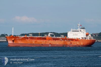
TRF KASHIMA
Tanker B
Current Trip
| Trip Time | 3 days |
|---|---|
| Trip Distance | 898.10 nm |
| AVG Speed | 11.2 Knots |
| MAX Speed | 14.6 Knots |
| Draught | 9.7 m |
| AVG Wind | 6.7 knots |
| MAX Wind | 20.5 knots |
| MIN Temp | 7.1°C / 44.78°F |
| MAX Temp | 20.6°C / 69.08°F |
| Position Received | 22 h, 58 m ago |
Current Position
| Longitude | 118.13282° |
|---|---|
| Latitude | 38.79920° |
| Status | Under way using engine |
| Speed | 5.7 Knots |
| Course | 290.1° |
| Area | Yellow Sea |
| Station | T-AIS |
| Position Received | 22 h, 58 m ago |
Info
Information
The current position of TRF KASHIMA is in Yellow Sea with coordinates 38.79920° / 118.13282° as reported on 2024-04-24 05:32 by AIS to our vessel tracker app. The vessel's current speed is 5.7 Knots and is currently inside the port of TIANJIN.
The vessel TRF KASHIMA (IMO: 9733349, MMSI: 538006611) is a Tanker B It's sailing under the flag of [MH] Marshall Is.
In this page you can find informations about the vessels current position, last detected port calls, and current voyage information. If the vessels is not in coverage by AIS you will find the latest position.
The current position of TRF KASHIMA is detected by our AIS receivers and we are not responsible for the reliability of the data. The last position was recorded while the vessel was in Coverage by the Ais receivers of our vessel tracking app.
The current draught of TRF KASHIMA as reported by AIS is 9.7 meters
Weather
| Temperature | 20.6°C / 69.08°F |
|---|---|
| Wind Speed | 8 knots |
| Direction | 203° SSW |
| Pressure | 1002.9 hPa |
| Humidity | 50.5 % |
| Cloud Coverage | 75 % |
Featured Company
Last Port Calls
| Port | Arrival | Departure | Time In Port |
|---|---|---|---|
| 2024-04-24 08:35 | |||
| 2024-04-21 01:24 | |||
| 2024-04-08 04:05 | 2024-04-09 04:25 | 1 d | |
| 2024-04-03 16:12 | 2024-04-04 08:29 | 16 h | |
| 2024-04-02 19:35 | 2024-04-03 09:04 | 13 h | |
| 2024-03-29 10:00 | 2024-03-30 05:44 | 19 h | |
| 2024-03-10 21:36 | 2024-03-14 09:32 | 3 d |
Most Visited Ports (Last year)
| Port | Arrivals | |
|---|---|---|
| 4 | ||
| 3 | ||
| 3 | ||
| 2 | ||
| 2 | ||
| 1 |
Last Trips
| Origin | Departure | Destination | Arrival | Distance | |
|---|---|---|---|---|---|
| 2024-04-21 09:24 | 2024-04-24 16:35 | 898.10 nm | |||
| 2024-04-04 15:29 | 2024-04-08 12:05 | 891.48 nm | |||
| 2024-04-03 16:04 | 2024-04-03 23:12 | 17.40 nm | |||
| 2024-03-30 12:44 | 2024-04-03 02:35 | 681.30 nm | |||
| 2024-03-14 12:32 | 2024-03-29 17:00 | 3723.25 nm | |||
| 2024-01-21 11:39 | 2024-03-11 00:36 | 8260.39 nm |
Events
| Time | Event | Details | Position / Dest | Info |
|---|---|---|---|---|
| 2024-04-24 08:35 | STOP Moving |
38.95203 / 117.74526
[CN] TIANJIN
|
Speed: 0.1 kn Course: 291° |
|
| 2024-04-24 08:35 | PORT ARRIVAL |
|
38.95203 / 117.74526
[CN] TIANJIN
|
Speed: 5.5 kn Course: 285° |
| 2024-04-24 05:40 | Status Changed | Default Under way using engine |
38.80510 / 118.11369
PADANG
|
Speed: 5.7 kn Course: 290.1° |
| 2024-04-24 05:32 | OUT of Coverage |
38.79920 / 118.13282
Yellow Sea
|
Speed: 5.7 kn Course: 290.1° |
|
| 2024-04-24 05:19 | Status Changed | Under way using engine Default |
38.78897 / 118.17710
PADANG
|
Speed: 3.5 kn Course: 295° |
| 2024-04-24 05:00 | Status Changed | Default Under way using engine |
38.78917 / 118.17619
PADANG
|
Speed: 4.3 kn Course: 285° |
| 2024-04-24 04:32 | Change Sea Area | Chinese part of the Yellow Sea Indian part of the Laccadive Sea |
38.79362 / 118.26841
Yellow Sea
|
Speed: 11.7 kn Course: 234° |
| 2024-04-24 04:32 | Status Changed | Under way using engine Default |
38.79362 / 118.26841
PADANG
|
Speed: 8.9 kn Course: 260° |
| 2024-04-24 04:23 | IN Coverage |
38.79362 / 118.26841
Yellow Sea
|
Speed: 11.7 kn Course: 234° |
|
| 2024-04-24 00:56 | START Moving |
38.78772 / 119.02344
PADANG
|
Speed: 4.4 kn Course: 277° |