
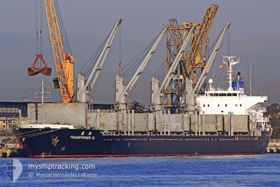
TRANSFORMER OL
Bulk Carrier
Current Trip
| Trip Time | 17 days |
|---|---|
| Trip Distance | 3910.81 nm |
| AVG Speed | 9.8 Knots |
| MAX Speed | 13.4 Knots |
| Draught | 9.3 m |
| AVG Wind | 8.1 knots |
| MAX Wind | 28.3 knots |
| MIN Temp | 21.9°C / 71.42°F |
| MAX Temp | 30.5°C / 86.9°F |
| Position Received | 4 d ago |
Current Position
| Longitude | 76.30332° |
|---|---|
| Latitude | 8.29680° |
| Status | Under way using engine |
| Speed | 9.5 Knots |
| Course | 328° |
| Area | Laccadive Sea |
| Station | T-AIS |
| Position Received | 4 d ago |
Info
Information
The current position of TRANSFORMER OL is in Laccadive Sea with coordinates 8.29680° / 76.30332° as reported on 2024-04-15 05:02 by AIS to our vessel tracker app. The vessel's current speed is 9.5 Knots and is currently inside the port of MUMBAI.
The vessel TRANSFORMER OL (IMO: 9550216, MMSI: 372789000) is a Bulk Carrier that was built in 2009 ( 15 years old ). It's sailing under the flag of [PA] Panama.
In this page you can find informations about the vessels current position, last detected port calls, and current voyage information. If the vessels is not in coverage by AIS you will find the latest position.
The current position of TRANSFORMER OL is detected by our AIS receivers and we are not responsible for the reliability of the data. The last position was recorded while the vessel was in Coverage by the Ais receivers of our vessel tracking app.
The current draught of TRANSFORMER OL as reported by AIS is 9.3 meters
Weather
| Temperature | 28.4°C / 83.12°F |
|---|---|
| Wind Speed | 12 knots |
| Direction | 323° NW |
| Pressure | 1007.3 hPa |
| Humidity | 70.5 % |
| Cloud Coverage | 12 % |
Featured Company
Last Port Calls
| Port | Arrival | Departure | Time In Port |
|---|---|---|---|
| 2024-04-19 16:00 | |||
| 2024-03-30 06:56 | 2024-04-02 11:53 | 3 d | |
| 2024-03-02 13:48 | 2024-03-11 14:42 | 9 d | |
| 2024-02-24 01:15 | 2024-02-25 22:14 | 1 d |
Most Visited Ports (Last year)
| Port | Arrivals | |
|---|---|---|
| 2 | ||
| 2 | ||
| 1 | ||
| 1 | ||
| 1 | ||
| 1 |
Last Trips
| Origin | Departure | Destination | Arrival | Distance | |
|---|---|---|---|---|---|
| 2024-04-02 19:53 | 2024-04-19 21:30 | 3910.81 nm | |||
| 2024-03-11 22:42 | 2024-03-30 14:56 | 3182.86 nm | |||
| 2024-02-26 07:14 | 2024-03-02 21:48 | 915.44 nm | |||
| 2023-12-29 15:02 | 2024-02-24 10:15 | 5464.91 nm |
Events
| Time | Event | Details | Position / Dest | Info |
|---|---|---|---|---|
| 2024-04-19 16:23 | STOP Moving |
18.93207 / 72.84388
[IN] MUMBAI
|
Speed: 0.1 kn Course: 347° |
|
| 2024-04-19 16:00 | PORT ARRIVAL |
|
18.93053 / 72.84745
[IN] MUMBAI
|
Speed: 3.2 kn Course: 303° |
| 2024-04-18 02:59 | STOP Moving | 19.7 nm, West of MUMBAI |
19.06747 / 72.53618
INBOM
|
Speed: 0.2 kn Course: 194° |
| 2024-04-15 05:11 | Status Changed | Default Under way using engine |
8.31707 / 76.29054
INBOM
|
Speed: 9.5 kn Course: 328° |
| 2024-04-15 05:02 | Status Changed | Under way using engine Default |
8.29680 / 76.30332
INBOM
|
Speed: 9.3 kn Course: 327° |
| 2024-04-15 05:02 | OUT of Coverage |
8.29680 / 76.30332
Laccadive Sea
INBOM
|
Speed: 9.5 kn Course: 328° |
|
| 2024-04-15 04:41 | Status Changed | Default Under way using engine |
8.24905 / 76.33207
INBOM
|
Speed: 9.3 kn Course: 328° |
| 2024-04-15 03:53 | Status Changed | Under way using engine Default |
8.14025 / 76.39915
INBOM
|
Speed: 9.7 kn Course: 330° |
| 2024-04-15 03:53 | IN Coverage |
8.14025 / 76.39915
Laccadive Sea
INBOM
|
Speed: 9.6 kn Course: 328° |
|
| 2024-04-15 02:24 | OUT of Coverage |
7.92337 / 76.51650
Laccadive Sea
INBOM
|
Speed: 9.9 kn Course: 328° |