
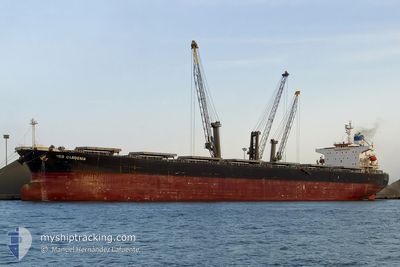
TRAMP LADY
Bulk Carrier
Current Trip
| Time Travelled | 5 days |
|---|---|
| Remaining Time | --- |
| Distance Travelled | 52.99 nm |
| Remaining Distance | --- |
| AVG Speed | 13 Knots |
| MAX Speed | 17 Knots |
| AVG Wind | 5.9 knots |
| MAX Wind | 14.2 knots |
| MIN Temp | 11.2°C / 52.16°F |
| MAX Temp | 15.7°C / 60.26°F |
| Draught | 12.9 m |
| Position Received | 7 h, 4 m ago |
Current Position
| Longitude | 37.16864° |
|---|---|
| Latitude | 44.31238° |
| Status | Under way using engine |
| Speed | 8.2 Knots |
| Course | 232.2° |
| Area | Black Sea |
| Station | T-AIS |
| Position Received | 7 h, 4 m ago |
Info
Information
The current position of TRAMP LADY is in Black Sea with coordinates 44.31238° / 37.16864° as reported on 2024-04-18 01:45 by AIS to our vessel tracker app. The vessel's current speed is 8.2 Knots and is heading at the port of DAMMAM. The estimated time of arrival as calculated by MyShipTracking vessel tracking app is 2024-05-03 22:30 LT
The vessel TRAMP LADY (IMO: 9286621, MMSI: 248110000) is a Bulk Carrier that was built in 2005 ( 19 years old ). It's sailing under the flag of [MT] Malta.
In this page you can find informations about the vessels current position, last detected port calls, and current voyage information. If the vessels is not in coverage by AIS you will find the latest position.
The current position of TRAMP LADY is detected by our AIS receivers and we are not responsible for the reliability of the data. The last position was recorded while the vessel was in Coverage by the Ais receivers of our vessel tracking app.
The current draught of TRAMP LADY as reported by AIS is 12.9 meters
Weather
| Temperature | 13.7°C / 56.66°F |
|---|---|
| Wind Speed | 11 knots |
| Direction | 135° SE |
| Pressure | 997.5 hPa |
| Humidity | 83.1 % |
| Cloud Coverage | 100 % |
Featured Company
Last Port Calls
| Port | Arrival | Departure | Time In Port |
|---|---|---|---|
| 2024-04-13 00:22 | |||
| 2024-04-01 03:53 | 2024-04-01 12:47 | 8 h | |
| 2024-03-13 08:02 | 2024-03-17 06:53 | 3 d | |
| 2024-02-07 19:26 | 2024-02-09 06:06 | 1 d | |
| 2024-02-06 18:14 | 2024-02-07 19:14 | 1 d | |
| 2024-02-06 16:58 | 2024-02-06 18:06 | 1 h |
Most Visited Ports (Last year)
| Port | Arrivals | |
|---|---|---|
| 4 | ||
| 3 | ||
| 1 | ||
| 1 | ||
| 1 | ||
| 1 |
Last Trips
| Origin | Departure | Destination | Arrival | Distance | |
|---|---|---|---|---|---|
| 2024-03-17 12:23 | 2024-04-01 05:53 | 3909.73 nm | |||
| 2024-02-09 14:06 | 2024-03-13 13:32 | 5302.80 nm | |||
| 2024-02-08 03:14 | 2024-02-08 03:26 | 1.11 nm | |||
| 2024-02-07 02:06 | 2024-02-07 02:14 | 0.37 nm | |||
| 2024-01-02 12:04 | 2024-02-07 00:58 | 7781.10 nm |
Events
| Time | Event | Details | Position / Dest | Info |
|---|---|---|---|---|
| 2024-04-18 02:41 | Status Changed | Default Under way using engine |
44.24564 / 36.95740
SA DMN
|
Speed: 8.2 kn Course: 232.2° |
| 2024-04-18 01:45 | OUT of Coverage |
44.31238 / 37.16864
Black Sea
SA DMN
|
Speed: 8.2 kn Course: 232.2° |
|
| 2024-04-18 01:33 | IN Coverage |
44.32923 / 37.21778
Black Sea
SA DMN
|
Speed: 12.9 kn Course: 243.1° |
|
| 2024-04-18 00:16 | OUT of Coverage |
44.46717 / 37.53793
Black Sea
SA DMN
|
Speed: 12.4 kn Course: 230.7° |
|
| 2024-04-18 00:14 | IN Coverage |
44.46717 / 37.53793
Black Sea
SA DMN
|
Speed: 12.4 kn Course: 230.7° |
|
| 2024-04-17 21:34 | ETA Changed | 2024/05/03 22:30 2024/04/25 22:30 |
44.57294 / 37.89602
SA DMN
|
Speed: Course: 272° |
| 2024-04-16 11:28 | Destination Changed | SA DMN NOVOROSSIYSK |
44.57294 / 37.89602
SA DMN
|
Speed: Course: 272° |
| 2024-04-15 23:02 | Destination Changed | NOVOROSSIYSK DAMMAM |
44.57294 / 37.89602
NOVOROSSIYSK
|
Speed: Course: 272° |
| 2024-04-14 12:03 | OUT of Coverage |
44.57294 / 37.89602
Black Sea
DAMMAM
|
Speed: Course: 208.9° |
|
| 2024-04-14 10:03 | IN Coverage |
44.57292 / 37.89577
Black Sea
DAMMAM
|
Speed: 0.1 kn Course: 208.9° |