
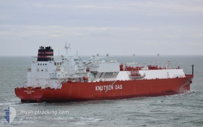
TRAIANO KNUTSEN
Tanker
Current Trip
| Time Travelled | 33 days |
|---|---|
| Remaining Time | --- |
| Distance Travelled | 10193.64 nm |
| Remaining Distance | --- |
| AVG Speed | 14.1 Knots |
| MAX Speed | 19.7 Knots |
| AVG Wind | 15.3 knots |
| MAX Wind | 37 knots |
| MIN Temp | 12.5°C / 54.5°F |
| MAX Temp | 26°C / 78.8°F |
| Draught | 11.3 m |
| Position Received | 10 m ago |
Current Position
| Longitude | -23.94859° |
|---|---|
| Latitude | 36.51154° |
| Status | Under way using engine |
| Speed | 16.7 Knots |
| Course | 92.2° |
| Area | North Atlantic Ocean |
| Station | T-AIS |
| Position Received | 10 m ago |
Info
Information
The current position of TRAIANO KNUTSEN is in North Atlantic Ocean with coordinates 36.51154° / -23.94859° as reported on 2024-04-23 16:47 by AIS to our vessel tracker app. The vessel's current speed is 16.7 Knots and is heading at the port of PIOMBINO. The estimated time of arrival as calculated by MyShipTracking vessel tracking app is 2024-04-28 10:00 LT
The vessel TRAIANO KNUTSEN (IMO: 9854765, MMSI: 257575000) is a Tanker It's sailing under the flag of [NO] Norway.
In this page you can find informations about the vessels current position, last detected port calls, and current voyage information. If the vessels is not in coverage by AIS you will find the latest position.
The current position of TRAIANO KNUTSEN is detected by our AIS receivers and we are not responsible for the reliability of the data. The last position was recorded while the vessel was in Coverage by the Ais receivers of our vessel tracking app.
The current draught of TRAIANO KNUTSEN as reported by AIS is 11.3 meters
Weather
| Temperature | 17.5°C / 63.5°F |
|---|---|
| Wind Speed | 15 knots |
| Direction | 57° ENE |
| Pressure | 1022.3 hPa |
| Humidity | 81.6 % |
| Cloud Coverage | 100 % |
Featured Company
Last Port Calls
| Port | Arrival | Departure | Time In Port |
|---|---|---|---|
| 2024-03-20 22:34 | 2024-03-20 22:54 | 20 m | |
| 2024-02-23 10:05 | 2024-02-24 10:29 | 1 d | |
| 2024-02-07 19:25 | 2024-02-10 14:36 | 2 d |
Last Trips
| Origin | Departure | Destination | Arrival | Distance | |
|---|---|---|---|---|---|
| 2024-02-24 05:29 | 2024-03-20 23:34 | 6107.68 nm | |||
| 2024-02-10 15:36 | 2024-02-23 05:05 | 5247.13 nm | |||
| 2024-01-08 18:43 | 2024-02-07 20:25 | 11593.78 nm |
Events
| Time | Event | Details | Position / Dest | Info |
|---|---|---|---|---|
| 2024-04-23 16:47 | Status Changed | Under way using engine Default |
36.51154 / -23.94859
ITPIO
|
Speed: 16.8 kn Course: 92° |
| 2024-04-23 16:40 | Status Changed | Default Under way using engine |
36.51247 / -23.99069
ITPIO
|
Speed: 16.9 kn Course: 92.1° |
| 2024-04-23 10:54 | ETA Changed | 2024/04/28 10:00 2024/04/28 06:00 |
36.59014 / -26.01417
ITPIO
|
Speed: 17.2 kn Course: 92.4° |
| 2024-04-23 10:43 | Status Changed | Under way using engine Default |
36.59272 / -26.07702
ITPIO
|
Speed: 17 kn Course: 91° |
| 2024-04-23 10:41 | Status Changed | Default Under way using engine |
36.59167 / -26.08833
ITPIO
|
Speed: 17.1 kn Course: 92.1° |
| 2024-04-23 10:21 | Status Changed | Under way using engine Default |
36.59599 / -26.20426
ITPIO
|
Speed: 16 kn Course: 91° |
| 2024-04-23 10:14 | Status Changed | Default Under way using engine |
36.59667 / -26.24667
ITPIO
|
Speed: 17 kn Course: 91° |
| 2024-04-23 09:46 | Status Changed | Under way using engine Default |
36.60223 / -26.40896
ITPIO
|
Speed: 16 kn Course: 92° |
| 2024-04-23 09:46 | IN Coverage |
36.60223 / -26.40896
North Atlantic Ocean
ITPIO
|
Speed: 17 kn Course: 92.5° |
|
| 2024-04-23 01:49 | OUT of Coverage |
36.70294 / -29.17954
North Atlantic Ocean
ITPIO
|
Speed: 16.6 kn Course: 93.7° |