
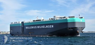
TOSCANA
Ro-Ro/Passenger Ship
Current Trip
| Time Travelled | 1 day |
|---|---|
| Remaining Time | 26 days |
| Distance Travelled | 728.20 nm |
| Remaining Distance | 10976.68 nm |
| AVG Speed | 13.2 Knots |
| MAX Speed | 17.9 Knots |
| AVG Wind | 13.1 knots |
| MAX Wind | 26 knots |
| MIN Temp | 4.9°C / 40.82°F |
| MAX Temp | 15.3°C / 59.54°F |
| Draught | 10.6 m |
| Position Received | 4 h, 33 m ago |
Current Position
| Longitude | -10.81433° |
|---|---|
| Latitude | 42.64338° |
| Status | Under way using engine |
| Speed | 17.5 Knots |
| Course | 196° |
| Area | North Atlantic Ocean |
| Station | T-AIS |
| Position Received | 4 h, 33 m ago |
Info
Information
The current position of TOSCANA is in North Atlantic Ocean with coordinates 42.64338° / -10.81433° as reported on 2024-04-19 17:16 by AIS to our vessel tracker app. The vessel's current speed is 17.5 Knots and is heading at the port of SINGAPORE. The estimated time of arrival as calculated by MyShipTracking vessel tracking app is 2024-05-16 01:36 LT
The vessel TOSCANA (IMO: 9398333, MMSI: 248912000) is a Ro-Ro/Passenger Ship that was built in 2009 ( 15 years old ). It's sailing under the flag of [MT] Malta.
In this page you can find informations about the vessels current position, last detected port calls, and current voyage information. If the vessels is not in coverage by AIS you will find the latest position.
The current position of TOSCANA is detected by our AIS receivers and we are not responsible for the reliability of the data. The last position was recorded while the vessel was in Coverage by the Ais receivers of our vessel tracking app.
The current draught of TOSCANA as reported by AIS is 10.6 meters
Weather
| Temperature | 14.9°C / 58.82°F |
|---|---|
| Wind Speed | 5 knots |
| Direction | 125° SE |
| Pressure | 1016.8 hPa |
| Humidity | 89.8 % |
| Cloud Coverage | 40 % |
Featured Company
Last Port Calls
| Port | Arrival | Departure | Time In Port |
|---|---|---|---|
| 2024-04-17 04:00 | 2024-04-18 00:32 | 20 h | |
| 2024-04-14 21:31 | 2024-04-15 23:35 | 1 d | |
| 2024-04-11 12:12 | 2024-04-13 05:26 | 1 d | |
| 2024-03-30 09:18 | 2024-03-31 01:01 | 15 h | |
| 2024-03-28 15:03 | 2024-03-29 18:00 | 1 d | |
| 2024-03-18 01:30 | 2024-03-21 04:02 | 3 d | |
| 2024-03-14 23:19 | 2024-03-16 00:14 | 1 d | |
| 2024-03-11 23:03 | 2024-03-13 03:11 | 1 d | |
| 2024-03-06 21:10 | 2024-03-06 22:21 | 1 h | |
| 2024-03-06 20:58 |
Last Trips
| Origin | Departure | Destination | Arrival | Distance | |
|---|---|---|---|---|---|
| 2024-04-16 01:35 | 2024-04-17 05:00 | 253.73 nm | |||
| 2024-04-13 07:26 | 2024-04-14 23:31 | 586.43 nm | |||
| 2024-03-30 21:01 | 2024-04-11 14:12 | 3864.20 nm | |||
| 2024-03-29 14:00 | 2024-03-30 05:18 | 188.23 nm | |||
| 2024-03-20 22:02 | 2024-03-28 11:03 | 2197.56 nm | |||
| 2024-03-15 19:14 | 2024-03-17 19:30 | 497.34 nm | |||
| 2024-03-12 21:11 | 2024-03-14 18:19 | 632.68 nm | |||
| 2024-03-06 17:21 | 2024-03-11 17:03 | 1539.10 nm | |||
| 2024-02-25 16:42 | 2024-03-06 16:10 | 3300.75 nm | |||
| 2024-02-25 16:42 | 2024-03-06 15:58 | 3300.75 nm |
Events
| Time | Event | Details | Position / Dest | Info |
|---|---|---|---|---|
| 2024-04-19 17:21 | Status Changed | Default Under way using engine |
42.61830 / -10.82425
GBSOU > SGSIN
|
Speed: 17.5 kn Course: 196° |
| 2024-04-19 17:16 | OUT of Coverage |
42.64338 / -10.81433
North Atlantic Ocean
GBSOU > SGSIN
|
Speed: 17.5 kn Course: 196° |
|
| 2024-04-19 17:05 | Status Changed | Under way using engine Default |
42.69378 / -10.79455
GBSOU > SGSIN
|
Speed: 17.3 kn Course: 196° |
| 2024-04-19 17:05 | IN Coverage |
42.68077 / -10.79970
North Atlantic Ocean
GBSOU > SGSIN
|
Speed: 17.4 kn Course: 196° |
|
| 2024-04-19 16:09 | Status Changed | Default Under way using engine |
42.95193 / -10.69275
GBSOU > SGSIN
|
Speed: 17.4 kn Course: 196° |
| 2024-04-19 16:04 | OUT of Coverage |
42.97558 / -10.68318
North Atlantic Ocean
GBSOU > SGSIN
|
Speed: 17.4 kn Course: 196° |
|
| 2024-04-19 15:50 | Status Changed | Under way using engine Default |
43.04135 / -10.65766
GBSOU > SGSIN
|
Speed: 17.1 kn Course: 195° |
| 2024-04-19 15:50 | IN Coverage |
43.02900 / -10.66203
North Atlantic Ocean
GBSOU > SGSIN
|
Speed: 17.3 kn Course: 194° |
|
| 2024-04-19 09:35 | Status Changed | Default Under way using engine |
44.64782 / -9.65325
GBSOU > SGSIN
|
Speed: 17 kn Course: 213° |
| 2024-04-19 09:12 | OUT of Coverage |
44.73935 / -9.57368
North Atlantic Ocean
GBSOU > SGSIN
|
Speed: 17 kn Course: 213° |