
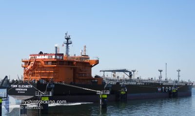
TORM ELIZABETH
Tanker
Current Trip
| Time Travelled | 38 days |
|---|---|
| Remaining Time | 4 days |
| Distance Travelled | 8246.24 nm |
| Remaining Distance | 1356.81 nm |
| AVG Speed | 11.6 Knots |
| MAX Speed | 16 Knots |
| AVG Wind | 8.6 knots |
| MAX Wind | 28.9 knots |
| MIN Temp | 12.4°C / 54.32°F |
| MAX Temp | 30.7°C / 87.26°F |
| Draught | 8.2 m |
| Position Received | 18 h, 31 m ago |
Current Position
| Longitude | 120.81667° |
|---|---|
| Latitude | 21.50737° |
| Status | Under way using engine |
| Speed | 11 Knots |
| Course | 219° |
| Area | South China Sea |
| Station | T-AIS |
| Position Received | 18 h, 31 m ago |
Info
Information
The current position of TORM ELIZABETH is in South China Sea with coordinates 21.50737° / 120.81667° as reported on 2024-04-22 15:12 by AIS to our vessel tracker app. The vessel's current speed is 11 Knots and is heading at the port of SINGAPORE. The estimated time of arrival as calculated by MyShipTracking vessel tracking app is 2024-04-27 21:55 LT
The vessel TORM ELIZABETH (IMO: 9850006, MMSI: 219295000) is a Tanker It's sailing under the flag of [DK] Denmark.
In this page you can find informations about the vessels current position, last detected port calls, and current voyage information. If the vessels is not in coverage by AIS you will find the latest position.
The current position of TORM ELIZABETH is detected by our AIS receivers and we are not responsible for the reliability of the data. The last position was recorded while the vessel was in Coverage by the Ais receivers of our vessel tracking app.
The current draught of TORM ELIZABETH as reported by AIS is 8.2 meters
Weather
| Temperature | 28.9°C / 84.02°F |
|---|---|
| Wind Speed | 6 knots |
| Direction | 226° SW |
| Pressure | 1007.5 hPa |
| Humidity | 70.4 % |
| Cloud Coverage | 2 % |
Featured Company
Last Port Calls
| Port | Arrival | Departure | Time In Port |
|---|---|---|---|
| 2024-03-14 12:02 | 2024-03-15 23:02 | 1 d | |
| 2024-03-10 06:41 | 2024-03-12 17:43 | 2 d | |
| 2024-02-07 07:34 | 2024-02-11 14:05 | 4 d |
Last Trips
| Origin | Departure | Destination | Arrival | Distance | |
|---|---|---|---|---|---|
| 2024-03-12 20:43 | 2024-03-14 16:02 | 498.86 nm | |||
| 2024-02-11 22:05 | 2024-03-10 09:41 | 4342.37 nm | |||
| 2024-01-18 09:56 | 2024-02-07 15:34 | 2711.10 nm |
Events
| Time | Event | Details | Position / Dest | Info |
|---|---|---|---|---|
| 2024-04-22 15:18 | Status Changed | Default Under way using engine |
21.49089 / 120.80319
SGSIN
|
Speed: 11 kn Course: 219° |
| 2024-04-22 15:12 | Status Changed | Under way using engine Default |
21.50737 / 120.81667
SGSIN
|
Speed: 10.6 kn Course: 221° |
| 2024-04-22 15:12 | OUT of Coverage |
21.50737 / 120.81667
South China Sea
SGSIN
|
Speed: 11 kn Course: 219° |
|
| 2024-04-22 14:23 | Status Changed | Default Under way using engine |
21.61592 / 120.91610
SGSIN
|
Speed: 10 kn Course: 220.5° |
| 2024-04-22 14:13 | Status Changed | Under way using engine Default |
21.63520 / 120.93371
SGSIN
|
Speed: 9.9 kn Course: 221° |
| 2024-04-22 14:10 | Status Changed | Default Under way using engine |
21.64157 / 120.93959
SGSIN
|
Speed: 10 kn Course: 220.1° |
| 2024-04-22 13:55 | Change Sea Area | Taiwanese part of the South China Sea Taiwanese part of the Philippine Sea |
21.67319 / 120.96798
South China Sea
SGSIN
|
Speed: 10 kn Course: 220.6° |
| 2024-04-22 13:55 | Status Changed | Under way using engine Default |
21.67319 / 120.96798
SGSIN
|
Speed: 10.1 kn Course: 222° |
| 2024-04-22 13:44 | IN Coverage |
21.67319 / 120.96798
South China Sea
SGSIN
|
Speed: 10 kn Course: 220.6° |
|
| 2024-04-22 11:18 | OUT of Coverage |
22.04828 / 121.24662
Philippine Sea
SGSIN
|
Speed: 10.6 kn Course: 211.5° |